While takeoff offers decent views of Florida's lakes and coast, the landing approach into PDX with views of Mount Hood and the Cascade Range is more dramatic and memorable. The volcanic peaks and snow-capped summit are iconic landmarks that dominate the approach corridor.
Flown MCO to PDX? Did we get it right?
Flight Path
Orlando to Portland is 2,531 miles (4,073 km), a flight of about 5 hours.
The flight path crosses the continental United States roughly northwest. Notable geographic features include the Mississippi River valley (visible around 2 hours into flight), the Rocky Mountains (particularly the Wasatch Range near Salt Lake City, visible around 3 hours), the Great Basin and high desert terrain of Nevada and Oregon, and the Cascade Range volcanic arc approaching Portland. The Snake River Plain in Idaho and the Blue Mountains of eastern Oregon are also visible during the descent phase.
Great circle distance and headings ›Phase by phase

Takeoff from MCO
RIGHTRight-side seats offer views of the Atlantic coast and the sprawling Orlando metropolitan area during the initial climb. MCO typically departs runways 17L/R or 35L/R depending on wind; northbound departures on 35 will show the city grid and lakes to your right as you climb northwest.
Landing at PDX
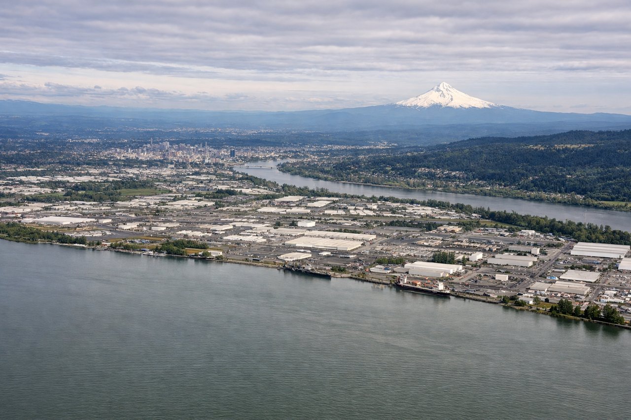
LEFTLeft-side seats provide excellent views of the Cascade Range and Mount Hood during the descent into PDX. PDX typically lands on runways 10L/R or 28L/R; southbound approaches on runway 10 will position the Cascades and Mount Hood prominently to your left (east) as you descend through 8,000–3,000 feet.
Will your flight be in sunlight?
Pick a date and time in the Sun Map to watch the sun move across your whole flight.
About This Route
Which side of the plane should I sit on flying from Orlando International (MCO) to Portland International (PDX)?
Sit on the Left side of the plane for the best views on flights from Orlando to Portland. While takeoff offers decent views of Florida's lakes and coast, the landing approach into PDX with views of Mount Hood and the Cascade Range is more dramatic and memorable. The volcanic peaks and snow-capped summit are iconic landmarks that dominate the approach corridor.
What can I see during takeoff from Orlando International in Orlando?
During takeoff from Orlando International (MCO), sit on the Right side for the best views. Right-side seats offer views of the Atlantic coast and the sprawling Orlando metropolitan area during the initial climb. MCO typically departs runways 17L/R or 35L/R depending on wind; northbound departures on 35 will show the city grid and lakes to your right as you climb northwest. Notable sights include: Lake Apopka (large freshwater lake north of MCO), Orlando downtown skyline, Kennedy Space Center (visible as a distant complex ~45 miles east on the coast), Atlantic coastline near Cocoa Beach.
What can I see when landing at Portland International in Portland?
When landing at Portland International (PDX), sit on the Left side for the best views. Left-side seats provide excellent views of the Cascade Range and Mount Hood during the descent into PDX. PDX typically lands on runways 10L/R or 28L/R; southbound approaches on runway 10 will position the Cascades and Mount Hood prominently to your left (east) as you descend through 8,000–3,000 feet. Notable sights include: Mount Hood (11,240 ft, snow-capped stratovolcano, ~50 miles southeast), Cascade Range (volcanic peaks extending north-south), Columbia River (major river valley visible as a wide corridor), Portland metropolitan area and Willamette River.
How long is the flight from Orlando to Portland?
The flight from Orlando International (MCO) to Portland International (PDX) takes about 5 hours. The shortest flight path between them is 2,531 miles (4,073 km); winds and air traffic control usually add a few percent.
What does the Orlando to Portland flight path pass over?
The flight path crosses the continental United States roughly northwest. Notable geographic features include the Mississippi River valley (visible around 2 hours into flight), the Rocky Mountains (particularly the Wasatch Range near Salt Lake City, visible around 3 hours), the Great Basin and high desert terrain of Nevada and Oregon, and the Cascade Range volcanic arc approaching Portland. The Snake River Plain in Idaho and the Blue Mountains of eastern Oregon are also visible during the descent phase.