The takeoff from Manado offers more dramatic and distinctive scenery with volcanic peaks and island formations. While the landing approach into Singapore provides urban interest, the natural geography visible during departure from MDC is more visually compelling for scenic viewing.
Flown MDC to SIN? Did we get it right?
Flight Path
Manado to Singapore is 1,446 miles (2,327 km), a flight of about 3 hours 25 minutes.
The flight path crosses the Celebes Sea southwestward, passing over open water with occasional visibility of the Natuna Islands chain to the southeast (typically below the cruise altitude flight path but sometimes visible on clear days). The Karimata Strait region marks the transition toward the Singapore approach corridor. No major mountain ranges or significant landmasses lie directly on the typical routing between these two airports.
Great circle distance and headings ›Phase by phase
Takeoff from MDC
RIGHTRight-side seats offer views of Manado Bay and the volcanic peaks of North Sulawesi as the aircraft climbs southwestward. The Bunaken Marine Park waters and coastal ridgelines are clearly visible during the initial climb-out phase.
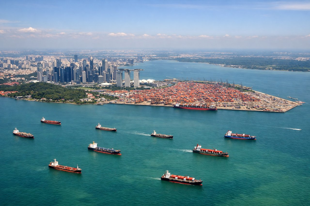
Landing at SIN
LEFTLeft-side seats provide excellent views during the descent approach into Singapore Changi. The Johor Strait, Malaysian coastline, and the urban sprawl of Singapore's northern districts are visible as the aircraft descends on its final approach from the north.
Will your flight be in sunlight?
Pick a date and time in the Sun Map to watch the sun move across your whole flight.
About This Route
Which side of the plane should I sit on flying from Sam Ratulangi (MDC) to Singapore Changi (SIN)?
Sit on the Right side of the plane for the best views on flights from Manado to Singapore. The takeoff from Manado offers more dramatic and distinctive scenery with volcanic peaks and island formations. While the landing approach into Singapore provides urban interest, the natural geography visible during departure from MDC is more visually compelling for scenic viewing.
What can I see during takeoff from Sam Ratulangi in Manado?
During takeoff from Sam Ratulangi (MDC), sit on the Right side for the best views. Right-side seats offer views of Manado Bay and the volcanic peaks of North Sulawesi as the aircraft climbs southwestward. The Bunaken Marine Park waters and coastal ridgelines are clearly visible during the initial climb-out phase. Notable sights include: Manado Bay, Bunaken Island, Manado city waterfront, volcanic ridge formations of northern Sulawesi.
What can I see when landing at Singapore Changi in Singapore?
When landing at Singapore Changi (SIN), sit on the Left side for the best views. Left-side seats provide excellent views during the descent approach into Singapore Changi. The Johor Strait, Malaysian coastline, and the urban sprawl of Singapore's northern districts are visible as the aircraft descends on its final approach from the north. Notable sights include: Johor Strait, Peninsular Malaysia coastline, Singapore's northern urban zones, Straits of Malacca shipping lanes.
How long is the flight from Manado to Singapore?
The flight from Sam Ratulangi (MDC) to Singapore Changi (SIN) takes about 3 hours 25 minutes. The shortest flight path between them is 1,446 miles (2,327 km); winds and air traffic control usually add a few percent.
What does the Manado to Singapore flight path pass over?
The flight path crosses the Celebes Sea southwestward, passing over open water with occasional visibility of the Natuna Islands chain to the southeast (typically below the cruise altitude flight path but sometimes visible on clear days). The Karimata Strait region marks the transition toward the Singapore approach corridor. No major mountain ranges or significant landmasses lie directly on the typical routing between these two airports.