Mendoza to Santiago is 122 miles (196 km), a flight of about 45 minutes.
The right side offers the best sustained views of the high Andes, including Aconcagua's massif to the north of the flight path, while the left side sees the equally dramatic but slightly less iconic southern peaks like Tupungato.
Flight Path
High Andes crossing near the Chile-Argentina border, including views of Aconcagua to the north and Tupungato volcano to the south of the flight path, with glaciated peaks and deep mountain valleys below.
Great circle distance and headings ›


Phase by phase
Takeoff from MDZ
RIGHTDeparting MDZ, the Andes wall rises to the west and the initial climb reveals the front range peaks straight ahead, but as the aircraft turns onto its westbound track, the higher northern peaks including Aconcagua come into view on the right side of the cabin.
Landing at SCL
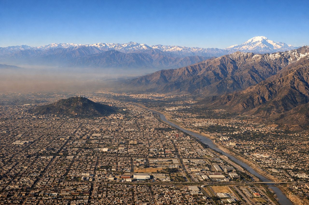
RIGHTOn approach into SCL from the north, the aircraft descends along the eastern edge of the Central Valley with the Andes still visible on the right, including the last close views of high peaks before leveling out over Santiago's outskirts.
Landmarks on this routeAll landmarks →
Will your flight be in sunlight?
Pick a date and time in the Sun Map to watch the sun move across your whole flight.
About This Route
Which side of the plane should I sit on flying from El Plumerillo (MDZ) to Arturo Merino Benitez International (SCL)?
Sit on the Right side of the plane for the best views on flights from Mendoza to Santiago. The right side offers the best sustained views of the high Andes, including Aconcagua's massif to the north of the flight path, while the left side sees the equally dramatic but slightly less iconic southern peaks like Tupungato.
What can I see during takeoff from El Plumerillo in Mendoza?
During takeoff from El Plumerillo (MDZ), sit on the Right side for the best views. Departing MDZ, the Andes wall rises to the west and the initial climb reveals the front range peaks straight ahead, but as the aircraft turns onto its westbound track, the higher northern peaks including Aconcagua come into view on the right side of the cabin. Notable sights include: Andes foothills, Precordillera ridges, Mendoza river valley, first glimpse of high Andean peaks.
What can I see when landing at Arturo Merino Benitez International in Santiago?
When landing at Arturo Merino Benitez International (SCL), sit on the Right side for the best views. On approach into SCL from the north, the aircraft descends along the eastern edge of the Central Valley with the Andes still visible on the right, including the last close views of high peaks before leveling out over Santiago's outskirts. Notable sights include: Andes foothills east of Santiago, Cerro El Plomo area, Santiago's eastern suburbs, Central Valley farmland.
How long is the flight from Mendoza to Santiago?
The flight from El Plumerillo (MDZ) to Arturo Merino Benitez International (SCL) takes about 45 minutes. The shortest flight path between them is 122 miles (196 km); winds and air traffic control usually add a few percent.
What does the Mendoza to Santiago flight path pass over?
High Andes crossing near the Chile-Argentina border, including views of Aconcagua to the north and Tupungato volcano to the south of the flight path, with glaciated peaks and deep mountain valleys below.