Memphis to Ontario is 1,569 miles (2,524 km), a flight of about 4 hours 15 minutes.
Right side edges ahead due to superior takeoff scenery from Memphis (Mississippi River and downtown skyline provide immediate engagement), while landing views are roughly equal between both sides. The river departure experience and urban context at Memphis outweigh Ontario's mountain views during approach, making right-side seats the better overall choice for this 4-hour flight.
Flight Path
Ozark Plateau (Missouri/Arkansas border region with rolling terrain and forested ridges), White River valley, Oklahoma panhandle (flat grasslands and sparse development), Texas Panhandle (high plains with sparse settlement), New Mexico high desert (sparse vegetation, mesas visible near Tucumcari area), Arizona high desert plateau (transition to Colorado Plateau terrain), Mojave Desert (increasingly visible as aircraft descends into Southern California airspace)
Great circle distance and headings ›
.jpg?width=600)


.jpeg?width=600)
.jpg?width=600)
Phase by phase
Takeoff from MEM
RIGHTRight side captures Memphis's urban core and Mississippi River during initial climb. The river's distinctive meanders and the downtown skyline provide immediate visual interest during the critical first 2,000 feet of departure.
Landing at ONT
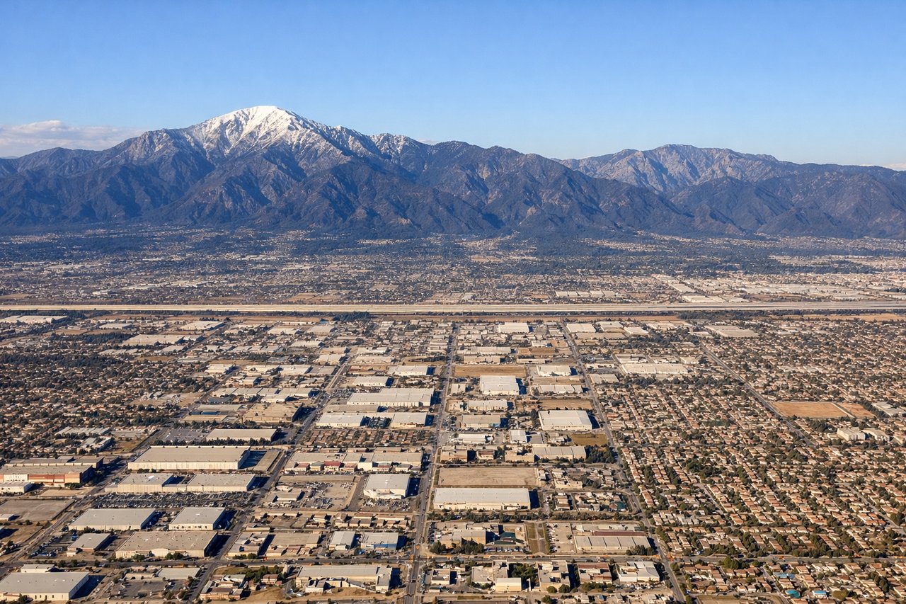
LEFTLeft side during approach to Ontario offers views of the San Gabriel Mountains and the transition from high desert to urban sprawl. The mountain range provides dramatic terrain contrast and is clearly visible during descent on typical westbound approaches.
Landmarks on this routeAll landmarks →
Will your flight be in sunlight?
Pick a date and time in the Sun Map to watch the sun move across your whole flight.
About This Route
Which side of the plane should I sit on flying from Memphis International (MEM) to Ontario International (ONT)?
Sit on the Right side of the plane for the best views on flights from Memphis to Ontario. Right side edges ahead due to superior takeoff scenery from Memphis (Mississippi River and downtown skyline provide immediate engagement), while landing views are roughly equal between both sides. The river departure experience and urban context at Memphis outweigh Ontario's mountain views during approach, making right-side seats the better overall choice for this 4-hour flight.
What can I see during takeoff from Memphis International in Memphis?
During takeoff from Memphis International (MEM), sit on the Right side for the best views. Right side captures Memphis's urban core and Mississippi River during initial climb. The river's distinctive meanders and the downtown skyline provide immediate visual interest during the critical first 2,000 feet of departure. Notable sights include: Mississippi River (main channel and oxbow lakes), Memphis downtown skyline, Shelby Farms Park (large reservoir visible east of city).
What can I see when landing at Ontario International in Ontario?
When landing at Ontario International (ONT), sit on the Left side for the best views. Left side during approach to Ontario offers views of the San Gabriel Mountains and the transition from high desert to urban sprawl. The mountain range provides dramatic terrain contrast and is clearly visible during descent on typical westbound approaches. Notable sights include: San Gabriel Mountains (snow-capped peaks visible to the north), Inland Empire urban development (Ontario, Rancho Cucamonga sprawl), San Bernardino Valley floor.
How long is the flight from Memphis to Ontario?
The flight from Memphis International (MEM) to Ontario International (ONT) takes about 4 hours 15 minutes. The shortest flight path between them is 1,569 miles (2,524 km); winds and air traffic control usually add a few percent.
What does the Memphis to Ontario flight path pass over?
Ozark Plateau (Missouri/Arkansas border region with rolling terrain and forested ridges), White River valley, Oklahoma panhandle (flat grasslands and sparse development), Texas Panhandle (high plains with sparse settlement), New Mexico high desert (sparse vegetation, mesas visible near Tucumcari area), Arizona high desert plateau (transition to Colorado Plateau terrain), Mojave Desert (increasingly visible as aircraft descends into Southern California airspace)