Right seats win overall because the takeoff view of the Sierra Madre Oriental is more dramatic and sustained than the landing approach. The landing view, while geographically interesting, consists mainly of flat, featureless terrain that becomes visually repetitive.
Flown MEX to MID? Did we get it right?
Flight Path
Mexico City to Merida is 620 miles (997 km), a flight of about 1 hour 15 minutes.
The flight path crosses from the Sierra Madre foothills into the Yucatan Peninsula's flat limestone plain. Notable features include the transition zone around Veracruz state where elevation drops from 2,000+ feet to near sea level, the Campeche lowlands (flat agricultural and scrubland terrain), and the gradual appearance of cenote fields as you approach Merida. The Gulf of Mexico remains visible to the north throughout much of the flight at altitude.
Great circle distance and headings ›

Phase by phase
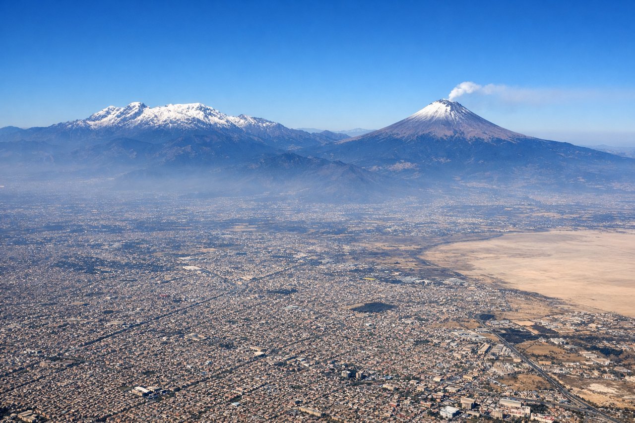
Takeoff from MEX
RIGHTRight-side seats capture the Sierra Madre Oriental as the aircraft climbs northeast toward Merida. The mountain range rises dramatically to the east of Mexico City and remains visible for the first 15-20 minutes of flight.
Landing at MID
LEFTLeft-side seats offer the best view during descent into Merida. The approach typically comes from the northwest, and left seats face the Yucatan Peninsula's distinctive flat terrain and cenote-dotted landscape as you descend toward the airport.
Will your flight be in sunlight?
Pick a date and time in the Sun Map to watch the sun move across your whole flight.
About This Route
Which side of the plane should I sit on flying from Licenciado Benito Juarez International (MEX) to Licenciado Manuel Crecencio Rejon International (MID)?
Sit on the Right side of the plane for the best views on flights from Mexico City to Merida. Right seats win overall because the takeoff view of the Sierra Madre Oriental is more dramatic and sustained than the landing approach. The landing view, while geographically interesting, consists mainly of flat, featureless terrain that becomes visually repetitive.
What can I see during takeoff from Licenciado Benito Juarez International in Mexico City?
During takeoff from Licenciado Benito Juarez International (MEX), sit on the Right side for the best views. Right-side seats capture the Sierra Madre Oriental as the aircraft climbs northeast toward Merida. The mountain range rises dramatically to the east of Mexico City and remains visible for the first 15-20 minutes of flight. Notable sights include: Sierra Madre Oriental (eastern escarpment), Lake Texcoco (remnant water bodies in Mexico City basin), Popocatépetl volcano (distant southern horizon on clear days), Mexico City urban sprawl extending northeast.
What can I see when landing at Licenciado Manuel Crecencio Rejon International in Merida?
When landing at Licenciado Manuel Crecencio Rejon International (MID), sit on the Left side for the best views. Left-side seats offer the best view during descent into Merida. The approach typically comes from the northwest, and left seats face the Yucatan Peninsula's distinctive flat terrain and cenote-dotted landscape as you descend toward the airport. Notable sights include: Yucatan Peninsula limestone plain (flat, featureless terrain with subtle vegetation patterns), cenote fields (small circular depressions visible as darker spots in the landscape), Merida city sprawl (white buildings and grid pattern), Gulf of Mexico horizon (visible on very clear days to the north).
How long is the flight from Mexico City to Merida?
The flight from Licenciado Benito Juarez International (MEX) to Licenciado Manuel Crecencio Rejon International (MID) takes about 1 hour 15 minutes. The shortest flight path between them is 620 miles (997 km); winds and air traffic control usually add a few percent.
What does the Mexico City to Merida flight path pass over?
The flight path crosses from the Sierra Madre foothills into the Yucatan Peninsula's flat limestone plain. Notable features include the transition zone around Veracruz state where elevation drops from 2,000+ feet to near sea level, the Campeche lowlands (flat agricultural and scrubland terrain), and the gradual appearance of cenote fields as you approach Merida. The Gulf of Mexico remains visible to the north throughout much of the flight at altitude.