While takeoff offers dramatic volcanic views on the right, the landing approach over Perth's Indian Ocean and coastal features provides more consistent and visually rewarding scenery. The left side captures the approach geography that defines Perth's setting.
Flight Path
This ultra-long-haul route crosses the Pacific Ocean entirely. Notable waypoints include: the Baja California Peninsula (visible during initial departure climb if heading southeast), then open Pacific for 8+ hours. The flight path crosses the International Date Line and passes south of Hawaii (not visible from typical cruise altitude and distance). Approaching Australia, the Indian Ocean dominates for the final 4-5 hours. No significant landmasses are visible during the mid-Pacific cruise phase—only open ocean, occasional weather systems, and cloud formations. The approach to Western Australia brings the first land sighting: the Australian coastline near Perth, with the Swan River estuary and surrounding coastal plains becoming visible during descent.
Great circle distance and headings ›

_(cropped).jpg?width=600)
.jpg?width=600)

Phase by phase
Takeoff from MEX
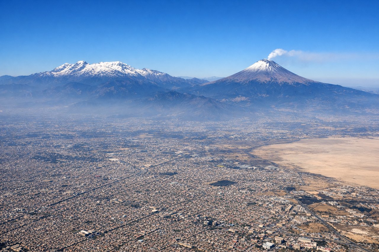
RIGHTRight-side seats capture the Valley of Mexico and surrounding volcanic peaks during the initial climb. MEX typically departs eastbound or southeastbound, and right-side windows face toward the Sierra Nevada volcanic complex.

Landing at PER
LEFTLeft-side seats offer views of the Indian Ocean approach and Perth's coastal geography. Arriving aircraft typically descend over the ocean from the west, and left windows face toward the city, Swan River, and the distinctive coastline.
Landmarks on this routeAll landmarks →
Will your flight be in sunlight?
See exactly which side of the plane gets sun and shade at your departure time.
About This Route
Which side of the plane should I sit on flying from Licenciado Benito Juarez International (MEX) to Perth International (PER)?
Sit on the Left side of the plane for the best views on flights from Mexico City to Perth. While takeoff offers dramatic volcanic views on the right, the landing approach over Perth's Indian Ocean and coastal features provides more consistent and visually rewarding scenery. The left side captures the approach geography that defines Perth's setting.
What can I see during takeoff from Licenciado Benito Juarez International in Mexico City?
During takeoff from Licenciado Benito Juarez International (MEX), sit on the Right side for the best views. Right-side seats capture the Valley of Mexico and surrounding volcanic peaks during the initial climb. MEX typically departs eastbound or southeastbound, and right-side windows face toward the Sierra Nevada volcanic complex. Notable sights include: Popocatépetl volcano (5,426m, often snow-capped), Iztaccíhuatl volcano, Lake Texcoco remnants, Mexico City urban sprawl.
What can I see when landing at Perth International in Perth?
When landing at Perth International (PER), sit on the Left side for the best views. Left-side seats offer views of the Indian Ocean approach and Perth's coastal geography. Arriving aircraft typically descend over the ocean from the west, and left windows face toward the city, Swan River, and the distinctive coastline. Notable sights include: Indian Ocean, Swan River estuary, Perth city skyline, Rottnest Island (visible on clear days).
How long is the flight from Mexico City to Perth?
The flight from Licenciado Benito Juarez International (MEX) to Perth International (PER) takes Approximately 14-15 hours.
What does the Mexico City to Perth flight path pass over?
This ultra-long-haul route crosses the Pacific Ocean entirely. Notable waypoints include: the Baja California Peninsula (visible during initial departure climb if heading southeast), then open Pacific for 8+ hours. The flight path crosses the International Date Line and passes south of Hawaii (not visible from typical cruise altitude and distance). Approaching Australia, the Indian Ocean dominates for the final 4-5 hours. No significant landmasses are visible during the mid-Pacific cruise phase—only open ocean, occasional weather systems, and cloud formations. The approach to Western Australia brings the first land sighting: the Australian coastline near Perth, with the Swan River estuary and surrounding coastal plains becoming visible during descent.