Mexico City to Manzanillo is 358 miles (577 km), a flight of about 1 hour 15 minutes.
Takeoff views of the Valley of Mexico and Sierra Nevada are more dramatic and geographically distinctive than the landing approach. The volcanic landscape and urban-to-mountain transition during departure outweighs the coastal approach scenery.
Flight Path
The flight path crosses westward over the Trans-Mexican Volcanic Belt. Visible landmarks during cruise include Nevado de Toluca (inactive volcano, 15,000 ft elevation) to the southwest, the Lerma River valley, and the transition from high plateau (7,000-8,000 ft) to lower coastal terrain. The Sierra Madre del Sur becomes visible as the aircraft descends toward the Pacific coast. On clear days, multiple volcanic peaks are visible along the route, including Colima volcano near the destination.
Great circle distance and headings ›
_(cropped).jpg?width=600)
Phase by phase
Takeoff from MEX
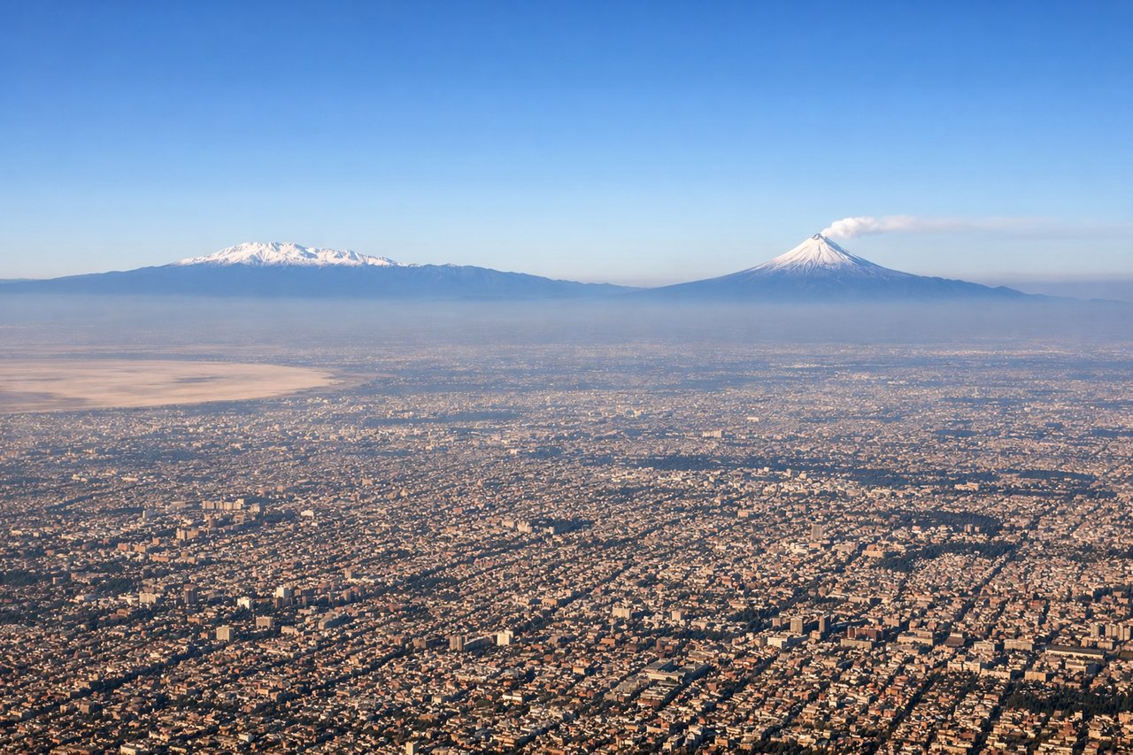
LEFTMEX typically departs westbound (Runway 05L/05R or 23L/23R depending on wind). Left seats face south initially, giving direct views of the Valley of Mexico's southern rim and the Sierra Nevada range. Right seats see the northern sprawl of Mexico City.
Landing at ZLO
RIGHTApproach to ZLO comes from the east over the Pacific. Right seats face the ocean and coastal features during descent. The airport sits on a peninsula, so right-side passengers see the Pacific coastline, Manzanillo Bay, and the approach path over water.
Landmarks on this routeAll landmarks →
Will your flight be in sunlight?
Pick a date and time in the Sun Map to watch the sun move across your whole flight.
About This Route
Which side of the plane should I sit on flying from Licenciado Benito Juarez International (MEX) to Playa De Oro International (ZLO)?
Sit on the Left side of the plane for the best views on flights from Mexico City to Manzanillo. Takeoff views of the Valley of Mexico and Sierra Nevada are more dramatic and geographically distinctive than the landing approach. The volcanic landscape and urban-to-mountain transition during departure outweighs the coastal approach scenery.
What can I see during takeoff from Licenciado Benito Juarez International in Mexico City?
During takeoff from Licenciado Benito Juarez International (MEX), sit on the Left side for the best views. MEX typically departs westbound (Runway 05L/05R or 23L/23R depending on wind). Left seats face south initially, giving direct views of the Valley of Mexico's southern rim and the Sierra Nevada range. Right seats see the northern sprawl of Mexico City. Notable sights include: Sierra Nevada (snow-capped volcanic peaks on the southern horizon), Lake Texcoco remnants (shallow water bodies and wetlands directly below during climb), Mexico City urban grid (sprawling development filling the valley floor), Popocatépetl volcano (visible as a distant peak to the southeast on clear days).
What can I see when landing at Playa De Oro International in Manzanillo?
When landing at Playa De Oro International (ZLO), sit on the Right side for the best views. Approach to ZLO comes from the east over the Pacific. Right seats face the ocean and coastal features during descent. The airport sits on a peninsula, so right-side passengers see the Pacific coastline, Manzanillo Bay, and the approach path over water. Notable sights include: Pacific Ocean (dominant feature to the west and south), Manzanillo Bay (sheltered water body with visible shipping activity), Coastal mountain ridges (Sierra de Manantlán foothills descending to the shore), Playa de Oro airport runway (visible on final approach against the coastal plain).
How long is the flight from Mexico City to Manzanillo?
The flight from Licenciado Benito Juarez International (MEX) to Playa De Oro International (ZLO) takes about 1 hour 15 minutes. The shortest flight path between them is 358 miles (577 km); winds and air traffic control usually add a few percent.
What does the Mexico City to Manzanillo flight path pass over?
The flight path crosses westward over the Trans-Mexican Volcanic Belt. Visible landmarks during cruise include Nevado de Toluca (inactive volcano, 15,000 ft elevation) to the southwest, the Lerma River valley, and the transition from high plateau (7,000-8,000 ft) to lower coastal terrain. The Sierra Madre del Sur becomes visible as the aircraft descends toward the Pacific coast. On clear days, multiple volcanic peaks are visible along the route, including Colima volcano near the destination.