Manzanillo to Mexico City is 358 miles (577 km), a flight of about 1 hour 15 minutes.
While the takeoff offers coastal beauty, the landing approach into Mexico City provides more dramatic and sustained scenery—the massive metropolitan area, surrounding mountain ranges, and potential volcano views outweigh the initial coastal climb-out.
Flight Path
The flight path crosses inland from the coast over Jalisco and Michoacán states. Notable features include the volcanic highlands of central Mexico, with the Trans-Mexican Volcanic Belt visible as elevated terrain. Lake Chapala (Mexico's largest freshwater lake) may be visible to the south of the direct route. The terrain transitions from coastal lowlands to high-altitude plateau as you approach the Valley of Mexico, with elevations rising from sea level to over 7,000 feet by landing.
Great circle distance and headings ›_(cropped).jpg?width=600)

Phase by phase
Takeoff from ZLO
RIGHTRight-side seats capture the Pacific coastline and the Manzanillo Bay as you climb out over the water. The aircraft departs westbound initially before turning southeast, so right-side passengers get extended views of the coastal geography.
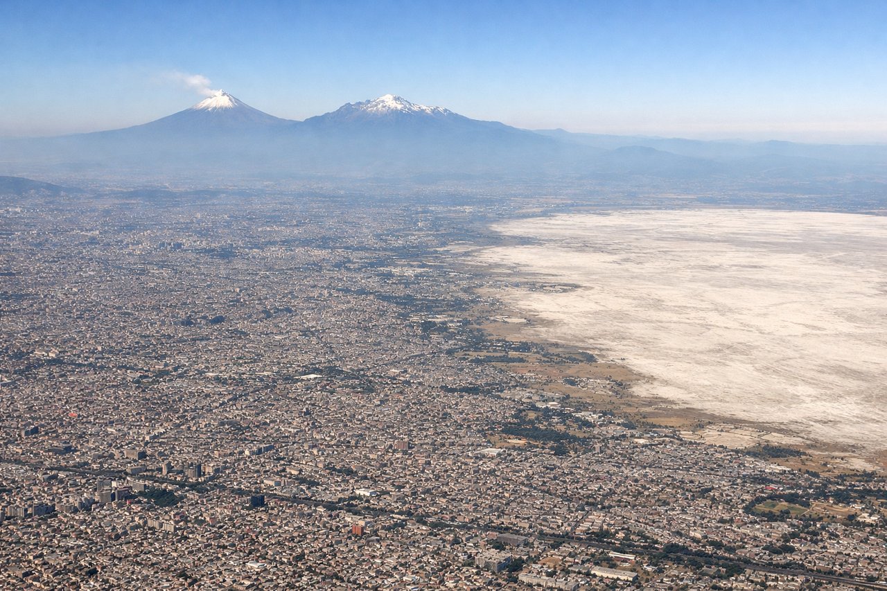
Landing at MEX
LEFTLeft-side seats provide views of the Valley of Mexico and Mexico City's urban sprawl as you descend into MEX. The approach from the west gives left-side passengers a clear view of the city's geography, surrounding mountains, and the descent path over the metropolitan area.
Landmarks on this routeAll landmarks →
Will your flight be in sunlight?
Pick a date and time in the Sun Map to watch the sun move across your whole flight.
About This Route
Which side of the plane should I sit on flying from Playa De Oro International (ZLO) to Licenciado Benito Juarez International (MEX)?
Sit on the Left side of the plane for the best views on flights from Manzanillo to Mexico City. While the takeoff offers coastal beauty, the landing approach into Mexico City provides more dramatic and sustained scenery—the massive metropolitan area, surrounding mountain ranges, and potential volcano views outweigh the initial coastal climb-out.
What can I see during takeoff from Playa De Oro International in Manzanillo?
During takeoff from Playa De Oro International (ZLO), sit on the Right side for the best views. Right-side seats capture the Pacific coastline and the Manzanillo Bay as you climb out over the water. The aircraft departs westbound initially before turning southeast, so right-side passengers get extended views of the coastal geography. Notable sights include: Manzanillo Bay, Pacific Ocean coastline, Sierra Madre Occidental foothills to the east, Colima state coastal plain.
What can I see when landing at Licenciado Benito Juarez International in Mexico City?
When landing at Licenciado Benito Juarez International (MEX), sit on the Left side for the best views. Left-side seats provide views of the Valley of Mexico and Mexico City's urban sprawl as you descend into MEX. The approach from the west gives left-side passengers a clear view of the city's geography, surrounding mountains, and the descent path over the metropolitan area. Notable sights include: Mexico City metropolitan area, Sierra de Guadalupe mountains to the north, Lake Texcoco remnants, Popocatépetl volcano (distant, weather permitting).
How long is the flight from Manzanillo to Mexico City?
The flight from Playa De Oro International (ZLO) to Licenciado Benito Juarez International (MEX) takes about 1 hour 15 minutes. The shortest flight path between them is 358 miles (577 km); winds and air traffic control usually add a few percent.
What does the Manzanillo to Mexico City flight path pass over?
The flight path crosses inland from the coast over Jalisco and Michoacán states. Notable features include the volcanic highlands of central Mexico, with the Trans-Mexican Volcanic Belt visible as elevated terrain. Lake Chapala (Mexico's largest freshwater lake) may be visible to the south of the direct route. The terrain transitions from coastal lowlands to high-altitude plateau as you approach the Valley of Mexico, with elevations rising from sea level to over 7,000 feet by landing.