Manzanillo to Vancouver is 2,319 miles (3,732 km), a flight of about 5 hours 15 minutes.
While the takeoff offers coastal scenery, the landing approach into Vancouver provides more dramatic and visually distinctive features—the Strait of Georgia, North Shore Mountains, and Cascade Range views make the left side the superior choice for the overall flight.
Flight Path
The flight path crosses the Pacific coast of Mexico northward, passing east of the Sierra Madre Occidental. Over the open Pacific, the route tracks northwest toward California. As the aircraft approaches the US West Coast, the Cascade Range and Sierra Nevada become visible on the eastern horizon. The flight then crosses into Canadian airspace over the Pacific, with Vancouver Island and the Strait of Georgia appearing before descent into YVR. Notable features along the route include the California coastline (if visible during daylight), the Cascade Range in Washington, and the British Columbia coastal mountains.
Great circle distance and headings ›
.jpeg?width=600)


Phase by phase
Takeoff from ZLO
RIGHTRight-side seats offer views of the Pacific coastline and the Sierra Madre Occidental as the aircraft climbs northwestward from Manzanillo. The left side faces inland terrain with less dramatic visual interest during the initial climb.
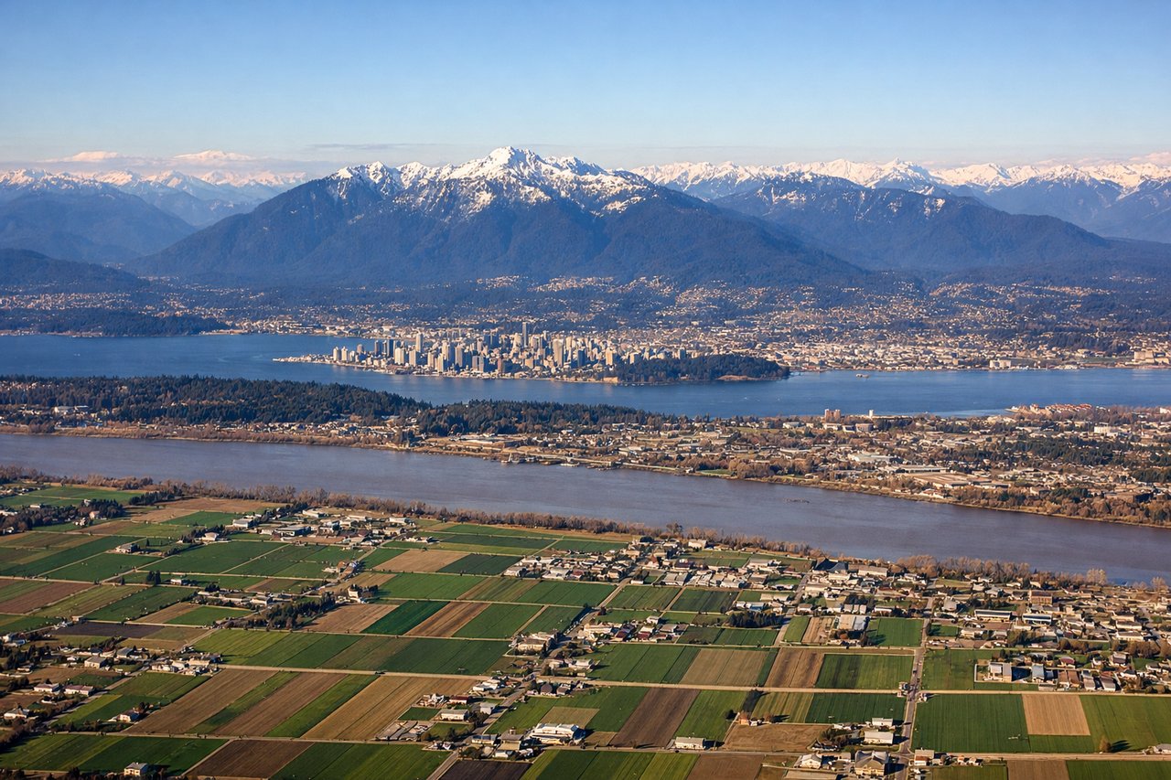
Landing at YVR
LEFTLeft-side seats provide excellent views during the descent into Vancouver, including the Cascade Range, the Strait of Georgia, and the North Shore Mountains. The approach path from the south offers clear sightlines to these major geographic features as the aircraft descends toward YVR.
Landmarks on this routeAll landmarks →
Will your flight be in sunlight?
Pick a date and time in the Sun Map to watch the sun move across your whole flight.
About This Route
Which side of the plane should I sit on flying from Playa De Oro International (ZLO) to Vancouver International (YVR)?
Sit on the Left side of the plane for the best views on flights from Manzanillo to Vancouver. While the takeoff offers coastal scenery, the landing approach into Vancouver provides more dramatic and visually distinctive features—the Strait of Georgia, North Shore Mountains, and Cascade Range views make the left side the superior choice for the overall flight.
What can I see during takeoff from Playa De Oro International in Manzanillo?
During takeoff from Playa De Oro International (ZLO), sit on the Right side for the best views. Right-side seats offer views of the Pacific coastline and the Sierra Madre Occidental as the aircraft climbs northwestward from Manzanillo. The left side faces inland terrain with less dramatic visual interest during the initial climb. Notable sights include: Pacific Ocean coastline, Manzanillo Bay, Sierra Madre Occidental mountain range, Colima volcanic plateau.
What can I see when landing at Vancouver International in Vancouver?
When landing at Vancouver International (YVR), sit on the Left side for the best views. Left-side seats provide excellent views during the descent into Vancouver, including the Cascade Range, the Strait of Georgia, and the North Shore Mountains. The approach path from the south offers clear sightlines to these major geographic features as the aircraft descends toward YVR. Notable sights include: Cascade Range, Strait of Georgia, North Shore Mountains (including Mount Seymour and Grouse Mountain), Vancouver city and harbor.
How long is the flight from Manzanillo to Vancouver?
The flight from Playa De Oro International (ZLO) to Vancouver International (YVR) takes about 5 hours 15 minutes. The shortest flight path between them is 2,319 miles (3,732 km); winds and air traffic control usually add a few percent.
What does the Manzanillo to Vancouver flight path pass over?
The flight path crosses the Pacific coast of Mexico northward, passing east of the Sierra Madre Occidental. Over the open Pacific, the route tracks northwest toward California. As the aircraft approaches the US West Coast, the Cascade Range and Sierra Nevada become visible on the eastern horizon. The flight then crosses into Canadian airspace over the Pacific, with Vancouver Island and the Strait of Georgia appearing before descent into YVR. Notable features along the route include the California coastline (if visible during daylight), the Cascade Range in Washington, and the British Columbia coastal mountains.