Vancouver to Manzanillo is 2,319 miles (3,732 km), a flight of about 4 hours 45 minutes.
While takeoff offers excellent mountain views from the left, the landing approach from the right provides sustained coastal and mountain scenery over the final 90 minutes of descent. The approach to ZLO is geographically more dramatic than departure from YVR.
Flight Path
Flight path crosses the Pacific Ocean southbound. Notable waypoints include passing west of the California coast (typically 100+ miles offshore), then tracking toward the Baja California peninsula. The Sea of Cortez lies to the east of the flight path. Approaching Mexico, the Sierra Madre Occidental becomes visible on the eastern horizon before the final descent toward the Colima coast. Most of the cruise phase is open ocean with no significant landmarks visible.
Great circle distance and headings ›

.jpeg?width=600)

Phase by phase
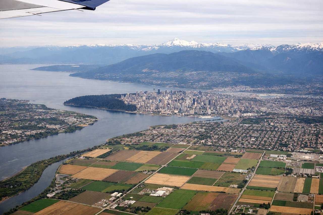
Takeoff from YVR
LEFTYVR typically departs southbound (runways 26L/26R). Left seats face west over the Strait of Georgia and North Shore Mountains, offering immediate dramatic relief. Right seats see suburban sprawl and industrial areas.
Landing at ZLO
RIGHTZLO approaches from the northwest over the Pacific. Right seats face the Mexican coastline, Manzanillo Bay, and the Sierra Madre del Sur mountains inland. Left seats see open ocean. The coastal and mountain scenery on descent is far more compelling from the right.
Landmarks on this routeAll landmarks →
Will your flight be in sunlight?
Pick a date and time in the Sun Map to watch the sun move across your whole flight.
About This Route
Which side of the plane should I sit on flying from Vancouver International (YVR) to Playa De Oro International (ZLO)?
Sit on the Right side of the plane for the best views on flights from Vancouver to Manzanillo. While takeoff offers excellent mountain views from the left, the landing approach from the right provides sustained coastal and mountain scenery over the final 90 minutes of descent. The approach to ZLO is geographically more dramatic than departure from YVR.
What can I see during takeoff from Vancouver International in Vancouver?
During takeoff from Vancouver International (YVR), sit on the Left side for the best views. YVR typically departs southbound (runways 26L/26R). Left seats face west over the Strait of Georgia and North Shore Mountains, offering immediate dramatic relief. Right seats see suburban sprawl and industrial areas. Notable sights include: North Shore Mountains (Coast Range), Strait of Georgia, Bowen Island, Vancouver Island distant shoreline.
What can I see when landing at Playa De Oro International in Manzanillo?
When landing at Playa De Oro International (ZLO), sit on the Right side for the best views. ZLO approaches from the northwest over the Pacific. Right seats face the Mexican coastline, Manzanillo Bay, and the Sierra Madre del Sur mountains inland. Left seats see open ocean. The coastal and mountain scenery on descent is far more compelling from the right. Notable sights include: Manzanillo Bay, Sierra Madre del Sur (western range), Colima volcanic peaks (inland), Pacific coastline with resort development.
How long is the flight from Vancouver to Manzanillo?
The flight from Vancouver International (YVR) to Playa De Oro International (ZLO) takes about 4 hours 45 minutes. The shortest flight path between them is 2,319 miles (3,732 km); winds and air traffic control usually add a few percent.
What does the Vancouver to Manzanillo flight path pass over?
Flight path crosses the Pacific Ocean southbound. Notable waypoints include passing west of the California coast (typically 100+ miles offshore), then tracking toward the Baja California peninsula. The Sea of Cortez lies to the east of the flight path. Approaching Mexico, the Sierra Madre Occidental becomes visible on the eastern horizon before the final descent toward the Colima coast. Most of the cruise phase is open ocean with no significant landmarks visible.