The left seat dominates the takeoff with the spectacular Fraser River delta and North Shore mountains, and through the cruise phase the left side tracks the Rocky Mountain and Cascade ranges as the flight arcs southeast over Idaho, Utah, and Tennessee. The landing advantage on the right is real but brief and modest compared to the sustained mountain scenery on the left during climb and early cruise.
Flight Path
The flight path arcs southeast over the Canadian Rockies and northern Idaho, then tracks across the Great Basin and over the Wasatch Range near Salt Lake City, continues over the Colorado Plateau and southern Rockies, crosses the Mississippi River lowlands near Memphis, and descends over the Appalachian foothills of northern Georgia into Atlanta. The Rocky Mountains and Cascades are the dominant visual feature in the first third of the flight.
Great circle distance and headings ›
.jpg?width=600)

.jpeg?width=600)
Phase by phase
Takeoff from YVR
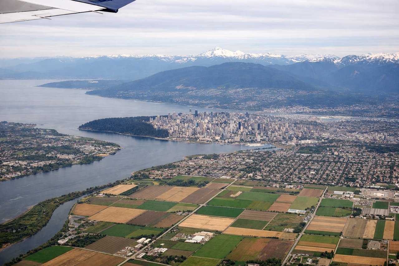
LEFTYVR's primary departure runway 26L sends aircraft westward over the Fraser River estuary before turning southeast. A left/south-facing seat captures the Fraser River delta, the city of Richmond's grid, and the North Shore mountains including the Garibaldi massif as the aircraft banks east. Right side faces north toward the suburban sprawl of Richmond with less dramatic geography.

Landing at ATL
RIGHTATL's primary arrival runways 26L/26R or 28 bring aircraft in from the east-northeast, meaning a right/north-facing seat looks toward downtown Atlanta's skyline as the aircraft descends over the southern suburbs. The left side faces south toward flat Georgia pine forest with little of interest.
Landmarks on this routeAll landmarks →
Will your flight be in sunlight?
See exactly which side of the plane gets sun and shade at your departure time.
About This Route
Which side of the plane should I sit on flying from Vancouver International (YVR) to The William B Hartsfield Atlanta International (ATL)?
Sit on the Left side of the plane for the best views on flights from Vancouver to Atlanta. The left seat dominates the takeoff with the spectacular Fraser River delta and North Shore mountains, and through the cruise phase the left side tracks the Rocky Mountain and Cascade ranges as the flight arcs southeast over Idaho, Utah, and Tennessee. The landing advantage on the right is real but brief and modest compared to the sustained mountain scenery on the left during climb and early cruise.
What can I see during takeoff from Vancouver International in Vancouver?
During takeoff from Vancouver International (YVR), sit on the Left side for the best views. YVR's primary departure runway 26L sends aircraft westward over the Fraser River estuary before turning southeast. A left/south-facing seat captures the Fraser River delta, the city of Richmond's grid, and the North Shore mountains including the Garibaldi massif as the aircraft banks east. Right side faces north toward the suburban sprawl of Richmond with less dramatic geography. Notable sights include: Fraser River delta and estuary, North Shore mountains (Garibaldi Provincial Park peaks), downtown Vancouver skyline across Burrard Inlet, Strait of Georgia.
What can I see when landing at The William B Hartsfield Atlanta International in Atlanta?
When landing at The William B Hartsfield Atlanta International (ATL), sit on the Right side for the best views. ATL's primary arrival runways 26L/26R or 28 bring aircraft in from the east-northeast, meaning a right/north-facing seat looks toward downtown Atlanta's skyline as the aircraft descends over the southern suburbs. The left side faces south toward flat Georgia pine forest with little of interest. Notable sights include: Downtown Atlanta skyline (Midtown and Buckhead towers visible to the north), Stone Mountain (granite dome 16 miles east of downtown), Chattahoochee River corridor, Hartsfield-Jackson airport complex.
How long is the flight from Vancouver to Atlanta?
The flight from Vancouver International (YVR) to The William B Hartsfield Atlanta International (ATL) takes Approximately 4 hours 30 minutes to 5 hours.
What does the Vancouver to Atlanta flight path pass over?
The flight path arcs southeast over the Canadian Rockies and northern Idaho, then tracks across the Great Basin and over the Wasatch Range near Salt Lake City, continues over the Colorado Plateau and southern Rockies, crosses the Mississippi River lowlands near Memphis, and descends over the Appalachian foothills of northern Georgia into Atlanta. The Rocky Mountains and Cascades are the dominant visual feature in the first third of the flight.