The cruise phase decides it: the flight path down the I-5 corridor runs just west of the Cascade Range, giving left-side passengers a long, clear procession of volcanic peaks — Baker, Rainier, St. Helens, Hood, and Shasta — one of the most recognizable scenic sequences on any West Coast route, outweighing the right side's stronger but shorter landing view.
Flight Path
Willamette Valley and the Cascade volcanoes near the Oregon-California border, including Mount Shasta and the Klamath Basin, with the Sacramento Valley opening up further south
Great circle distance and headings ›


.jpg?width=600)
Phase by phase
Takeoff from YVR
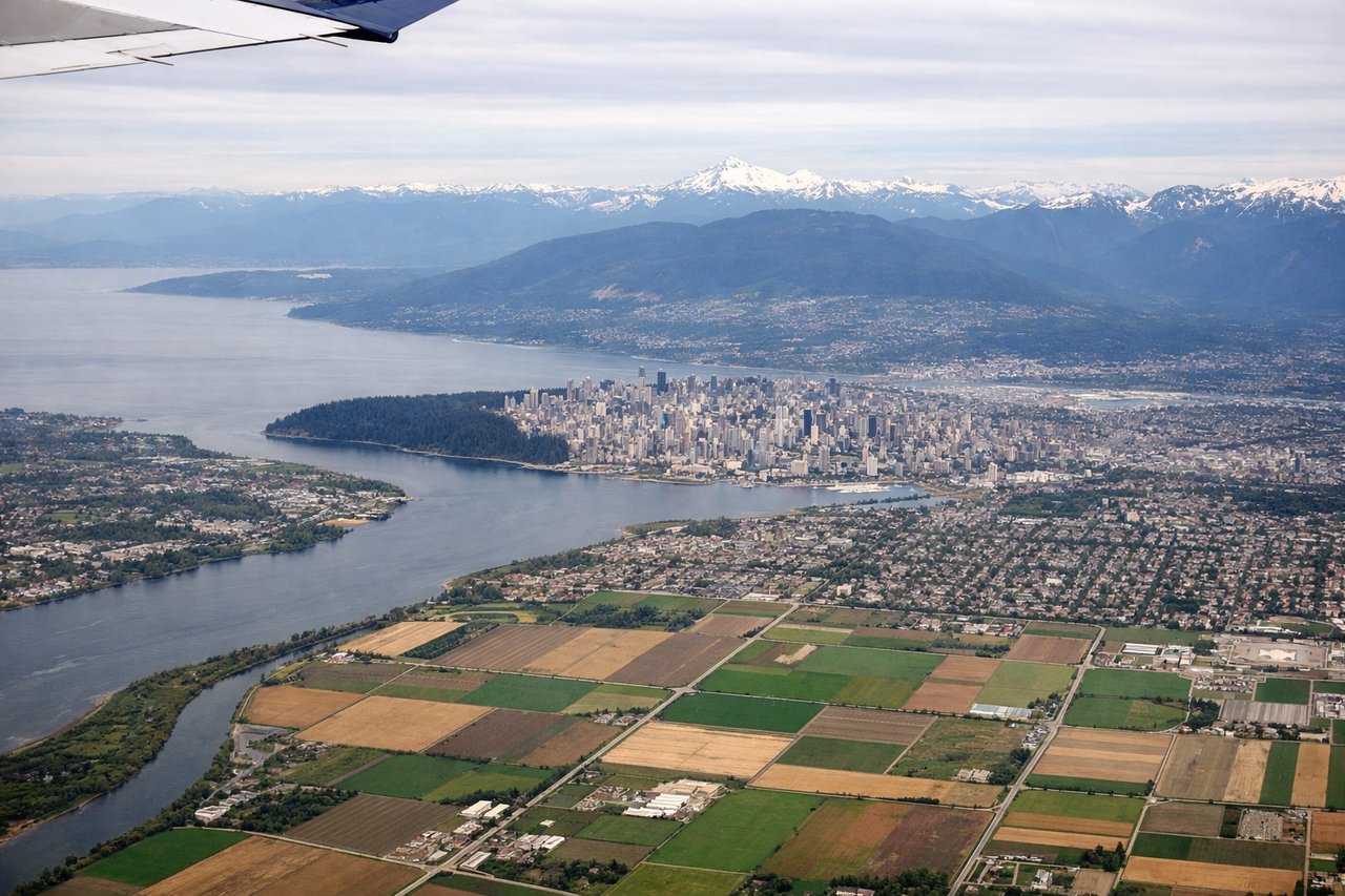
LEFTAfter takeoff on runway 26, the aircraft banks south and passengers on the left get a receding view of downtown Vancouver, the North Shore mountains, and the Fraser River delta, with the glaciated cone of Mount Baker rising on the horizon. The right side mainly shows the Strait of Georgia and Gulf Islands, which is pleasant but less dramatic.

Landing at LAX
RIGHTLAX arrivals from the north typically swing out over Santa Monica Bay before turning to land west, putting the Pacific coastline on the right side. Passengers get a sweeping view of Malibu, the Santa Monica Pier area, and the Palos Verdes Peninsula, with Catalina Island sometimes visible offshore.
Landmarks on this routeAll landmarks →
Will your flight be in sunlight?
See exactly which side of the plane gets sun and shade at your departure time.
About This Route
Which side of the plane should I sit on flying from Vancouver International (YVR) to Los Angeles International (LAX)?
Sit on the Left side of the plane for the best views on flights from Vancouver to Los Angeles. The cruise phase decides it: the flight path down the I-5 corridor runs just west of the Cascade Range, giving left-side passengers a long, clear procession of volcanic peaks — Baker, Rainier, St. Helens, Hood, and Shasta — one of the most recognizable scenic sequences on any West Coast route, outweighing the right side's stronger but shorter landing view.
What can I see during takeoff from Vancouver International in Vancouver?
During takeoff from Vancouver International (YVR), sit on the Left side for the best views. After takeoff on runway 26, the aircraft banks south and passengers on the left get a receding view of downtown Vancouver, the North Shore mountains, and the Fraser River delta, with the glaciated cone of Mount Baker rising on the horizon. The right side mainly shows the Strait of Georgia and Gulf Islands, which is pleasant but less dramatic. Notable sights include: Downtown Vancouver skyline, North Shore/Coast Mountains, Fraser River delta, Mount Baker.
What can I see when landing at Los Angeles International in Los Angeles?
When landing at Los Angeles International (LAX), sit on the Right side for the best views. LAX arrivals from the north typically swing out over Santa Monica Bay before turning to land west, putting the Pacific coastline on the right side. Passengers get a sweeping view of Malibu, the Santa Monica Pier area, and the Palos Verdes Peninsula, with Catalina Island sometimes visible offshore. Notable sights include: Santa Monica Bay, Malibu coastline, Palos Verdes Peninsula, Catalina Island (haze permitting).
How long is the flight from Vancouver to Los Angeles?
The flight from Vancouver International (YVR) to Los Angeles International (LAX) takes 2h 45m.
What does the Vancouver to Los Angeles flight path pass over?
Willamette Valley and the Cascade volcanoes near the Oregon-California border, including Mount Shasta and the Klamath Basin, with the Sacramento Valley opening up further south