Left side scores higher due to the dramatic volcanic and mountainous terrain visible during takeoff from Medford, which is the most visually distinctive phase of this short flight. While the landing approach on the right offers urban and coastal scenery, the Cascade Range and Rogue Valley landscape during departure provides greater terrain drama and variety. The flight is relatively short (approximately 2 hours), so the takeoff experience carries more weight in the overall scoring.
Flown MFR to LAX? Did we get it right?
Flight Path
Medford to Los Angeles is 631 miles (1,015 km), a flight of about 2 hours 5 minutes.
Northern California interior: Sierra Nevada foothills, Sacramento Valley floor, scattered volcanic peaks of the Modoc Plateau region, transition from forested mountains to agricultural valleys and desert scrubland as the flight progresses south toward the Central Valley and Tehachapi Mountains
Great circle distance and headings ›Phase by phase
Takeoff from MFR
LEFTLeft side captures the Cascade Range and Rogue Valley terrain during climb-out from runway 32 (northwest departure). The volcanic peaks and forested valleys of southern Oregon are immediately visible and dramatic during the initial climb phase.
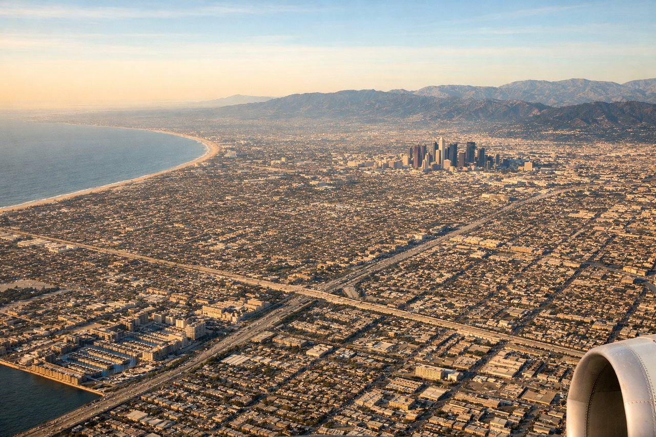
Landing at LAX
RIGHTRight side offers superior approach scenery during typical west-flow arrivals at LAX. Aircraft descending on runway 24R or 25L pass over the San Gabriel Mountains, Los Angeles basin, and coastal features including Santa Monica Bay and the Pacific coastline before landing.
Will your flight be in sunlight?
Pick a date and time in the Sun Map to watch the sun move across your whole flight.
About This Route
Which side of the plane should I sit on flying from Rogue Valley International-Medford Airport (MFR) to Los Angeles International (LAX)?
Sit on the Left side of the plane for the best views on flights from Medford to Los Angeles. Left side scores higher due to the dramatic volcanic and mountainous terrain visible during takeoff from Medford, which is the most visually distinctive phase of this short flight. While the landing approach on the right offers urban and coastal scenery, the Cascade Range and Rogue Valley landscape during departure provides greater terrain drama and variety. The flight is relatively short (approximately 2 hours), so the takeoff experience carries more weight in the overall scoring.
What can I see during takeoff from Rogue Valley International-Medford Airport in Medford?
During takeoff from Rogue Valley International-Medford Airport (MFR), sit on the Left side for the best views. Left side captures the Cascade Range and Rogue Valley terrain during climb-out from runway 32 (northwest departure). The volcanic peaks and forested valleys of southern Oregon are immediately visible and dramatic during the initial climb phase. Notable sights include: Cascade Range peaks (including Mount McLoughlin to the north), Rogue Valley floor with Medford visible below, forested ridgelines of the Siskiyou Mountains to the south.
What can I see when landing at Los Angeles International in Los Angeles?
When landing at Los Angeles International (LAX), sit on the Right side for the best views. Right side offers superior approach scenery during typical west-flow arrivals at LAX. Aircraft descending on runway 24R or 25L pass over the San Gabriel Mountains, Los Angeles basin, and coastal features including Santa Monica Bay and the Pacific coastline before landing. Notable sights include: San Gabriel Mountains (snow-capped in winter, visible from 15,000+ feet), Los Angeles basin sprawl, Santa Monica Bay and Pacific coastline, Long Beach harbor area.
How long is the flight from Medford to Los Angeles?
The flight from Rogue Valley International-Medford Airport (MFR) to Los Angeles International (LAX) takes about 2 hours 5 minutes. The shortest flight path between them is 631 miles (1,015 km); winds and air traffic control usually add a few percent.
What does the Medford to Los Angeles flight path pass over?
Northern California interior: Sierra Nevada foothills, Sacramento Valley floor, scattered volcanic peaks of the Modoc Plateau region, transition from forested mountains to agricultural valleys and desert scrubland as the flight progresses south toward the Central Valley and Tehachapi Mountains