While takeoff offers good views of Lake Managua and the Marrabios range on the right, the landing approach provides more dramatic and sustained scenery with the San Salvador and San Vicente volcanic complex dominating the view. The volcanic peaks are more visually striking and closer to the flight path during descent.
Flown MGA to SAL? Did we get it right?
Flight Path
Managua to San Salvador is 214 miles (345 km), a flight of about 45 minutes.
The flight crosses the Pacific coastal plains of Nicaragua and El Salvador at low altitude relative to typical cruising. Notable features along the route include the Lempa River valley (visible as a green corridor through agricultural land in central El Salvador), the transition from Nicaraguan lowlands to Salvadoran highlands, and scattered volcanic peaks of the Central American cordillera. Lake Ilopango becomes visible approximately 20 minutes before landing.
Great circle distance and headings ›Phase by phase
Takeoff from MGA
RIGHTRight-side seats offer views of Lake Managua (Lago de Managua) immediately after departure, plus the volcanic peaks of the Marrabios range rising to the northwest. The flight path climbs northwest toward El Salvador, so right-side passengers see these features directly off the wing during initial climb.
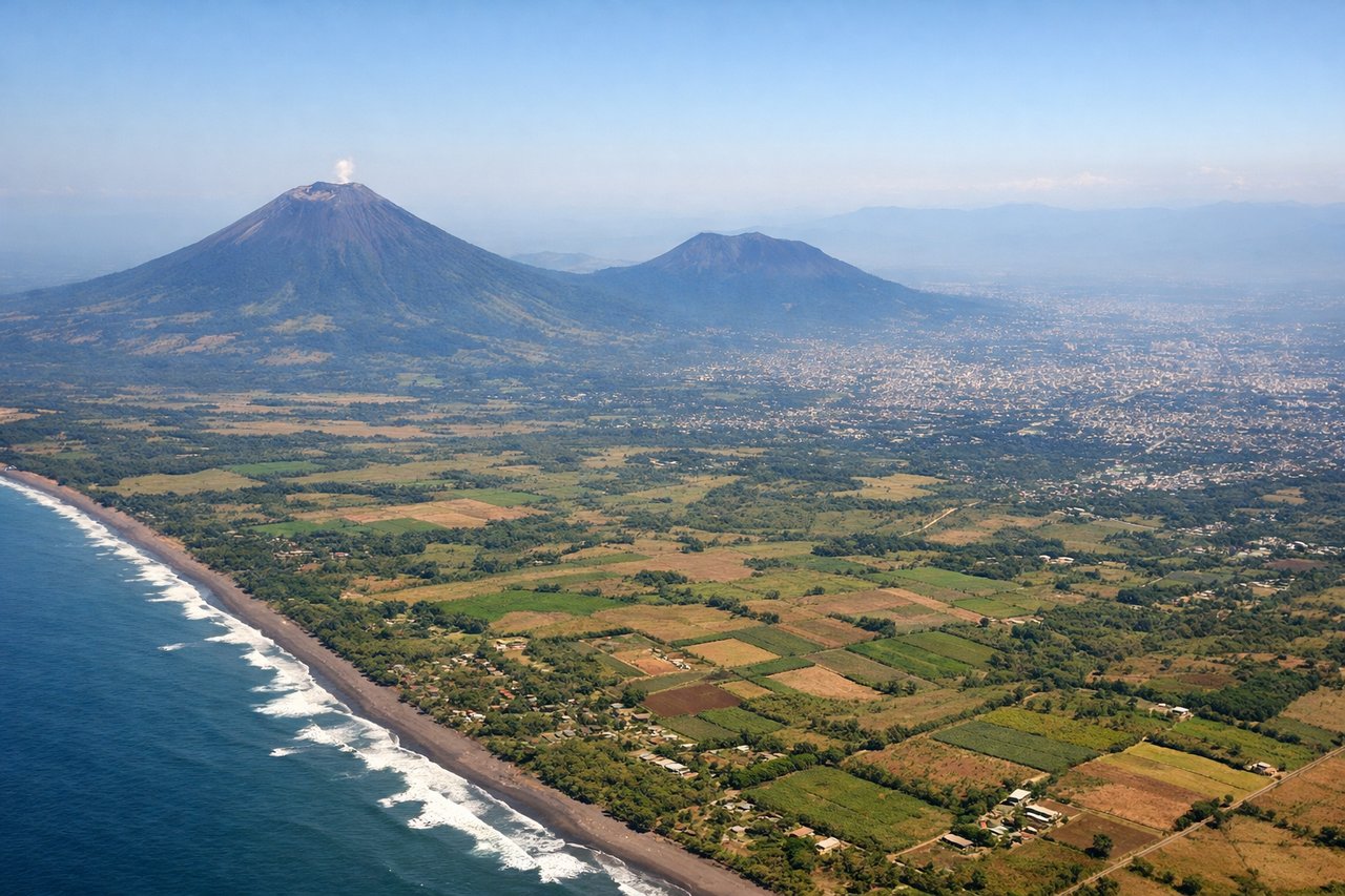
Landing at SAL
LEFTLeft-side seats provide excellent views of the San Salvador volcanic complex and the approach path over the Central American highlands. As the aircraft descends toward El Salvador International (located east of San Salvador), left-side passengers see the San Salvador and San Vicente volcanic peaks and the surrounding highland terrain directly off the wing.
Will your flight be in sunlight?
Pick a date and time in the Sun Map to watch the sun move across your whole flight.
About This Route
Which side of the plane should I sit on flying from Managua International (MGA) to El Salvador International (SAL)?
Sit on the Left side of the plane for the best views on flights from Managua to San Salvador. While takeoff offers good views of Lake Managua and the Marrabios range on the right, the landing approach provides more dramatic and sustained scenery with the San Salvador and San Vicente volcanic complex dominating the view. The volcanic peaks are more visually striking and closer to the flight path during descent.
What can I see during takeoff from Managua International in Managua?
During takeoff from Managua International (MGA), sit on the Right side for the best views. Right-side seats offer views of Lake Managua (Lago de Managua) immediately after departure, plus the volcanic peaks of the Marrabios range rising to the northwest. The flight path climbs northwest toward El Salvador, so right-side passengers see these features directly off the wing during initial climb. Notable sights include: Lake Managua (Lago de Managua), Marrabios volcanic range, Managua city sprawl to the south, Pacific coastal plains to the southwest.
What can I see when landing at El Salvador International in San Salvador?
When landing at El Salvador International (SAL), sit on the Left side for the best views. Left-side seats provide excellent views of the San Salvador volcanic complex and the approach path over the Central American highlands. As the aircraft descends toward El Salvador International (located east of San Salvador), left-side passengers see the San Salvador and San Vicente volcanic peaks and the surrounding highland terrain directly off the wing. Notable sights include: San Salvador volcano, San Vicente volcano (Chinchontepec), Lake Ilopango, Salvadoran highlands.
How long is the flight from Managua to San Salvador?
The flight from Managua International (MGA) to El Salvador International (SAL) takes about 45 minutes. The shortest flight path between them is 214 miles (345 km); winds and air traffic control usually add a few percent.
What does the Managua to San Salvador flight path pass over?
The flight crosses the Pacific coastal plains of Nicaragua and El Salvador at low altitude relative to typical cruising. Notable features along the route include the Lempa River valley (visible as a green corridor through agricultural land in central El Salvador), the transition from Nicaraguan lowlands to Salvadoran highlands, and scattered volcanic peaks of the Central American cordillera. Lake Ilopango becomes visible approximately 20 minutes before landing.