Mariehamn to Helsinki is 174 miles (281 km), a flight of about 40 minutes.
Left-side seats capture the most geographically distinctive features of this short route: the Aland Islands archipelago during departure (right-side advantage) is offset by the superior landing views of Helsinki's harbor, metropolitan area, and Gulf of Finland geography (left-side advantage). Since landing views are typically more memorable and the approach to Helsinki offers more dramatic urban and maritime features, left wins overall.
Flight Path
The flight crosses the central Baltic Sea between the Aland Islands and the Finnish mainland. At midpoint, the aircraft passes over open water with scattered skerries and small islands visible below. The flight path generally tracks northeast across the Gulf of Finland, with the Finnish coastline becoming progressively more visible as the aircraft approaches Helsinki. No major mountain ranges or large cities are visible at midpoint—this is primarily open water and low-lying archipelago terrain.
Great circle distance and headings ›Phase by phase
Takeoff from MHQ
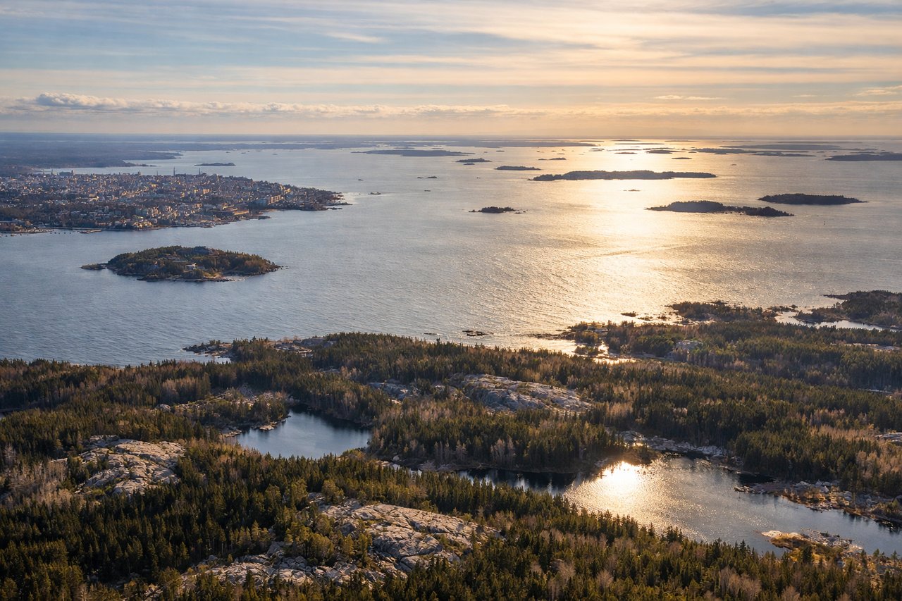
RIGHTMariehamn typically departs runway 09/27 depending on wind. Right-side seats offer views of the Aland Islands archipelago spreading eastward across the Baltic, with the intricate pattern of skerries and waterways visible during the initial climb. Left side faces the open Baltic with less distinctive features.
Landing at HEL
LEFTApproaching Helsinki Vantaa typically uses runways 04L/04R or 09L/09R depending on wind. Left-side seats during descent offer views of the Gulf of Finland's eastern basin, the Helsinki metropolitan area sprawling across peninsulas, and the distinctive pattern of islands and skerries around the capital. Right side faces inland forest with less visual interest.
Will your flight be in sunlight?
Pick a date and time in the Sun Map to watch the sun move across your whole flight.
About This Route
Which side of the plane should I sit on flying from Mariehamn (MHQ) to Helsinki Vantaa (HEL)?
Sit on the Left side of the plane for the best views on flights from Mariehamn to Helsinki. Left-side seats capture the most geographically distinctive features of this short route: the Aland Islands archipelago during departure (right-side advantage) is offset by the superior landing views of Helsinki's harbor, metropolitan area, and Gulf of Finland geography (left-side advantage). Since landing views are typically more memorable and the approach to Helsinki offers more dramatic urban and maritime features, left wins overall.
What can I see during takeoff from Mariehamn in Mariehamn?
During takeoff from Mariehamn (MHQ), sit on the Right side for the best views. Mariehamn typically departs runway 09/27 depending on wind. Right-side seats offer views of the Aland Islands archipelago spreading eastward across the Baltic, with the intricate pattern of skerries and waterways visible during the initial climb. Left side faces the open Baltic with less distinctive features. Notable sights include: Aland Islands archipelago (dense cluster of islands and skerries), Baltic Sea (open water to the west), Mariehamn harbor and town (directly below during climb), Lake Lumparn (visible as a distinct freshwater body within the islands).
What can I see when landing at Helsinki Vantaa in Helsinki?
When landing at Helsinki Vantaa (HEL), sit on the Left side for the best views. Approaching Helsinki Vantaa typically uses runways 04L/04R or 09L/09R depending on wind. Left-side seats during descent offer views of the Gulf of Finland's eastern basin, the Helsinki metropolitan area sprawling across peninsulas, and the distinctive pattern of islands and skerries around the capital. Right side faces inland forest with less visual interest. Notable sights include: Gulf of Finland (open water body), Helsinki metropolitan area and harbor districts (visible as urban sprawl across peninsulas), Suomenlinna fortress islands (distinctive cluster in the harbor approaches), Finnish archipelago and skerries (scattered islands in the gulf).
How long is the flight from Mariehamn to Helsinki?
The flight from Mariehamn (MHQ) to Helsinki Vantaa (HEL) takes about 40 minutes. The shortest flight path between them is 174 miles (281 km); winds and air traffic control usually add a few percent.
What does the Mariehamn to Helsinki flight path pass over?
The flight crosses the central Baltic Sea between the Aland Islands and the Finnish mainland. At midpoint, the aircraft passes over open water with scattered skerries and small islands visible below. The flight path generally tracks northeast across the Gulf of Finland, with the Finnish coastline becoming progressively more visible as the aircraft approaches Helsinki. No major mountain ranges or large cities are visible at midpoint—this is primarily open water and low-lying archipelago terrain.