Miami to Cedar City is 2,082 miles (3,351 km), a flight of about 4 hours 30 minutes.
The right side delivers the standout views at both ends of the flight — Miami's coastal geography on departure and the dramatic Colorado Plateau escarpment on arrival. During the cruise over the Gulf Coast, Mississippi, and Texas, the right side also tends to offer better angles on the Gulf of Mexico shoreline and the Texas Hill Country before the terrain rises into the Southwest plateau country.
Flight Path
The flight tracks northwest over the Florida Everglades and Gulf Coast, then crosses the Gulf of Mexico shoreline near the Florida Panhandle or Alabama coast, continues over Mississippi and Louisiana lowlands, crosses the Texas Hill Country and Edwards Plateau, then traverses the Chihuahuan and Sonoran desert transition zones of New Mexico and Arizona before climbing onto the Colorado Plateau approaching Cedar City. The Four Corners region and the southern edge of the Great Basin are visible in the final hour.
Great circle distance and headings ›

.jpg?width=600)

.jpg?width=600)

Phase by phase
Takeoff from MIA
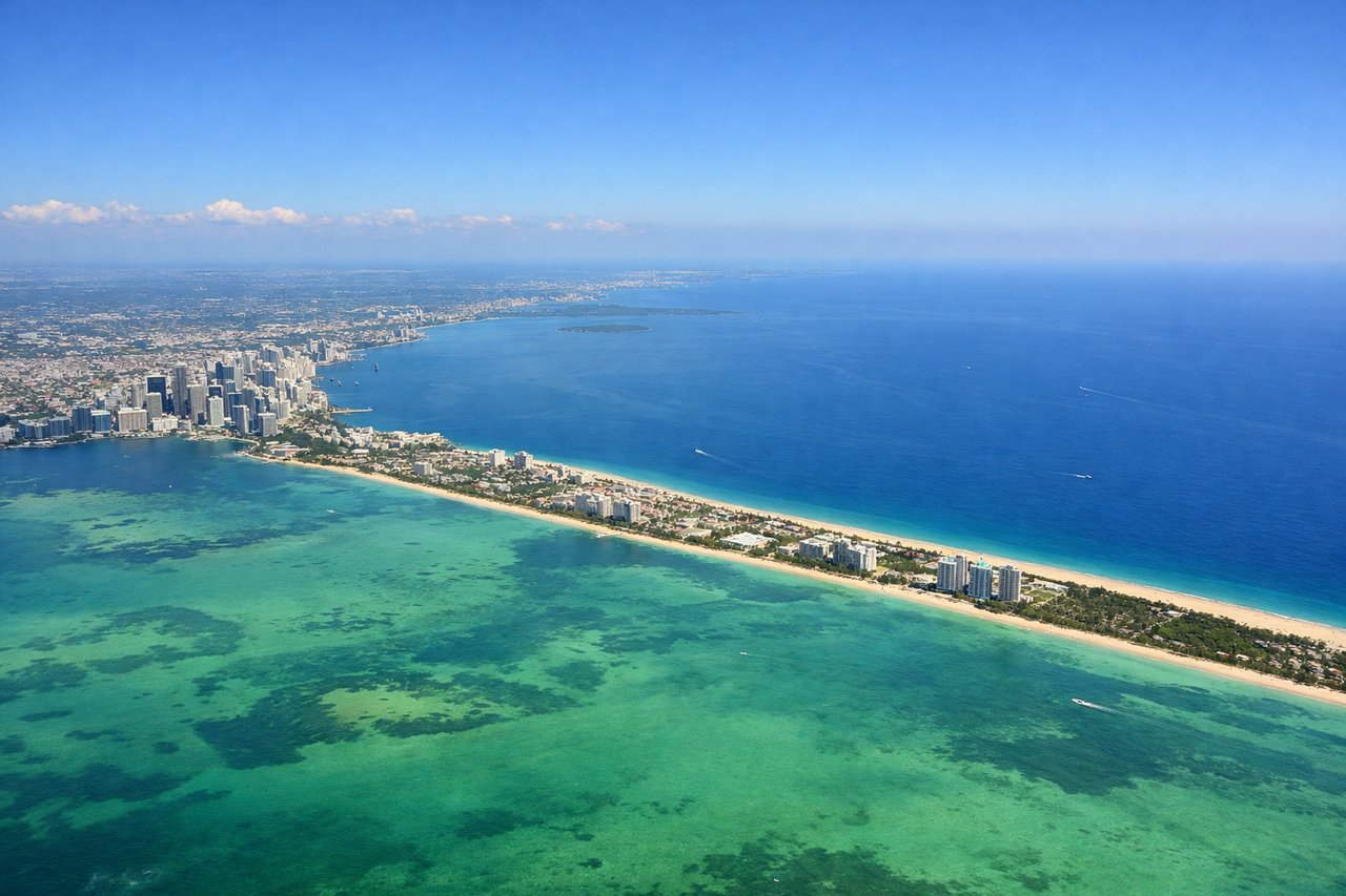
RIGHTMIA typically departs westbound on runway 09/27 or northbound on 12/30. A right-side seat on westbound departure gives you Biscayne Bay, the Miami Beach barrier islands, and the Atlantic coastline as the aircraft banks northwest. The downtown Miami skyline and Port of Miami are clearly visible to the right during the initial climb.
Landing at CDC
RIGHTCedar City Regional typically uses runway 20 for southerly approaches, meaning the aircraft arrives from the north-northeast. A right-side seat on approach gives you the best view of the Markagunt Plateau, the red rock canyon country to the east, and the dramatic escarpment of the Colorado Plateau edge. The Zion Canyon area sits to the southwest and is visible on the right side during the descent arc.
Landmarks on this routeAll landmarks →
Will your flight be in sunlight?
Pick a date and time in the Sun Map to watch the sun move across your whole flight.
About This Route
Which side of the plane should I sit on flying from Miami International (MIA) to Cedar City Rgnl (CDC)?
Sit on the Right side of the plane for the best views on flights from Miami to Cedar City. The right side delivers the standout views at both ends of the flight — Miami's coastal geography on departure and the dramatic Colorado Plateau escarpment on arrival. During the cruise over the Gulf Coast, Mississippi, and Texas, the right side also tends to offer better angles on the Gulf of Mexico shoreline and the Texas Hill Country before the terrain rises into the Southwest plateau country.
What can I see during takeoff from Miami International in Miami?
During takeoff from Miami International (MIA), sit on the Right side for the best views. MIA typically departs westbound on runway 09/27 or northbound on 12/30. A right-side seat on westbound departure gives you Biscayne Bay, the Miami Beach barrier islands, and the Atlantic coastline as the aircraft banks northwest. The downtown Miami skyline and Port of Miami are clearly visible to the right during the initial climb. Notable sights include: Biscayne Bay, Miami Beach barrier islands, Port of Miami, downtown Miami skyline.
What can I see when landing at Cedar City Rgnl in Cedar City?
When landing at Cedar City Rgnl (CDC), sit on the Right side for the best views. Cedar City Regional typically uses runway 20 for southerly approaches, meaning the aircraft arrives from the north-northeast. A right-side seat on approach gives you the best view of the Markagunt Plateau, the red rock canyon country to the east, and the dramatic escarpment of the Colorado Plateau edge. The Zion Canyon area sits to the southwest and is visible on the right side during the descent arc. Notable sights include: Markagunt Plateau, Hurricane Cliffs escarpment, Zion Canyon area, Iron County desert basin.
How long is the flight from Miami to Cedar City?
The flight from Miami International (MIA) to Cedar City Rgnl (CDC) takes about 4 hours 30 minutes. The shortest flight path between them is 2,082 miles (3,351 km); winds and air traffic control usually add a few percent.
What does the Miami to Cedar City flight path pass over?
The flight tracks northwest over the Florida Everglades and Gulf Coast, then crosses the Gulf of Mexico shoreline near the Florida Panhandle or Alabama coast, continues over Mississippi and Louisiana lowlands, crosses the Texas Hill Country and Edwards Plateau, then traverses the Chihuahuan and Sonoran desert transition zones of New Mexico and Arizona before climbing onto the Colorado Plateau approaching Cedar City. The Four Corners region and the southern edge of the Great Basin are visible in the final hour.