Cedar City to Miami is 2,082 miles (3,351 km), a flight of about 5 hours.
While takeoff offers interesting high-desert geology, the landing approach provides more dramatic and varied scenery with the Everglades-to-coast transition and Biscayne Bay's distinctive turquoise waters. Left-side seats capture the most visually striking portion of the flight.
Flight Path
The flight path crosses the Mississippi River valley (visible around 2.5 hours into flight), the Gulf of Mexico coastline near Louisiana or Mississippi, and then crosses the Gulf itself. Notable midpoint landmarks include the Mississippi River delta region, the Louisiana coastline with its barrier islands, and open Gulf waters. The Gulf crossing offers minimal ground features but clear water and occasional weather systems. As the flight approaches Florida, the Panhandle coastline becomes visible, followed by inland Florida lakes and wetland systems before the final descent into Miami.
Great circle distance and headings ›
.jpg?width=600)

.jpg?width=600)


Phase by phase
Takeoff from CDC
RIGHTRight-side seats offer views of the red rock formations and plateaus surrounding Cedar City during climb-out. The aircraft departs eastbound initially before turning southeast, so right-side passengers see the distinctive Markagunt Plateau and surrounding high desert terrain.
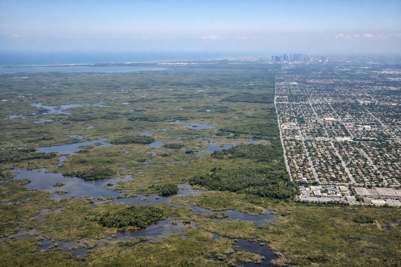
Landing at MIA
LEFTLeft-side seats provide views of the Everglades, Biscayne Bay, and the Miami metropolitan area during descent. The approach to MIA comes from the northwest, so left-side passengers see the transition from inland wetlands to coastal development and the bay's turquoise waters.
Landmarks on this routeAll landmarks →
Will your flight be in sunlight?
Pick a date and time in the Sun Map to watch the sun move across your whole flight.
About This Route
Which side of the plane should I sit on flying from Cedar City Rgnl (CDC) to Miami International (MIA)?
Sit on the Left side of the plane for the best views on flights from Cedar City to Miami. While takeoff offers interesting high-desert geology, the landing approach provides more dramatic and varied scenery with the Everglades-to-coast transition and Biscayne Bay's distinctive turquoise waters. Left-side seats capture the most visually striking portion of the flight.
What can I see during takeoff from Cedar City Rgnl in Cedar City?
During takeoff from Cedar City Rgnl (CDC), sit on the Right side for the best views. Right-side seats offer views of the red rock formations and plateaus surrounding Cedar City during climb-out. The aircraft departs eastbound initially before turning southeast, so right-side passengers see the distinctive Markagunt Plateau and surrounding high desert terrain. Notable sights include: Markagunt Plateau, Cedar Breaks National Monument rim, Hurricane Cliffs, High desert scrubland with sparse vegetation.
What can I see when landing at Miami International in Miami?
When landing at Miami International (MIA), sit on the Left side for the best views. Left-side seats provide views of the Everglades, Biscayne Bay, and the Miami metropolitan area during descent. The approach to MIA comes from the northwest, so left-side passengers see the transition from inland wetlands to coastal development and the bay's turquoise waters. Notable sights include: Everglades wetlands with tree islands, Biscayne Bay with shallow turquoise water, Miami downtown skyline and port facilities, Barrier islands and coastal development.
How long is the flight from Cedar City to Miami?
The flight from Cedar City Rgnl (CDC) to Miami International (MIA) takes about 5 hours. The shortest flight path between them is 2,082 miles (3,351 km); winds and air traffic control usually add a few percent.
What does the Cedar City to Miami flight path pass over?
The flight path crosses the Mississippi River valley (visible around 2.5 hours into flight), the Gulf of Mexico coastline near Louisiana or Mississippi, and then crosses the Gulf itself. Notable midpoint landmarks include the Mississippi River delta region, the Louisiana coastline with its barrier islands, and open Gulf waters. The Gulf crossing offers minimal ground features but clear water and occasional weather systems. As the flight approaches Florida, the Panhandle coastline becomes visible, followed by inland Florida lakes and wetland systems before the final descent into Miami.