While landing views on the left are spectacular, the takeoff scenery from Cedar City is more distinctive and visually dramatic. The right side captures the unique red rock geology that makes this region memorable, whereas the landing approach, though beautiful, is a standard Bay Area descent that left-side passengers will see clearly regardless.
Flown CDC to SFO? Did we get it right?
Flight Path
Cedar City to San Francisco is 507 miles (816 km), a flight of about 2 hours 15 minutes.
The flight path crosses the Sierra Nevada range roughly 60 miles east of San Francisco. Passengers will see the High Sierra peaks (including portions of the Sierra crest above 10,000 feet) during cruise altitude, with Lake Tahoe visible to the north if the flight path permits. The transition from the high desert plateau of Utah to the forested Sierra Nevada and then to the coastal valleys of California represents the most dramatic geographical shift of the journey.
Great circle distance and headings ›

Phase by phase
Takeoff from CDC
RIGHTRight-side seats offer immediate views of the red rock formations and plateaus surrounding Cedar City. The aircraft departs westbound, so right-side passengers see the distinctive terrain of the Colorado Plateau as the plane climbs.
Landing at SFO
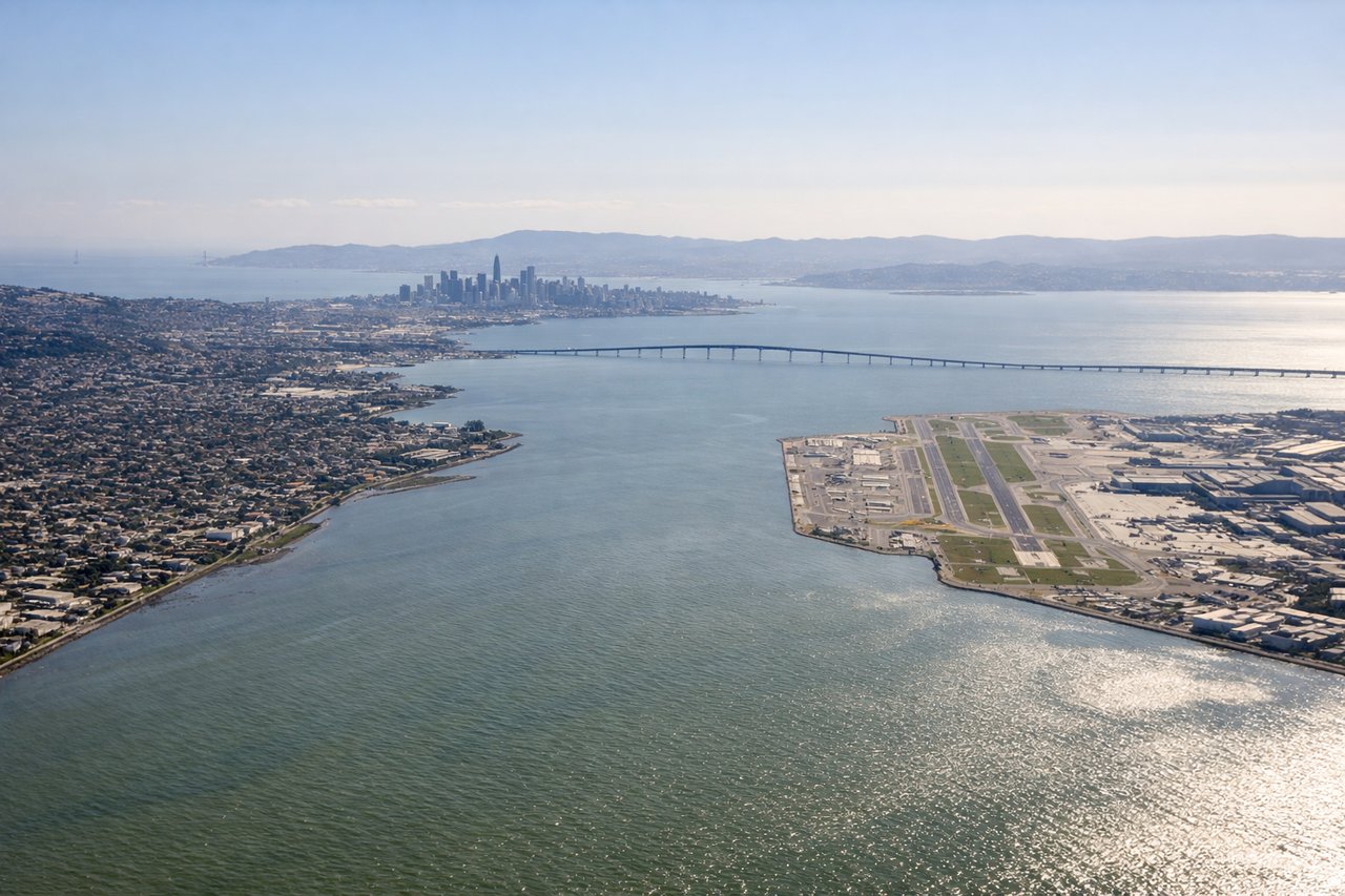
LEFTLeft-side seats provide excellent views during the descent approach into San Francisco. The aircraft descends from the east over the Central Valley and Sierra Nevada foothills, so left-side passengers see the San Francisco Bay, Golden Gate Strait, and the city skyline as the plane banks for final approach.
Will your flight be in sunlight?
Pick a date and time in the Sun Map to watch the sun move across your whole flight.
About This Route
Which side of the plane should I sit on flying from Cedar City Rgnl (CDC) to San Francisco International (SFO)?
Sit on the Right side of the plane for the best views on flights from Cedar City to San Francisco. While landing views on the left are spectacular, the takeoff scenery from Cedar City is more distinctive and visually dramatic. The right side captures the unique red rock geology that makes this region memorable, whereas the landing approach, though beautiful, is a standard Bay Area descent that left-side passengers will see clearly regardless.
What can I see during takeoff from Cedar City Rgnl in Cedar City?
During takeoff from Cedar City Rgnl (CDC), sit on the Right side for the best views. Right-side seats offer immediate views of the red rock formations and plateaus surrounding Cedar City. The aircraft departs westbound, so right-side passengers see the distinctive terrain of the Colorado Plateau as the plane climbs. Notable sights include: Markagunt Plateau, Cedar Breaks National Monument rim, Hurricane Cliffs, Kolob Canyons.
What can I see when landing at San Francisco International in San Francisco?
When landing at San Francisco International (SFO), sit on the Left side for the best views. Left-side seats provide excellent views during the descent approach into San Francisco. The aircraft descends from the east over the Central Valley and Sierra Nevada foothills, so left-side passengers see the San Francisco Bay, Golden Gate Strait, and the city skyline as the plane banks for final approach. Notable sights include: San Francisco Bay, Golden Gate Strait, Sierra Nevada foothills, San Francisco skyline and downtown core.
How long is the flight from Cedar City to San Francisco?
The flight from Cedar City Rgnl (CDC) to San Francisco International (SFO) takes about 2 hours 15 minutes. The shortest flight path between them is 507 miles (816 km); winds and air traffic control usually add a few percent.
What does the Cedar City to San Francisco flight path pass over?
The flight path crosses the Sierra Nevada range roughly 60 miles east of San Francisco. Passengers will see the High Sierra peaks (including portions of the Sierra crest above 10,000 feet) during cruise altitude, with Lake Tahoe visible to the north if the flight path permits. The transition from the high desert plateau of Utah to the forested Sierra Nevada and then to the coastal valleys of California represents the most dramatic geographical shift of the journey.