Miami to Basse Terre is 1,270 miles (2,044 km), a flight of about 2 hours 55 minutes.
The right side delivers the spectacular Miami Beach and Biscayne Bay departure, and during the cruise over the Caribbean you still get reasonable views of the Bahamas chain and Puerto Rico in the distance on the right. The left side wins at landing, but the right side's takeoff scenery is more dramatic overall.
Flight Path
The flight tracks southeast over the Bahamas, passing near Great Exuma and the Turks and Caicos Islands, then crosses the open Caribbean northeast of Hispaniola and Puerto Rico before descending toward the northern Leeward Islands. The Bahamas' shallow turquoise banks are visible from altitude, and on clear days the mountainous spine of Hispaniola appears on the southern horizon.
Great circle distance and headings ›Phase by phase
Takeoff from MIA
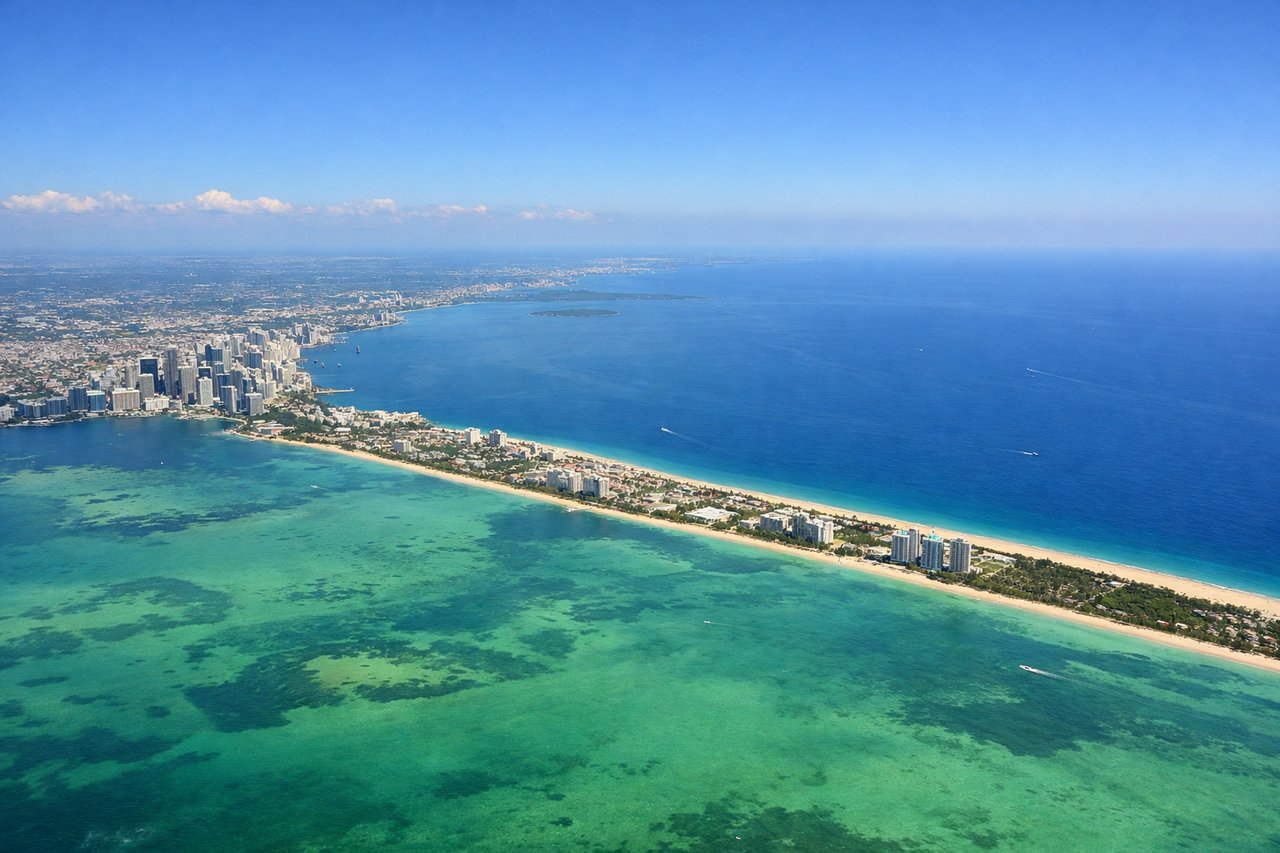
RIGHTMIA typically departs east on runway 08R/09, putting the right side over Biscayne Bay, Miami Beach, and the Atlantic. You get a clear view of the barrier islands, the Port of Miami, and downtown Miami's skyline as the aircraft banks southeast toward the Caribbean.
Landing at SKB
LEFTSKB's runway 07/25 means arrivals typically come in from the west over the Caribbean, putting the left side facing south toward the volcanic peak of Mount Liamuiga on St. Kitts and the island's southeastern peninsula. You also get views of Nevis Peak across the Narrows strait as you descend.
Landmarks on this routeAll landmarks →
Will your flight be in sunlight?
Pick a date and time in the Sun Map to watch the sun move across your whole flight.
About This Route
Which side of the plane should I sit on flying from Miami International (MIA) to Robert L Bradshaw (SKB)?
Sit on the Right side of the plane for the best views on flights from Miami to Basse Terre. The right side delivers the spectacular Miami Beach and Biscayne Bay departure, and during the cruise over the Caribbean you still get reasonable views of the Bahamas chain and Puerto Rico in the distance on the right. The left side wins at landing, but the right side's takeoff scenery is more dramatic overall.
What can I see during takeoff from Miami International in Miami?
During takeoff from Miami International (MIA), sit on the Right side for the best views. MIA typically departs east on runway 08R/09, putting the right side over Biscayne Bay, Miami Beach, and the Atlantic. You get a clear view of the barrier islands, the Port of Miami, and downtown Miami's skyline as the aircraft banks southeast toward the Caribbean. Notable sights include: Biscayne Bay, Miami Beach barrier island, Port of Miami, downtown Miami skyline.
What can I see when landing at Robert L Bradshaw in Basse Terre?
When landing at Robert L Bradshaw (SKB), sit on the Left side for the best views. SKB's runway 07/25 means arrivals typically come in from the west over the Caribbean, putting the left side facing south toward the volcanic peak of Mount Liamuiga on St. Kitts and the island's southeastern peninsula. You also get views of Nevis Peak across the Narrows strait as you descend. Notable sights include: Mount Liamuiga (St. Kitts), Nevis Peak, The Narrows strait, southeastern peninsula of St. Kitts.
How long is the flight from Miami to Basse Terre?
The flight from Miami International (MIA) to Robert L Bradshaw (SKB) takes about 2 hours 55 minutes. The shortest flight path between them is 1,270 miles (2,044 km); winds and air traffic control usually add a few percent.
What does the Miami to Basse Terre flight path pass over?
The flight tracks southeast over the Bahamas, passing near Great Exuma and the Turks and Caicos Islands, then crosses the open Caribbean northeast of Hispaniola and Puerto Rico before descending toward the northern Leeward Islands. The Bahamas' shallow turquoise banks are visible from altitude, and on clear days the mountainous spine of Hispaniola appears on the southern horizon.