While takeoff favors the right for Lake Michigan views, the landing approach on the left provides more sustained scenic interest over Chicago's urban landscape, river system, and the final approach over the South Side. The left side captures more of the journey's geographic context.
Flown MKE to MDW? Did we get it right?
Flight Path
Milwaukee to Chicago is 81 miles (130 km), a flight of about 30 minutes.
The flight path crosses directly over the Illinois-Wisconsin border and passes above the suburban communities between Milwaukee and Chicago. Lake Michigan remains visible to the east throughout much of the flight. Notable midpoint features include the Des Plaines River valley (visible from altitude as a linear depression in the landscape), suburban sprawl of communities like Oak Creek and Cudahy south of Milwaukee, and the transition from Milwaukee's industrial waterfront to Chicago's broader urban grid. The flight maintains relatively low altitude for this distance, so ground features remain clearly visible throughout.
Great circle distance and headings ›Phase by phase
Takeoff from MKE
RIGHTRight-side seats offer views of Lake Michigan's shoreline immediately after departure. The aircraft climbs southward out of MKE, and right-side windows capture the lake's western edge and Milwaukee's downtown waterfront before the turn toward Chicago.
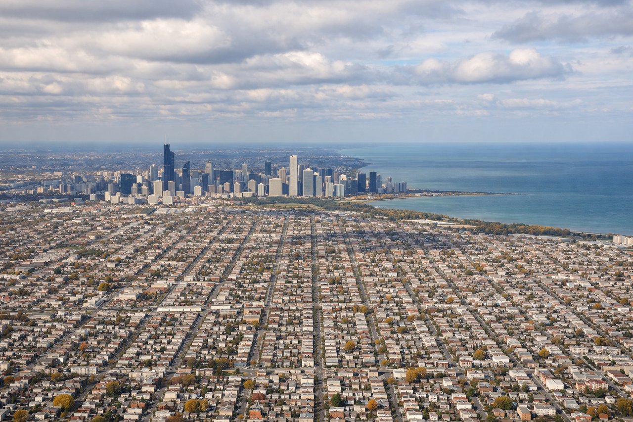
Landing at MDW
LEFTLeft-side seats provide the best views during approach to Midway. The aircraft descends from the north over Chicago's South Side, and left windows frame the city's grid, the Chicago River system, and Lake Michigan's shoreline as the airport comes into view.
Will your flight be in sunlight?
Pick a date and time in the Sun Map to watch the sun move across your whole flight.
About This Route
Which side of the plane should I sit on flying from General Mitchell International (MKE) to Chicago Midway International (MDW)?
Sit on the Left side of the plane for the best views on flights from Milwaukee to Chicago. While takeoff favors the right for Lake Michigan views, the landing approach on the left provides more sustained scenic interest over Chicago's urban landscape, river system, and the final approach over the South Side. The left side captures more of the journey's geographic context.
What can I see during takeoff from General Mitchell International in Milwaukee?
During takeoff from General Mitchell International (MKE), sit on the Right side for the best views. Right-side seats offer views of Lake Michigan's shoreline immediately after departure. The aircraft climbs southward out of MKE, and right-side windows capture the lake's western edge and Milwaukee's downtown waterfront before the turn toward Chicago. Notable sights include: Lake Michigan (western shoreline), Milwaukee downtown and harbor, Kinnickinnic River confluence, Shorewood and North Shore suburbs along the coast.
What can I see when landing at Chicago Midway International in Chicago?
When landing at Chicago Midway International (MDW), sit on the Left side for the best views. Left-side seats provide the best views during approach to Midway. The aircraft descends from the north over Chicago's South Side, and left windows frame the city's grid, the Chicago River system, and Lake Michigan's shoreline as the airport comes into view. Notable sights include: Lake Michigan (eastern shoreline), Chicago downtown skyline (distant), Chicago River and canal system, Midway Airport runways and surrounding South Side neighborhoods.
How long is the flight from Milwaukee to Chicago?
The flight from General Mitchell International (MKE) to Chicago Midway International (MDW) takes about 30 minutes. The shortest flight path between them is 81 miles (130 km); winds and air traffic control usually add a few percent.
What does the Milwaukee to Chicago flight path pass over?
The flight path crosses directly over the Illinois-Wisconsin border and passes above the suburban communities between Milwaukee and Chicago. Lake Michigan remains visible to the east throughout much of the flight. Notable midpoint features include the Des Plaines River valley (visible from altitude as a linear depression in the landscape), suburban sprawl of communities like Oak Creek and Cudahy south of Milwaukee, and the transition from Milwaukee's industrial waterfront to Chicago's broader urban grid. The flight maintains relatively low altitude for this distance, so ground features remain clearly visible throughout.