While takeoff offers Lake Michigan views on the right, the landing approach provides the most dramatic and sustained geographic feature—the San Gabriel Mountains are genuinely impressive and visible for 30+ minutes of descent. The mountains offer far more visual interest than the Inland Empire sprawl visible from the right.
Flown MKE to ONT? Did we get it right?
Flight Path
Milwaukee to Ontario is 1,709 miles (2,750 km), a flight of about 4 hours 15 minutes.
Over Arizona and southern Nevada, you'll cross the Colorado River (visible as a thin brown line in desert terrain around 35,000 ft), the Grand Canyon region (if routed north), and the Mojave Desert with its distinctive sparse vegetation and dry lake beds. The flight path typically follows airways over northern Arizona, passing east of Las Vegas. The terrain transitions from Great Lakes humidity to high desert with increasingly sparse vegetation and exposed rock formations.
Great circle distance and headings ›


Phase by phase
Takeoff from MKE
RIGHTMKE typically departs to the east or northeast. Right-side seats offer views of Lake Michigan's shoreline as you climb out, plus the Milwaukee urban grid spreading inland. Left side faces inland terrain with less distinctive features.
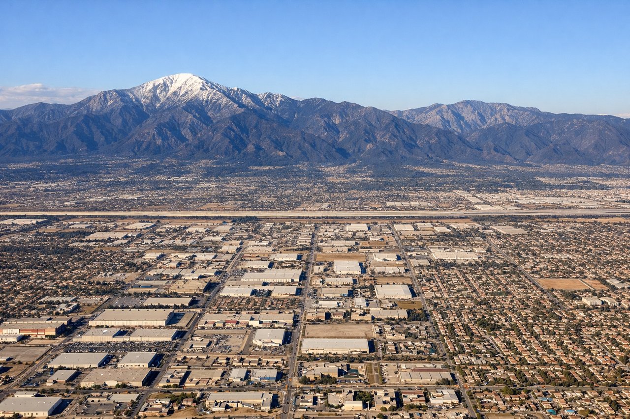
Landing at ONT
LEFTONT typically lands on runways 26L/26R (westbound) or occasionally 08L/08R. On descent from the east, left-side seats face the San Gabriel Mountains directly ahead and to the left, providing dramatic close-range views of the peaks. Right side shows the Inland Empire sprawl but fewer distinctive geographic features.
Will your flight be in sunlight?
Pick a date and time in the Sun Map to watch the sun move across your whole flight.
About This Route
Which side of the plane should I sit on flying from General Mitchell International (MKE) to Ontario International (ONT)?
Sit on the Left side of the plane for the best views on flights from Milwaukee to Ontario. While takeoff offers Lake Michigan views on the right, the landing approach provides the most dramatic and sustained geographic feature—the San Gabriel Mountains are genuinely impressive and visible for 30+ minutes of descent. The mountains offer far more visual interest than the Inland Empire sprawl visible from the right.
What can I see during takeoff from General Mitchell International in Milwaukee?
During takeoff from General Mitchell International (MKE), sit on the Right side for the best views. MKE typically departs to the east or northeast. Right-side seats offer views of Lake Michigan's shoreline as you climb out, plus the Milwaukee urban grid spreading inland. Left side faces inland terrain with less distinctive features. Notable sights include: Lake Michigan (immediate eastern shore), Milwaukee downtown skyline, Kinnickinnic River valley, suburban sprawl extending west toward Waukesha.
What can I see when landing at Ontario International in Ontario?
When landing at Ontario International (ONT), sit on the Left side for the best views. ONT typically lands on runways 26L/26R (westbound) or occasionally 08L/08R. On descent from the east, left-side seats face the San Gabriel Mountains directly ahead and to the left, providing dramatic close-range views of the peaks. Right side shows the Inland Empire sprawl but fewer distinctive geographic features. Notable sights include: San Gabriel Mountains (prominent ridge), San Bernardino National Forest (dark forested slopes), Ontario city grid and industrial areas, Cucamonga Peak (highest visible summit in range).
How long is the flight from Milwaukee to Ontario?
The flight from General Mitchell International (MKE) to Ontario International (ONT) takes about 4 hours 15 minutes. The shortest flight path between them is 1,709 miles (2,750 km); winds and air traffic control usually add a few percent.
What does the Milwaukee to Ontario flight path pass over?
Over Arizona and southern Nevada, you'll cross the Colorado River (visible as a thin brown line in desert terrain around 35,000 ft), the Grand Canyon region (if routed north), and the Mojave Desert with its distinctive sparse vegetation and dry lake beds. The flight path typically follows airways over northern Arizona, passing east of Las Vegas. The terrain transitions from Great Lakes humidity to high desert with increasingly sparse vegetation and exposed rock formations.