While takeoff favors the right for Lake Michigan views, the landing approach on the left side provides superior scenery with the Cascade Range, Mount Hood, and the Willamette River valley. The left side captures the most dramatic geography of the entire flight.
Flown MKE to PDX? Did we get it right?
Flight Path
Milwaukee to Portland is 1,713 miles (2,757 km), a flight of about 3 hours 45 minutes.
The flight path crosses central Wisconsin (relatively flat, forested terrain with scattered lakes), then enters Minnesota and Iowa airspace. You'll pass east of the Twin Cities, cross the Mississippi River valley, and enter the Great Plains of South Dakota and Wyoming. The Black Hills appear as a subtle elevation change in South Dakota. As you approach Oregon, the Rocky Mountains give way to the Columbia Plateau, and the Cascade Range becomes increasingly prominent on the eastern horizon during descent into Portland.
Great circle distance and headings ›Phase by phase
Takeoff from MKE
RIGHTRight-side seats capture Lake Michigan immediately after departure, which dominates the eastern view during climb-out. Milwaukee's urban grid and the lakefront are most prominent on the right side as you gain altitude heading northwest.
Landing at PDX
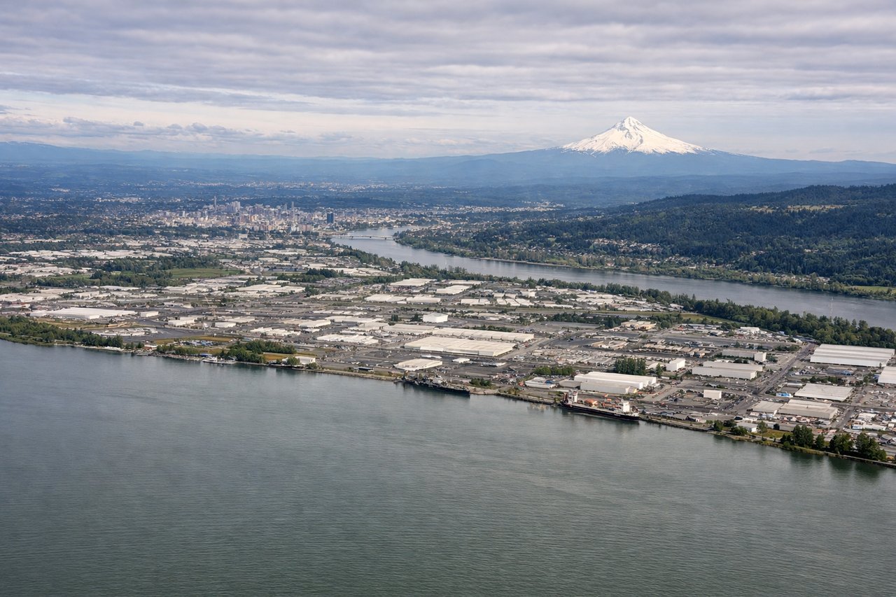
LEFTLeft-side seats offer the best views during descent into PDX. You'll see the Cascade Range rising dramatically to the east, and the Willamette River valley spreading out below. Portland's urban core and the Columbia River are positioned left of the flight path on final approach.
Will your flight be in sunlight?
Pick a date and time in the Sun Map to watch the sun move across your whole flight.
About This Route
Which side of the plane should I sit on flying from General Mitchell International (MKE) to Portland International (PDX)?
Sit on the Left side of the plane for the best views on flights from Milwaukee to Portland. While takeoff favors the right for Lake Michigan views, the landing approach on the left side provides superior scenery with the Cascade Range, Mount Hood, and the Willamette River valley. The left side captures the most dramatic geography of the entire flight.
What can I see during takeoff from General Mitchell International in Milwaukee?
During takeoff from General Mitchell International (MKE), sit on the Right side for the best views. Right-side seats capture Lake Michigan immediately after departure, which dominates the eastern view during climb-out. Milwaukee's urban grid and the lakefront are most prominent on the right side as you gain altitude heading northwest. Notable sights include: Lake Michigan (eastern shore), Milwaukee downtown skyline, Kinnickinnic River valley, suburban sprawl extending west toward Waukesha.
What can I see when landing at Portland International in Portland?
When landing at Portland International (PDX), sit on the Left side for the best views. Left-side seats offer the best views during descent into PDX. You'll see the Cascade Range rising dramatically to the east, and the Willamette River valley spreading out below. Portland's urban core and the Columbia River are positioned left of the flight path on final approach. Notable sights include: Cascade Range (Mount Hood visible on clear days), Willamette River valley, Columbia River, Portland downtown and bridges.
How long is the flight from Milwaukee to Portland?
The flight from General Mitchell International (MKE) to Portland International (PDX) takes about 3 hours 45 minutes. The shortest flight path between them is 1,713 miles (2,757 km); winds and air traffic control usually add a few percent.
What does the Milwaukee to Portland flight path pass over?
The flight path crosses central Wisconsin (relatively flat, forested terrain with scattered lakes), then enters Minnesota and Iowa airspace. You'll pass east of the Twin Cities, cross the Mississippi River valley, and enter the Great Plains of South Dakota and Wyoming. The Black Hills appear as a subtle elevation change in South Dakota. As you approach Oregon, the Rocky Mountains give way to the Columbia Plateau, and the Cascade Range becomes increasingly prominent on the eastern horizon during descent into Portland.