The right side wins because it captures the most dramatic terrain along this route: Montana's Rocky Mountain Front and the edge of Glacier National Park during cruise, followed by the North Cascades and Mount Baker on descent into Seattle. The left side spends most of the flight over the flat plains of the Dakotas and eastern Montana with fewer standout features.
Flight Path
Missouri River valley, North Dakota Badlands, Montana's Rocky Mountain Front near Glacier National Park, Continental Divide crossing into Idaho
Great circle distance and headings ›
.jpg?width=600)

Phase by phase
Takeoff from MKE
RIGHTDeparting MKE, the right side offers a brief but clear view of Lake Michigan's shoreline and Milwaukee's downtown lakefront as the aircraft climbs out and banks onto its westward heading. The left side mostly shows flat suburban grid streets with little visual interest.
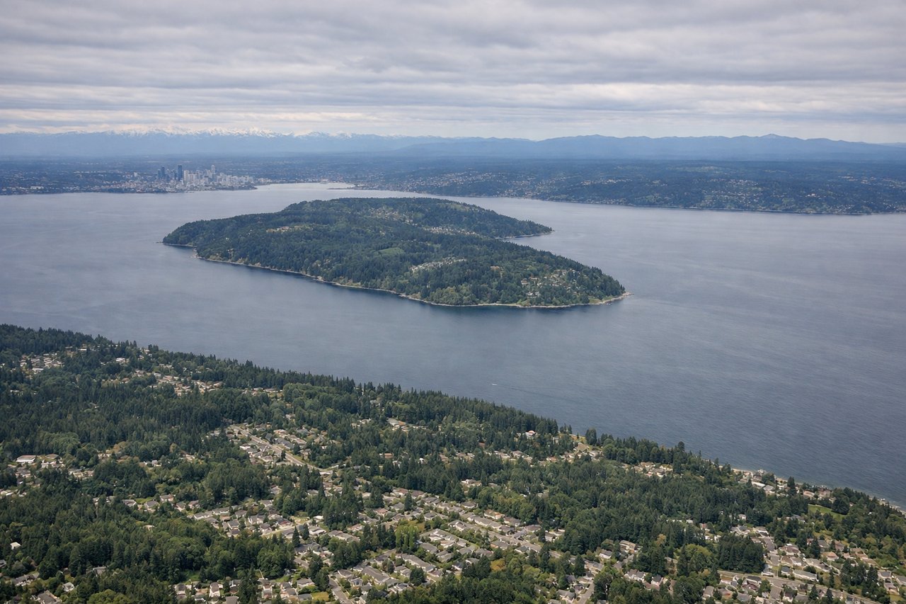
Landing at SEA
RIGHTOn approach into SEA from the east, the right side gives passengers a strong view of the North Cascades, including the glaciated cone of Mount Baker, before the aircraft descends over Puget Sound's islands. The left side mainly faces south toward flatter Cascade foothills with less dramatic relief.
Landmarks on this routeAll landmarks →
Will your flight be in sunlight?
See exactly which side of the plane gets sun and shade at your departure time.
About This Route
Which side of the plane should I sit on flying from General Mitchell International (MKE) to Seattle Tacoma International (SEA)?
Sit on the Right side of the plane for the best views on flights from Milwaukee to Seattle. The right side wins because it captures the most dramatic terrain along this route: Montana's Rocky Mountain Front and the edge of Glacier National Park during cruise, followed by the North Cascades and Mount Baker on descent into Seattle. The left side spends most of the flight over the flat plains of the Dakotas and eastern Montana with fewer standout features.
What can I see during takeoff from General Mitchell International in Milwaukee?
During takeoff from General Mitchell International (MKE), sit on the Right side for the best views. Departing MKE, the right side offers a brief but clear view of Lake Michigan's shoreline and Milwaukee's downtown lakefront as the aircraft climbs out and banks onto its westward heading. The left side mostly shows flat suburban grid streets with little visual interest. Notable sights include: Lake Michigan shoreline, Milwaukee downtown/lakefront, Milwaukee River mouth.
What can I see when landing at Seattle Tacoma International in Seattle?
When landing at Seattle Tacoma International (SEA), sit on the Right side for the best views. On approach into SEA from the east, the right side gives passengers a strong view of the North Cascades, including the glaciated cone of Mount Baker, before the aircraft descends over Puget Sound's islands. The left side mainly faces south toward flatter Cascade foothills with less dramatic relief. Notable sights include: Mount Baker, North Cascades peaks, Puget Sound islands, Whidbey Island.
How long is the flight from Milwaukee to Seattle?
The flight from General Mitchell International (MKE) to Seattle Tacoma International (SEA) takes 4h 15m.
What does the Milwaukee to Seattle flight path pass over?
Missouri River valley, North Dakota Badlands, Montana's Rocky Mountain Front near Glacier National Park, Continental Divide crossing into Idaho