The right side delivers a much richer visual sequence: Malta's harbor city at takeoff, likely views of Sicily's Mount Etna and the Bay of Naples with Vesuvius during cruise, and a rare glimpse of London's skyline on approach. The left side mostly faces open Mediterranean and less distinctive French countryside.
Flight Path
The flight's midpoint falls near the French Riviera and the Ligurian Alps around Nice, with the Mediterranean coastline visible below before the route continues north over southern France toward the English Channel.
Great circle distance and headings ›.jpg?width=600)


.jpg?width=600)
.jpeg?width=600)
Phase by phase
Takeoff from MLA
RIGHTDeparting on runway 31 (heading roughly 312°), the aircraft's right side faces northeast, putting Valletta's Grand Harbour, the Three Cities, and the Sliema/St Julian's coastline in clear view just after liftoff. The left side only shows open farmland and the featureless southern coast of Malta.
Landing at LGW
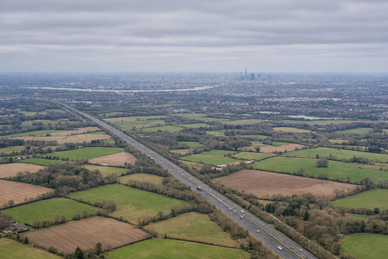
RIGHTOn the typical approach to runway 26, the aircraft comes in from the east and turns to align westward, meaning the right side faces north toward Greater London. On a clear day passengers get a distant glimpse of the London skyline and the Thames valley before the final descent over Surrey's green fields.
Landmarks on this routeAll landmarks →
Will your flight be in sunlight?
See exactly which side of the plane gets sun and shade at your departure time.
About This Route
Which side of the plane should I sit on flying from Luqa (MLA) to Gatwick (LGW)?
Sit on the Right side of the plane for the best views on flights from Malta to London. The right side delivers a much richer visual sequence: Malta's harbor city at takeoff, likely views of Sicily's Mount Etna and the Bay of Naples with Vesuvius during cruise, and a rare glimpse of London's skyline on approach. The left side mostly faces open Mediterranean and less distinctive French countryside.
What can I see during takeoff from Luqa in Malta?
During takeoff from Luqa (MLA), sit on the Right side for the best views. Departing on runway 31 (heading roughly 312°), the aircraft's right side faces northeast, putting Valletta's Grand Harbour, the Three Cities, and the Sliema/St Julian's coastline in clear view just after liftoff. The left side only shows open farmland and the featureless southern coast of Malta. Notable sights include: Valletta and Grand Harbour, The Three Cities (Vittoriosa, Senglea, Cospicua), Sliema/St Julian's coastline, Comino and Gozo in the distance.
What can I see when landing at Gatwick in London?
When landing at Gatwick (LGW), sit on the Right side for the best views. On the typical approach to runway 26, the aircraft comes in from the east and turns to align westward, meaning the right side faces north toward Greater London. On a clear day passengers get a distant glimpse of the London skyline and the Thames valley before the final descent over Surrey's green fields. Notable sights include: Distant London skyline (Shard, City towers), Thames valley haze, Surrey Hills patchwork fields, Gatwick's approach lights near Crawley.
How long is the flight from Malta to London?
The flight from Luqa (MLA) to Gatwick (LGW) takes 3h 15m.
What does the Malta to London flight path pass over?
The flight's midpoint falls near the French Riviera and the Ligurian Alps around Nice, with the Mediterranean coastline visible below before the route continues north over southern France toward the English Channel.