Miyako to Naha is 176 miles (283 km), a flight of about 50 minutes.
The right side captures the most dramatic scenery: Miyako Island's distinctive limestone plateau during takeoff and the central Okinawa ridge during landing. The flight path itself passes over open ocean with minimal mid-flight landmarks, making the endpoints the priority.
Flight Path
The flight crosses the open waters of the Miyako Strait and East China Sea between the two islands. No significant landmarks are visible in the midpoint—primarily deep blue ocean with occasional small islands (Sesoko, Motobu area) visible far to the right (east) at altitude, but these are too distant for clear viewing. The flight maintains altitude over open water for most of the journey before beginning descent toward Okinawa Island's western approach.
Great circle distance and headings ›Phase by phase
Takeoff from MMY
RIGHTMiyako Island's dramatic limestone plateaus and the surrounding Miyako Strait are best viewed from the right side during northwestward climb-out. You'll see the island's distinctive flat-topped terrain and the deep blue water separating Miyako from neighboring islands.
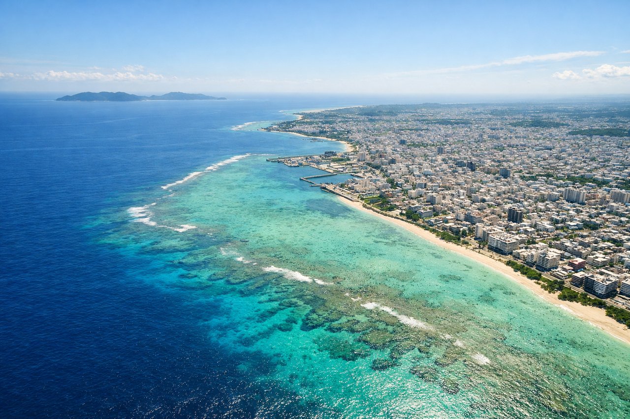
Landing at OKA
LEFTOn approach to Naha from the southeast, the left side offers views of Okinawa Island's central mountainous spine and the Kerama Islands. You'll see the transition from open ocean to the island's interior terrain and urban development around Naha.
Will your flight be in sunlight?
Pick a date and time in the Sun Map to watch the sun move across your whole flight.
About This Route
Which side of the plane should I sit on flying from Miyako (MMY) to Naha (OKA)?
Sit on the Right side of the plane for the best views on flights from Miyako to Naha. The right side captures the most dramatic scenery: Miyako Island's distinctive limestone plateau during takeoff and the central Okinawa ridge during landing. The flight path itself passes over open ocean with minimal mid-flight landmarks, making the endpoints the priority.
What can I see during takeoff from Miyako in Miyako?
During takeoff from Miyako (MMY), sit on the Right side for the best views. Miyako Island's dramatic limestone plateaus and the surrounding Miyako Strait are best viewed from the right side during northwestward climb-out. You'll see the island's distinctive flat-topped terrain and the deep blue water separating Miyako from neighboring islands. Notable sights include: Miyako Island's central plateau, Miyako Strait, Ikema Island to the northeast, Shimoji Island to the south.
What can I see when landing at Naha in Naha?
When landing at Naha (OKA), sit on the Left side for the best views. On approach to Naha from the southeast, the left side offers views of Okinawa Island's central mountainous spine and the Kerama Islands. You'll see the transition from open ocean to the island's interior terrain and urban development around Naha. Notable sights include: Kerama Islands (southwest), Okinawa Island's central ridge, Naha urban area, East China Sea coastline.
How long is the flight from Miyako to Naha?
The flight from Miyako (MMY) to Naha (OKA) takes about 50 minutes. The shortest flight path between them is 176 miles (283 km); winds and air traffic control usually add a few percent.
What does the Miyako to Naha flight path pass over?
The flight crosses the open waters of the Miyako Strait and East China Sea between the two islands. No significant landmarks are visible in the midpoint—primarily deep blue ocean with occasional small islands (Sesoko, Motobu area) visible far to the right (east) at altitude, but these are too distant for clear viewing. The flight maintains altitude over open water for most of the journey before beginning descent toward Okinawa Island's western approach.