While the takeoff offers dramatic mountain scenery on the left, the landing approach provides more extensive and varied visual interest with the Trinity River valley, multiple lakes, and the expansive Fort Worth-Dallas metropolitan area. The right side captures more of the flight's geographic diversity.
Flown MSO to DFW? Did we get it right?
Flight Path
Missoula to Dallas-Fort Worth is 1,319 miles (2,123 km), a flight of about 3 hours 15 minutes.
The flight path crosses from the Northern Rockies southeastward across central Montana and Wyoming, passing over the Absaroka Range and Bighorn Mountains (visible from either side depending on exact routing), then transitions into the Great Plains of eastern Wyoming and the Texas Panhandle. Notable midpoint features include the Powder River Basin terrain, the transition from mountainous to high plains topography around the Wyoming-Colorado border, and the Canadian River valley as the aircraft approaches the Texas Panhandle. The landscape gradually flattens from 8,000-foot mountain elevations to 3,000-4,000-foot plains, with increasing agricultural development visible as the flight approaches the Dallas-Fort Worth area.
Great circle distance and headings ›

Phase by phase
Takeoff from MSO
LEFTLeft-side seats offer immediate views of the Northern Rocky Mountains as the aircraft climbs out of Missoula. The Flathead Range and Mission Mountains dominate the western and northwestern skyline during the initial climb phase.
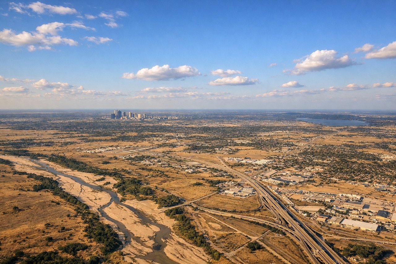
Landing at DFW
RIGHTRight-side seats provide excellent views during the descent approach into DFW. The aircraft descends over the Fort Worth metropolitan area and surrounding terrain, with the Trinity River valley and urban sprawl becoming increasingly visible on the right side of the aircraft.
Will your flight be in sunlight?
Pick a date and time in the Sun Map to watch the sun move across your whole flight.
About This Route
Which side of the plane should I sit on flying from Missoula Montana Airport (MSO) to Dallas Fort Worth International (DFW)?
Sit on the Right side of the plane for the best views on flights from Missoula to Dallas-Fort Worth. While the takeoff offers dramatic mountain scenery on the left, the landing approach provides more extensive and varied visual interest with the Trinity River valley, multiple lakes, and the expansive Fort Worth-Dallas metropolitan area. The right side captures more of the flight's geographic diversity.
What can I see during takeoff from Missoula Montana Airport in Missoula?
During takeoff from Missoula Montana Airport (MSO), sit on the Left side for the best views. Left-side seats offer immediate views of the Northern Rocky Mountains as the aircraft climbs out of Missoula. The Flathead Range and Mission Mountains dominate the western and northwestern skyline during the initial climb phase. Notable sights include: Mission Mountains (northwest), Flathead Range (west), Missoula Valley floor (directly below during climb), Clark Fork River valley (visible snaking through terrain).
What can I see when landing at Dallas Fort Worth International in Dallas-Fort Worth?
When landing at Dallas Fort Worth International (DFW), sit on the Right side for the best views. Right-side seats provide excellent views during the descent approach into DFW. The aircraft descends over the Fort Worth metropolitan area and surrounding terrain, with the Trinity River valley and urban sprawl becoming increasingly visible on the right side of the aircraft. Notable sights include: Trinity River valley (major geographic feature), Fort Worth and Dallas urban areas (sprawling development), Lake Worth and Eagle Mountain Lake (visible reservoirs), Brazos River valley (to the south).
How long is the flight from Missoula to Dallas-Fort Worth?
The flight from Missoula Montana Airport (MSO) to Dallas Fort Worth International (DFW) takes about 3 hours 15 minutes. The shortest flight path between them is 1,319 miles (2,123 km); winds and air traffic control usually add a few percent.
What does the Missoula to Dallas-Fort Worth flight path pass over?
The flight path crosses from the Northern Rockies southeastward across central Montana and Wyoming, passing over the Absaroka Range and Bighorn Mountains (visible from either side depending on exact routing), then transitions into the Great Plains of eastern Wyoming and the Texas Panhandle. Notable midpoint features include the Powder River Basin terrain, the transition from mountainous to high plains topography around the Wyoming-Colorado border, and the Canadian River valley as the aircraft approaches the Texas Panhandle. The landscape gradually flattens from 8,000-foot mountain elevations to 3,000-4,000-foot plains, with increasing agricultural development visible as the flight approaches the Dallas-Fort Worth area.