Both sides face over 12 hours of open Pacific Ocean with no land at all, which caps the score for either side, but the right side uniquely bookends that ocean crossing with the Colorado Rockies and Grand Canyon on departure and Auckland's volcanic harbour and skyline on arrival — landmarks the left side does not get.
Flown MSP to AKL? Did we get it right?
Flight Path
Minneapolis to Auckland is 8,042 miles (12,942 km), a flight of about 17 hours 5 minutes.
The route crosses the open Pacific well south of Hawaii, passing near French Polynesia's Marquesas and Cook Islands and skirting close to the uninhabited Kermadec Islands before descending into New Zealand — otherwise there is no land visible for many hours of cruise.
Great circle distance and headings ›


Phase by phase
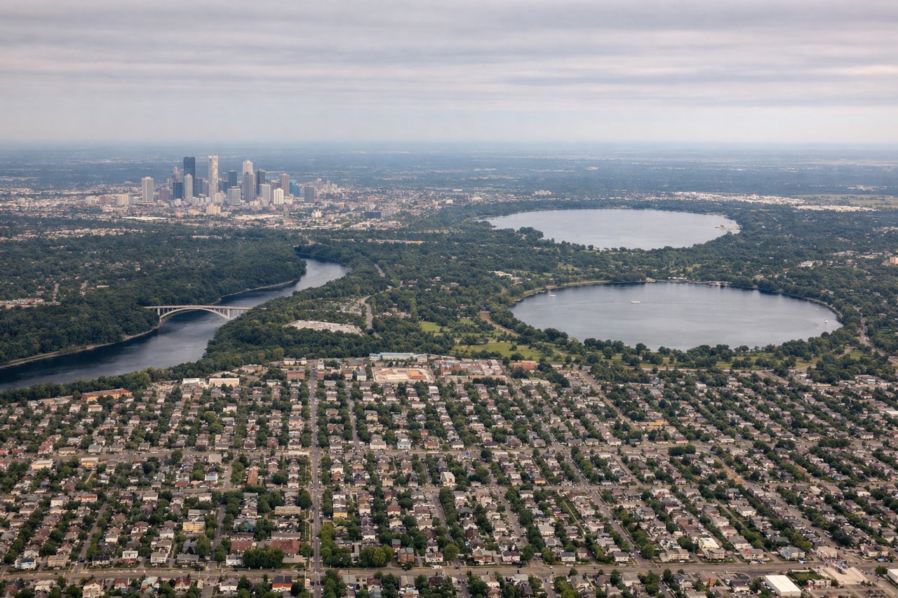
Takeoff from MSP
RIGHTAfter a flat climb-out over Minnesota farmland, the great-circle route to Auckland tracks WSW directly across Colorado and northern Arizona. On the right side, passengers get a good look at the Colorado Rockies (Elk Mountains near Aspen) and, shortly after, the Grand Canyon's north rim before the coastline near San Diego gives way to open Pacific.
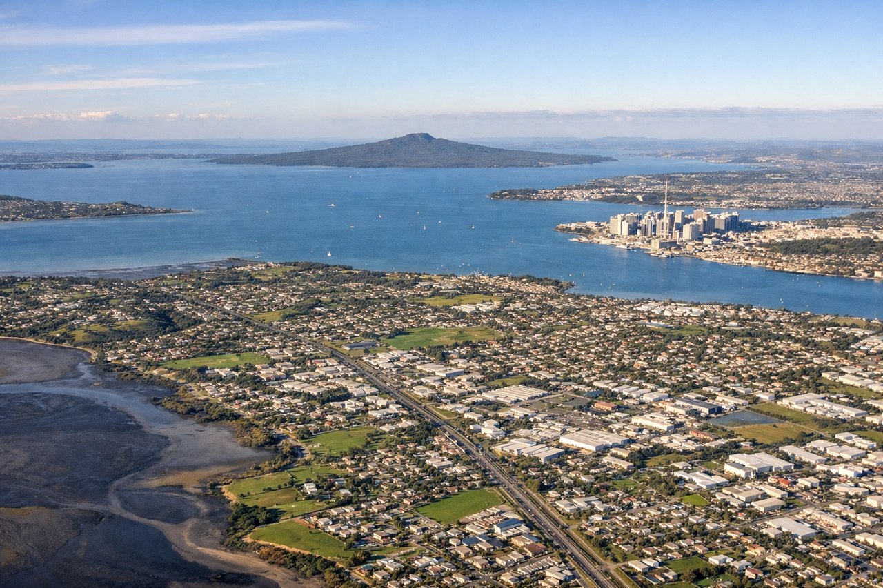
Landing at AKL
RIGHTArriving from the northeast for the standard approach to runway 23L, the aircraft tracks down over the Hauraki Gulf and Waitemata Harbour before landing. The right side faces this harbour and city, giving views of Rangitoto's volcanic cone and the Auckland skyline, while the left side only sees the flatter Manukau Harbour and Tasman coast.
Will your flight be in sunlight?
Pick a date and time in the Sun Map to watch the sun move across your whole flight.
About This Route
Which side of the plane should I sit on flying from Minneapolis St Paul International (MSP) to Auckland International (AKL)?
Sit on the Right side of the plane for the best views on flights from Minneapolis to Auckland. Both sides face over 12 hours of open Pacific Ocean with no land at all, which caps the score for either side, but the right side uniquely bookends that ocean crossing with the Colorado Rockies and Grand Canyon on departure and Auckland's volcanic harbour and skyline on arrival — landmarks the left side does not get.
What can I see during takeoff from Minneapolis St Paul International in Minneapolis?
During takeoff from Minneapolis St Paul International (MSP), sit on the Right side for the best views. After a flat climb-out over Minnesota farmland, the great-circle route to Auckland tracks WSW directly across Colorado and northern Arizona. On the right side, passengers get a good look at the Colorado Rockies (Elk Mountains near Aspen) and, shortly after, the Grand Canyon's north rim before the coastline near San Diego gives way to open Pacific. Notable sights include: Elk Mountains/Maroon Bells (Colorado), Grand Mesa, Grand Canyon and Colorado Plateau, Southern California coastline near San Diego.
What can I see when landing at Auckland International in Auckland?
When landing at Auckland International (AKL), sit on the Right side for the best views. Arriving from the northeast for the standard approach to runway 23L, the aircraft tracks down over the Hauraki Gulf and Waitemata Harbour before landing. The right side faces this harbour and city, giving views of Rangitoto's volcanic cone and the Auckland skyline, while the left side only sees the flatter Manukau Harbour and Tasman coast. Notable sights include: Rangitoto Island (volcanic cone), Waitemata Harbour, Auckland CBD skyline and Sky Tower, Hauraki Gulf islands.
How long is the flight from Minneapolis to Auckland?
The flight from Minneapolis St Paul International (MSP) to Auckland International (AKL) takes about 17 hours 5 minutes. The shortest flight path between them is 8,042 miles (12,942 km); winds and air traffic control usually add a few percent.
What does the Minneapolis to Auckland flight path pass over?
The route crosses the open Pacific well south of Hawaii, passing near French Polynesia's Marquesas and Cook Islands and skirting close to the uninhabited Kermadec Islands before descending into New Zealand — otherwise there is no land visible for many hours of cruise.