While takeoff offers good river and urban views on the right, the landing approach on the left provides the most dramatic and visually distinctive scenery—the Superstition Mountains are a striking landmark that dominates the final descent and offer far more visual interest than the relatively flat Minnesota landscape.
Flown MSP to AZA? Did we get it right?
Flight Path
Minneapolis to Mesa is 1,266 miles (2,038 km), a flight of about 3 hours 15 minutes.
Great Plains agricultural landscape (Iowa, Missouri, Kansas), Missouri River valley, transition from Midwest grasslands to High Plains, Rocky Mountain foothills appearing on western horizon near Colorado-New Mexico border, Rio Grande valley, Sangre de Cristo Mountains visible to the north in New Mexico during final descent phase
Great circle distance and headings ›


Phase by phase
Takeoff from MSP
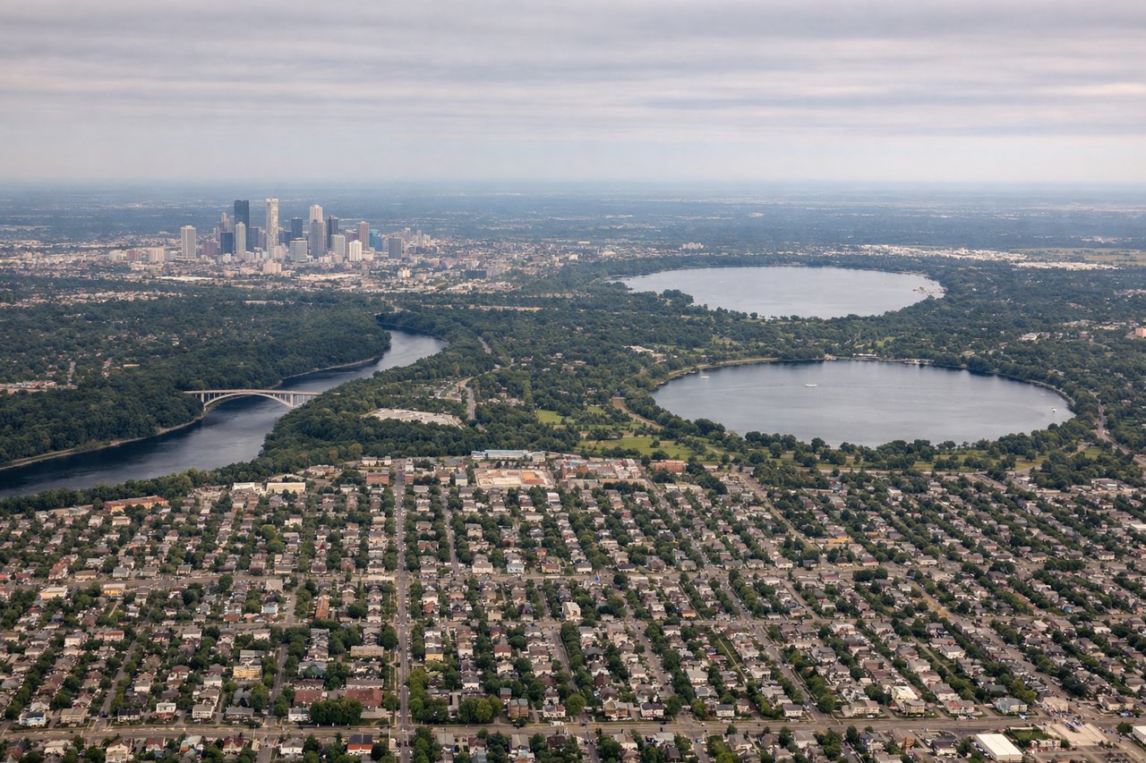
RIGHTRight-side seats capture the Mississippi River valley and the urban sprawl of the Twin Cities as you climb westward. The river's meandering path through Minneapolis and St. Paul is clearly visible during the initial climb, and you'll see the transition from urban development to agricultural plains.
Landing at AZA
LEFTLeft-side seats offer the best views during descent into Mesa Gateway. You'll see the Superstition Mountains rising dramatically to the north and northeast of the airport, and the Salt River valley's distinctive desert terrain with sparse vegetation and exposed red-brown earth.
Will your flight be in sunlight?
Pick a date and time in the Sun Map to watch the sun move across your whole flight.
About This Route
Which side of the plane should I sit on flying from Minneapolis St Paul International (MSP) to Mesa Gateway Airport (AZA)?
Sit on the Left side of the plane for the best views on flights from Minneapolis to Mesa. While takeoff offers good river and urban views on the right, the landing approach on the left provides the most dramatic and visually distinctive scenery—the Superstition Mountains are a striking landmark that dominates the final descent and offer far more visual interest than the relatively flat Minnesota landscape.
What can I see during takeoff from Minneapolis St Paul International in Minneapolis?
During takeoff from Minneapolis St Paul International (MSP), sit on the Right side for the best views. Right-side seats capture the Mississippi River valley and the urban sprawl of the Twin Cities as you climb westward. The river's meandering path through Minneapolis and St. Paul is clearly visible during the initial climb, and you'll see the transition from urban development to agricultural plains. Notable sights include: Mississippi River, Minneapolis-St. Paul urban corridor, Minnesota farmland and lakes, Minnesota River confluence.
What can I see when landing at Mesa Gateway Airport in Mesa?
When landing at Mesa Gateway Airport (AZA), sit on the Left side for the best views. Left-side seats offer the best views during descent into Mesa Gateway. You'll see the Superstition Mountains rising dramatically to the north and northeast of the airport, and the Salt River valley's distinctive desert terrain with sparse vegetation and exposed red-brown earth. Notable sights include: Superstition Mountains, Salt River valley, Phoenix metropolitan area sprawl, Arizona desert terrain with saguaro habitat.
How long is the flight from Minneapolis to Mesa?
The flight from Minneapolis St Paul International (MSP) to Mesa Gateway Airport (AZA) takes about 3 hours 15 minutes. The shortest flight path between them is 1,266 miles (2,038 km); winds and air traffic control usually add a few percent.
What does the Minneapolis to Mesa flight path pass over?
Great Plains agricultural landscape (Iowa, Missouri, Kansas), Missouri River valley, transition from Midwest grasslands to High Plains, Rocky Mountain foothills appearing on western horizon near Colorado-New Mexico border, Rio Grande valley, Sangre de Cristo Mountains visible to the north in New Mexico during final descent phase