This is a short, flat Midwest hop with no mountains or coastline, so scores stay low overall, but the right side edges ahead because the Minneapolis skyline and Mississippi River during departure offer more sustained visual interest than the brief glimpse of Des Moines on landing.
Flown MSP to DSM? Did we get it right?
Flight Path
Minneapolis to Des Moines is 232 miles (374 km), a flight of about 1 hour 5 minutes.
Flat Iowa farmland with grid-pattern fields, scattered small towns, and the Iowa River valley crossing the route roughly midway
Great circle distance and headings ›Phase by phase
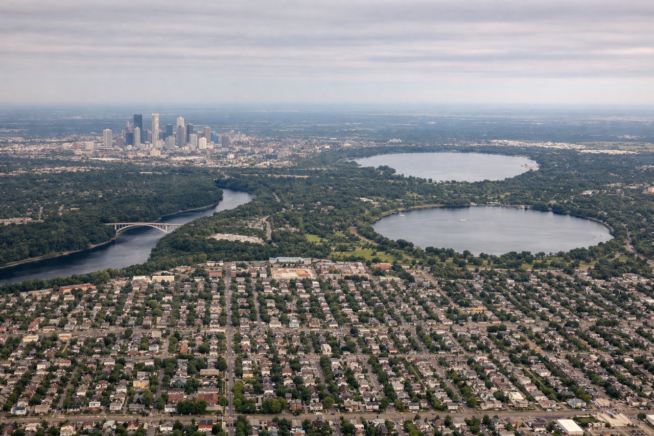
Takeoff from MSP
RIGHTDeparting MSP, a southbound climb typically banks over the Minneapolis-St Paul metro, putting downtown Minneapolis and the Mississippi River's bends on the right side of the aircraft as it turns south toward Iowa.
Landing at DSM
LEFTOn approach into DSM from the north on runway 31, the Des Moines River and the compact downtown skyline typically sit to the left of the aircraft as it lines up for final approach, offering the only real urban landmark on this short route.
Will your flight be in sunlight?
Pick a date and time in the Sun Map to watch the sun move across your whole flight.
About This Route
Which side of the plane should I sit on flying from Minneapolis St Paul International (MSP) to Des Moines International (DSM)?
Sit on the Right side of the plane for the best views on flights from Minneapolis to Des Moines. This is a short, flat Midwest hop with no mountains or coastline, so scores stay low overall, but the right side edges ahead because the Minneapolis skyline and Mississippi River during departure offer more sustained visual interest than the brief glimpse of Des Moines on landing.
What can I see during takeoff from Minneapolis St Paul International in Minneapolis?
During takeoff from Minneapolis St Paul International (MSP), sit on the Right side for the best views. Departing MSP, a southbound climb typically banks over the Minneapolis-St Paul metro, putting downtown Minneapolis and the Mississippi River's bends on the right side of the aircraft as it turns south toward Iowa. Notable sights include: Minneapolis downtown skyline, Mississippi River bends, Fort Snelling area confluence, Twin Cities suburban sprawl.
What can I see when landing at Des Moines International in Des Moines?
When landing at Des Moines International (DSM), sit on the Left side for the best views. On approach into DSM from the north on runway 31, the Des Moines River and the compact downtown skyline typically sit to the left of the aircraft as it lines up for final approach, offering the only real urban landmark on this short route. Notable sights include: Des Moines River, downtown Des Moines skyline, Iowa State Capitol golden dome, surrounding farmland grid.
How long is the flight from Minneapolis to Des Moines?
The flight from Minneapolis St Paul International (MSP) to Des Moines International (DSM) takes about 1 hour 5 minutes. The shortest flight path between them is 232 miles (374 km); winds and air traffic control usually add a few percent.
What does the Minneapolis to Des Moines flight path pass over?
Flat Iowa farmland with grid-pattern fields, scattered small towns, and the Iowa River valley crossing the route roughly midway