While takeoff favors the right for Minneapolis views, the landing approach into IND is superior on the left, showing the White River, downtown skyline, and the city's distinctive circular beltway. The landing experience outweighs the takeoff advantage.
Flown MSP to IND? Did we get it right?
Flight Path
Minneapolis to Indianapolis is 502 miles (808 km), a flight of about 1 hour 55 minutes.
The flight path crosses central Illinois, passing east of the Illinois River valley and over the flat agricultural plains of central Illinois. Around the midpoint (near Champaign-Urbana area), the terrain remains uniformly flat with a patchwork of rectangular farm fields. No significant mountains or major water bodies are visible at cruising altitude along this route. The landscape transitions gradually from Minnesota's glaciated terrain to Illinois's prairie, then to Indiana's similar flat agricultural zone.
Great circle distance and headings ›Phase by phase
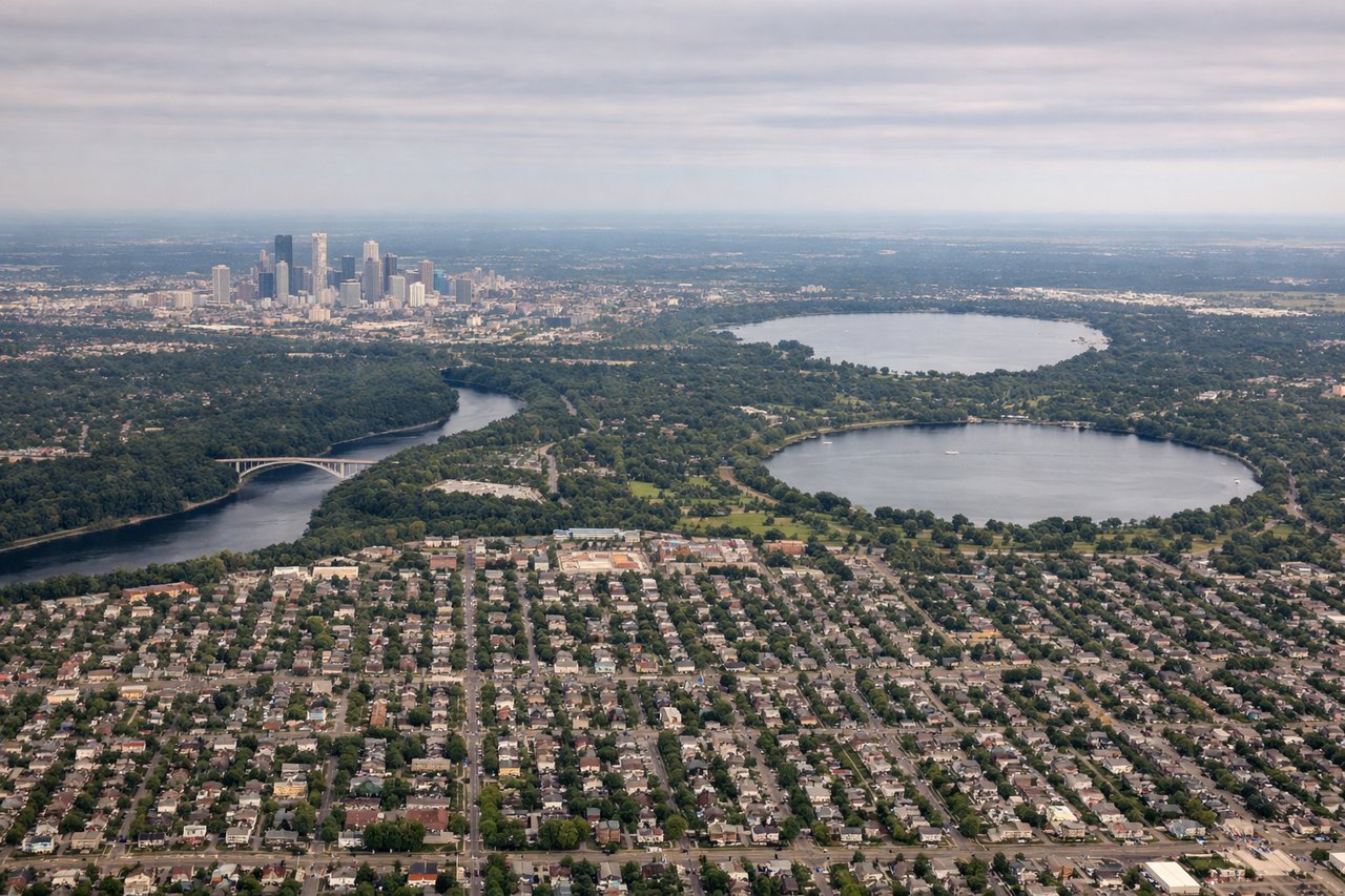
Takeoff from MSP
RIGHTRight-side seats capture the Mississippi River valley and downtown Minneapolis as you climb out. MSP typically departs to the south or southeast, and right-side views show the river's distinctive meanders and the urban core before climbing into cruising altitude.

Landing at IND
LEFTLeft-side seats offer the best views during descent into IND. Approaching from the northwest (typical for MSP-IND routing), left-side views show the White River and downtown Indianapolis's skyline as you descend through 5,000-8,000 feet. The city's distinctive street grid and Monument Circle become visible.
Will your flight be in sunlight?
Pick a date and time in the Sun Map to watch the sun move across your whole flight.
About This Route
Which side of the plane should I sit on flying from Minneapolis St Paul International (MSP) to Indianapolis International (IND)?
Sit on the Left side of the plane for the best views on flights from Minneapolis to Indianapolis. While takeoff favors the right for Minneapolis views, the landing approach into IND is superior on the left, showing the White River, downtown skyline, and the city's distinctive circular beltway. The landing experience outweighs the takeoff advantage.
What can I see during takeoff from Minneapolis St Paul International in Minneapolis?
During takeoff from Minneapolis St Paul International (MSP), sit on the Right side for the best views. Right-side seats capture the Mississippi River valley and downtown Minneapolis as you climb out. MSP typically departs to the south or southeast, and right-side views show the river's distinctive meanders and the urban core before climbing into cruising altitude. Notable sights include: Mississippi River (immediate right, winding through the Twin Cities), downtown Minneapolis skyline (right side during initial climb), Minnesota River confluence (visible as you gain altitude), suburban sprawl extending south toward Bloomington.
What can I see when landing at Indianapolis International in Indianapolis?
When landing at Indianapolis International (IND), sit on the Left side for the best views. Left-side seats offer the best views during descent into IND. Approaching from the northwest (typical for MSP-IND routing), left-side views show the White River and downtown Indianapolis's skyline as you descend through 5,000-8,000 feet. The city's distinctive street grid and Monument Circle become visible. Notable sights include: White River (winding through downtown Indianapolis on the left), downtown Indianapolis skyline with Monument Circle (visible as you descend to 6,000 feet), I-465 beltway (circular highway surrounding the city, visible on left and center), suburban neighborhoods extending north and west.
How long is the flight from Minneapolis to Indianapolis?
The flight from Minneapolis St Paul International (MSP) to Indianapolis International (IND) takes about 1 hour 55 minutes. The shortest flight path between them is 502 miles (808 km); winds and air traffic control usually add a few percent.
What does the Minneapolis to Indianapolis flight path pass over?
The flight path crosses central Illinois, passing east of the Illinois River valley and over the flat agricultural plains of central Illinois. Around the midpoint (near Champaign-Urbana area), the terrain remains uniformly flat with a patchwork of rectangular farm fields. No significant mountains or major water bodies are visible at cruising altitude along this route. The landscape transitions gradually from Minnesota's glaciated terrain to Illinois's prairie, then to Indiana's similar flat agricultural zone.