The right side wins for both the Twin Cities skyline and river views on departure and the dramatic Casco Bay coastal approach into Portland, giving more varied and distinctive scenery than the left side's flat farmland and inland forest views.
Flown MSP to PWM? Did we get it right?
Flight Path
Minneapolis to Portland is 1,133 miles (1,824 km), a flight of about 2 hours 50 minutes.
Wisconsin farmland and forests, Lake Michigan's southern shore may be glimpsed depending on routing, and rolling hills of northern New England as the flight approaches Maine
Great circle distance and headings ›


Phase by phase
Takeoff from MSP
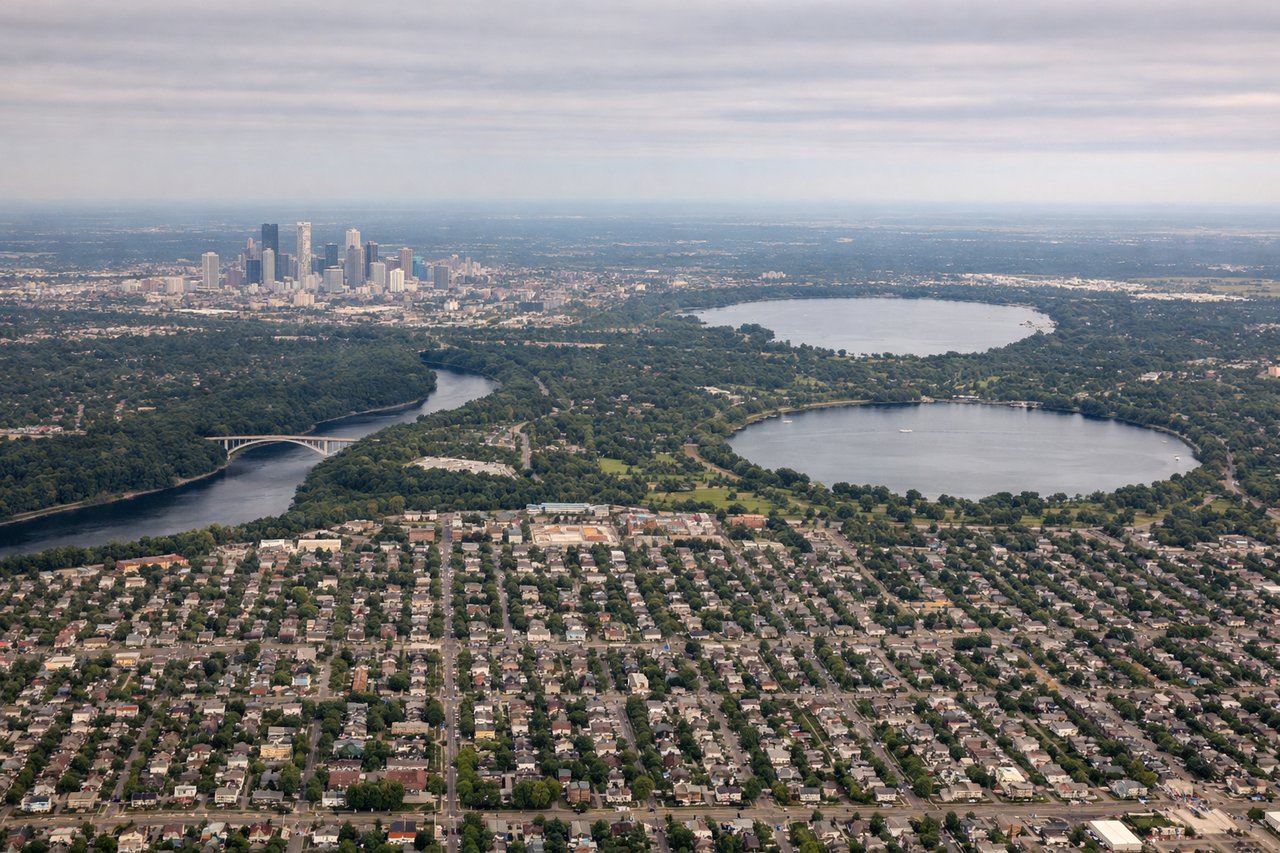
RIGHTDeparting MSP toward the northeast, the right side offers views over the Minneapolis-St. Paul skyline and the Mississippi River as the plane climbs out, with the metro's lakes visible below. The left side mostly shows suburban sprawl and flat farmland.
Landing at PWM
RIGHTOn approach to PWM from the southwest, the right side reveals Casco Bay's islands and the rocky Maine coastline just before landing, a distinctive and scenic feature unique to this airport's approach. The left side shows inland forests and lakes with less visual variety.
Will your flight be in sunlight?
Pick a date and time in the Sun Map to watch the sun move across your whole flight.
About This Route
Which side of the plane should I sit on flying from Minneapolis St Paul International (MSP) to Portland International Jetport (PWM)?
Sit on the Right side of the plane for the best views on flights from Minneapolis to Portland. The right side wins for both the Twin Cities skyline and river views on departure and the dramatic Casco Bay coastal approach into Portland, giving more varied and distinctive scenery than the left side's flat farmland and inland forest views.
What can I see during takeoff from Minneapolis St Paul International in Minneapolis?
During takeoff from Minneapolis St Paul International (MSP), sit on the Right side for the best views. Departing MSP toward the northeast, the right side offers views over the Minneapolis-St. Paul skyline and the Mississippi River as the plane climbs out, with the metro's lakes visible below. The left side mostly shows suburban sprawl and flat farmland. Notable sights include: Minneapolis downtown skyline, Mississippi River, Twin Cities lakes (Lake Minnetonka area).
What can I see when landing at Portland International Jetport in Portland?
When landing at Portland International Jetport (PWM), sit on the Right side for the best views. On approach to PWM from the southwest, the right side reveals Casco Bay's islands and the rocky Maine coastline just before landing, a distinctive and scenic feature unique to this airport's approach. The left side shows inland forests and lakes with less visual variety. Notable sights include: Casco Bay islands, Portland Head Light area, Atlantic coastline, downtown Portland harbor.
How long is the flight from Minneapolis to Portland?
The flight from Minneapolis St Paul International (MSP) to Portland International Jetport (PWM) takes about 2 hours 50 minutes. The shortest flight path between them is 1,133 miles (1,824 km); winds and air traffic control usually add a few percent.
What does the Minneapolis to Portland flight path pass over?
Wisconsin farmland and forests, Lake Michigan's southern shore may be glimpsed depending on routing, and rolling hills of northern New England as the flight approaches Maine