Both sides score equally at 1.5 due to the short flight duration (approximately 1 hour) over predominantly flat Midwestern terrain with minimal dramatic geography. However, the left side edges ahead slightly for takeoff scenery with the Minneapolis-St. Paul urban area and visible lakes providing more concentrated visual interest during the departure phase. The landing experience is comparable on both sides, with neither offering significant scenic advantage. This is a short regional flight over agricultural plains with limited terrain variation—neither side delivers compelling scenic value.
Flown MSP to SBN? Did we get it right?
Flight Path
Minneapolis to South Bend is 410 miles (660 km), a flight of about 1 hour 5 minutes.
The flight path crosses central Wisconsin and northern Indiana agricultural regions. Notable features include the transition from Minnesota's lake-dotted landscape to Wisconsin's rolling farmland, scattered small towns and county roads visible as grid patterns, occasional river valleys (particularly the Kalamazoo River drainage system in southern Michigan/northern Indiana), and extensive corn and soybean fields dominating the landscape. No significant mountains, coastlines, or dramatic terrain features are present along this route. The landscape remains consistently flat to gently rolling throughout the cruise phase.
Great circle distance and headings ›Phase by phase
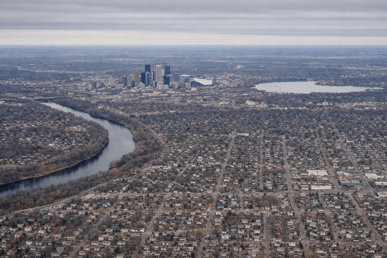
Takeoff from MSP
LEFTLeft side offers views of Minneapolis-St. Paul urban area and surrounding lakes during initial climb. The Twin Cities sprawl, including downtown Minneapolis skyline and the chain of lakes (Calhoun, Harriet, Bde Maka Ska) are visible during the first 5-10 minutes of departure, providing brief urban interest before transitioning to farmland.
Landing at SBN
RIGHTRight side provides views of the St. Joseph River valley and South Bend's urban core during approach to runway 27L (westbound landing). The river's distinctive meanders and the city's industrial waterfront are visible during descent, offering more concentrated urban scenery than the left side's farmland approach.
Will your flight be in sunlight?
Pick a date and time in the Sun Map to watch the sun move across your whole flight.
About This Route
Which side of the plane should I sit on flying from Minneapolis St Paul International (MSP) to South Bend International Airport (SBN)?
Sit on the Left side of the plane for the best views on flights from Minneapolis to South Bend. Both sides score equally at 1.5 due to the short flight duration (approximately 1 hour) over predominantly flat Midwestern terrain with minimal dramatic geography. However, the left side edges ahead slightly for takeoff scenery with the Minneapolis-St. Paul urban area and visible lakes providing more concentrated visual interest during the departure phase. The landing experience is comparable on both sides, with neither offering significant scenic advantage. This is a short regional flight over agricultural plains with limited terrain variation—neither side delivers compelling scenic value.
What can I see during takeoff from Minneapolis St Paul International in Minneapolis?
During takeoff from Minneapolis St Paul International (MSP), sit on the Left side for the best views. Left side offers views of Minneapolis-St. Paul urban area and surrounding lakes during initial climb. The Twin Cities sprawl, including downtown Minneapolis skyline and the chain of lakes (Calhoun, Harriet, Bde Maka Ska) are visible during the first 5-10 minutes of departure, providing brief urban interest before transitioning to farmland. Notable sights include: Minneapolis downtown skyline, Lake Calhoun, Lake Harriet, suburban sprawl of St. Paul to the east.
What can I see when landing at South Bend International Airport in South Bend?
When landing at South Bend International Airport (SBN), sit on the Right side for the best views. Right side provides views of the St. Joseph River valley and South Bend's urban core during approach to runway 27L (westbound landing). The river's distinctive meanders and the city's industrial waterfront are visible during descent, offering more concentrated urban scenery than the left side's farmland approach. Notable sights include: St. Joseph River meanders, South Bend downtown industrial district, surrounding agricultural fields, approach corridor over northern Indiana farmland.
How long is the flight from Minneapolis to South Bend?
The flight from Minneapolis St Paul International (MSP) to South Bend International Airport (SBN) takes about 1 hour 5 minutes. The shortest flight path between them is 410 miles (660 km); winds and air traffic control usually add a few percent.
What does the Minneapolis to South Bend flight path pass over?
The flight path crosses central Wisconsin and northern Indiana agricultural regions. Notable features include the transition from Minnesota's lake-dotted landscape to Wisconsin's rolling farmland, scattered small towns and county roads visible as grid patterns, occasional river valleys (particularly the Kalamazoo River drainage system in southern Michigan/northern Indiana), and extensive corn and soybean fields dominating the landscape. No significant mountains, coastlines, or dramatic terrain features are present along this route. The landscape remains consistently flat to gently rolling throughout the cruise phase.