The left side captures the dramatic Sierra Nevada and Lake Tahoe views during the descent, plus glimpses of the Rocky Mountain front and Wasatch Range during cruise, giving it far more topographic variety than the right side's flatter Great Plains and valley scenery.
Flown MSP to SMF? Did we get it right?
Flight Path
Minneapolis to Sacramento is 1,514 miles (2,436 km), a flight of about 3 hours 15 minutes.
The flight path crosses the South Dakota plains near the Black Hills, then the Bighorn and Wind River ranges of Wyoming, the Great Salt Lake basin in Utah, and the Nevada desert basins before crossing the Sierra Nevada into California's Central Valley.
Great circle distance and headings ›


Phase by phase
Takeoff from MSP
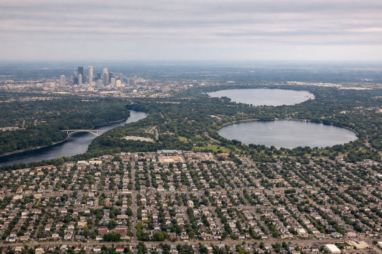
RIGHTDeparting MSP toward the west, the Twin Cities skyline and the Mississippi River's confluence with the Minnesota River sit off the right side of the aircraft as it climbs out over St. Paul. The left side shows mostly flat suburban sprawl with little contrast.
Landing at SMF
LEFTOn the descent into Sacramento from the east, the Sierra Nevada crest and the deep blue basin of Lake Tahoe are visible off the left side before the plane drops into the Central Valley. The right side mostly shows the flat, hazy valley floor with less definition.
Will your flight be in sunlight?
Pick a date and time in the Sun Map to watch the sun move across your whole flight.
About This Route
Which side of the plane should I sit on flying from Minneapolis St Paul International (MSP) to Sacramento International (SMF)?
Sit on the Left side of the plane for the best views on flights from Minneapolis to Sacramento. The left side captures the dramatic Sierra Nevada and Lake Tahoe views during the descent, plus glimpses of the Rocky Mountain front and Wasatch Range during cruise, giving it far more topographic variety than the right side's flatter Great Plains and valley scenery.
What can I see during takeoff from Minneapolis St Paul International in Minneapolis?
During takeoff from Minneapolis St Paul International (MSP), sit on the Right side for the best views. Departing MSP toward the west, the Twin Cities skyline and the Mississippi River's confluence with the Minnesota River sit off the right side of the aircraft as it climbs out over St. Paul. The left side shows mostly flat suburban sprawl with little contrast. Notable sights include: Downtown St. Paul skyline, Mississippi River bends, Minneapolis-St. Paul river confluence, Fort Snelling bluffs.
What can I see when landing at Sacramento International in Sacramento?
When landing at Sacramento International (SMF), sit on the Left side for the best views. On the descent into Sacramento from the east, the Sierra Nevada crest and the deep blue basin of Lake Tahoe are visible off the left side before the plane drops into the Central Valley. The right side mostly shows the flat, hazy valley floor with less definition. Notable sights include: Sierra Nevada crest, Lake Tahoe basin, Sacramento River delta, Central Valley farmland patchwork.
How long is the flight from Minneapolis to Sacramento?
The flight from Minneapolis St Paul International (MSP) to Sacramento International (SMF) takes about 3 hours 15 minutes. The shortest flight path between them is 1,514 miles (2,436 km); winds and air traffic control usually add a few percent.
What does the Minneapolis to Sacramento flight path pass over?
The flight path crosses the South Dakota plains near the Black Hills, then the Bighorn and Wind River ranges of Wyoming, the Great Salt Lake basin in Utah, and the Nevada desert basins before crossing the Sierra Nevada into California's Central Valley.