Minneapolis to Sioux City is 233 miles (375 km), a flight of about 55 minutes.
While takeoff offers good views to the right, the landing approach provides more dramatic and distinctive geography. The Missouri River valley and loess hills terrain on approach are more visually striking than the suburban sprawl visible on departure.
Flight Path
The flight path crosses central Iowa, passing over the Des Moines area to the west. Notable features include the Des Moines River valley, the transition from Minnesota's glaciated terrain to Iowa's loess hills landscape, and scattered agricultural land with visible field patterns and small towns. The terrain gradually becomes more rolling and less developed as the aircraft approaches the Missouri River valley near Sioux City.
Great circle distance and headings ›Phase by phase
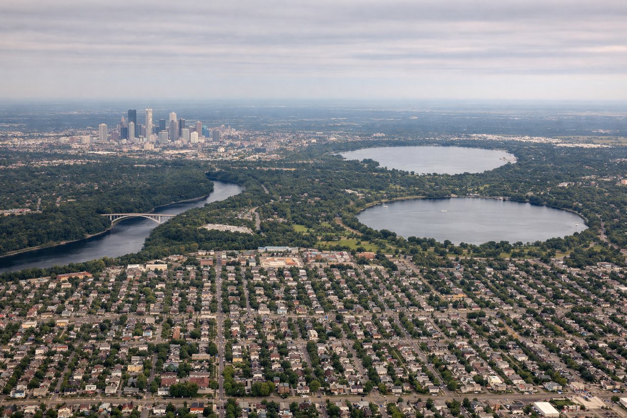
Takeoff from MSP
RIGHTMSP typically departs to the south or southwest. Right-side seats offer views of the Minnesota River valley and the urban sprawl south of Minneapolis, including the distinctive pattern of suburban development around Bloomington and Eagan.
Landing at SUX
LEFTApproach to SUX typically comes from the northeast. Left-side seats provide views of the Missouri River bluffs and the distinctive landscape around Sioux City, including the river's dramatic valley and the surrounding loess hills terrain.
Landmarks on this routeAll landmarks →
Will your flight be in sunlight?
Pick a date and time in the Sun Map to watch the sun move across your whole flight.
About This Route
Which side of the plane should I sit on flying from Minneapolis St Paul International (MSP) to Sioux Gateway Col Bud Day Fld (SUX)?
Sit on the Left side of the plane for the best views on flights from Minneapolis to Sioux City. While takeoff offers good views to the right, the landing approach provides more dramatic and distinctive geography. The Missouri River valley and loess hills terrain on approach are more visually striking than the suburban sprawl visible on departure.
What can I see during takeoff from Minneapolis St Paul International in Minneapolis?
During takeoff from Minneapolis St Paul International (MSP), sit on the Right side for the best views. MSP typically departs to the south or southwest. Right-side seats offer views of the Minnesota River valley and the urban sprawl south of Minneapolis, including the distinctive pattern of suburban development around Bloomington and Eagan. Notable sights include: Minnesota River valley (dark ribbon of water and vegetation), Minneapolis-St. Paul urban core to the north, suburban grid pattern of Bloomington/Eagan, Chain of Lakes district (visible as small water bodies west of downtown).
What can I see when landing at Sioux Gateway Col Bud Day Fld in Sioux City?
When landing at Sioux Gateway Col Bud Day Fld (SUX), sit on the Left side for the best views. Approach to SUX typically comes from the northeast. Left-side seats provide views of the Missouri River bluffs and the distinctive landscape around Sioux City, including the river's dramatic valley and the surrounding loess hills terrain. Notable sights include: Missouri River (wide, meandering watercourse), Sioux City urban area and riverfront, loess hills topography (rolling, treeless terrain), Big Sioux River confluence area.
How long is the flight from Minneapolis to Sioux City?
The flight from Minneapolis St Paul International (MSP) to Sioux Gateway Col Bud Day Fld (SUX) takes about 55 minutes. The shortest flight path between them is 233 miles (375 km); winds and air traffic control usually add a few percent.
What does the Minneapolis to Sioux City flight path pass over?
The flight path crosses central Iowa, passing over the Des Moines area to the west. Notable features include the Des Moines River valley, the transition from Minnesota's glaciated terrain to Iowa's loess hills landscape, and scattered agricultural land with visible field patterns and small towns. The terrain gradually becomes more rolling and less developed as the aircraft approaches the Missouri River valley near Sioux City.