While takeoff from MSP slightly favors the left side due to the Minnesota River valley and Twin Cities visibility, the landing approach to Toronto City Centre strongly favors the right side with Lake Ontario, the Toronto Islands, and the downtown waterfront skyline. The landing experience is more visually distinctive and memorable, giving the right side the overall edge on this route.
Flown MSP to YTZ? Did we get it right?
Flight Path
Minneapolis to Toronto is 689 miles (1,109 km), a flight of about 2 hours 15 minutes.
The flight path crosses the Great Lakes region, passing over or near Lake Michigan's eastern shore, then over Michigan's Lower Peninsula, crossing into Ontario over the Great Lakes (likely over or near Lake Huron), and following the northern shore of Lake Ontario toward Toronto. Notable midpoint features include the Michigan-Ontario border region with its lakes and forests, and the approach across Lake Ontario itself.
Great circle distance and headings ›

Phase by phase
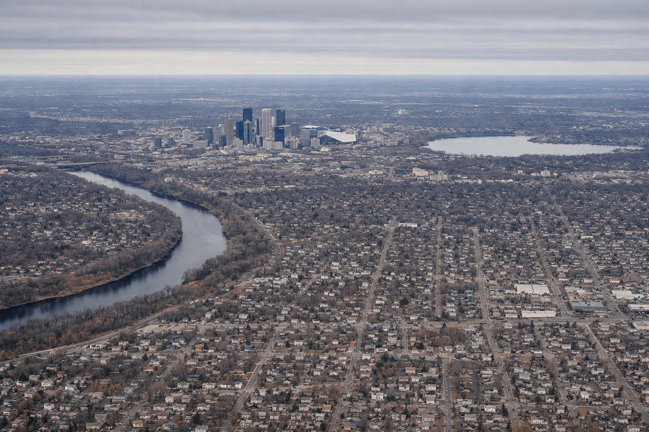
Takeoff from MSP
LEFTMinneapolis-St. Paul sits in relatively flat terrain, but the left (north) side offers views of the Minnesota River valley and urban sprawl of the Twin Cities during climb-out. The right side shows similar flat agricultural land with less distinctive features.
Landing at YTZ
RIGHTThe approach to Toronto City Centre (YTZ) from the west brings the right side into view of Lake Ontario's shoreline and Toronto's downtown waterfront. The left side would show inland suburban areas with less visual interest during descent.
Will your flight be in sunlight?
Pick a date and time in the Sun Map to watch the sun move across your whole flight.
About This Route
Which side of the plane should I sit on flying from Minneapolis St Paul International (MSP) to City Centre (YTZ)?
Sit on the Right side of the plane for the best views on flights from Minneapolis to Toronto. While takeoff from MSP slightly favors the left side due to the Minnesota River valley and Twin Cities visibility, the landing approach to Toronto City Centre strongly favors the right side with Lake Ontario, the Toronto Islands, and the downtown waterfront skyline. The landing experience is more visually distinctive and memorable, giving the right side the overall edge on this route.
What can I see during takeoff from Minneapolis St Paul International in Minneapolis?
During takeoff from Minneapolis St Paul International (MSP), sit on the Left side for the best views. Minneapolis-St. Paul sits in relatively flat terrain, but the left (north) side offers views of the Minnesota River valley and urban sprawl of the Twin Cities during climb-out. The right side shows similar flat agricultural land with less distinctive features. Notable sights include: Minnesota River valley, Minneapolis-St. Paul urban grid, Chain of Lakes district (visible as water features), suburban sprawl extending north.
What can I see when landing at City Centre in Toronto?
When landing at City Centre (YTZ), sit on the Right side for the best views. The approach to Toronto City Centre (YTZ) from the west brings the right side into view of Lake Ontario's shoreline and Toronto's downtown waterfront. The left side would show inland suburban areas with less visual interest during descent. Notable sights include: Lake Ontario shoreline, Toronto Islands (Toronto Island Park), downtown Toronto skyline, Scarborough Bluffs (visible on clear days).
How long is the flight from Minneapolis to Toronto?
The flight from Minneapolis St Paul International (MSP) to City Centre (YTZ) takes about 2 hours 15 minutes. The shortest flight path between them is 689 miles (1,109 km); winds and air traffic control usually add a few percent.
What does the Minneapolis to Toronto flight path pass over?
The flight path crosses the Great Lakes region, passing over or near Lake Michigan's eastern shore, then over Michigan's Lower Peninsula, crossing into Ontario over the Great Lakes (likely over or near Lake Huron), and following the northern shore of Lake Ontario toward Toronto. Notable midpoint features include the Michigan-Ontario border region with its lakes and forests, and the approach across Lake Ontario itself.