While the takeoff offers dramatic Drakensberg views, the landing approach into Phoenix provides more sustained visual interest with the Salt River, extensive urban landscape, and mountain framing. The approach descent gives passengers extended viewing time over recognizable Phoenix geography.
Flight Path
The flight path crosses the Atlantic Ocean (no landmarks visible for approximately 8-10 hours of flight time). Approaching North America, passengers may see the Appalachian Mountains or eastern US coastline depending on exact routing. The final approach into Phoenix crosses the Sonoran Desert with scattered saguaro vegetation visible at lower altitudes, and the Salt River valley becomes prominent during descent.
Great circle distance and headings ›

.jpg?width=600)
Phase by phase
Takeoff from MSU
LEFTLeft side offers views of the Drakensberg Mountains immediately west of Maseru as the aircraft climbs. The range rises sharply from the plateau and provides dramatic relief against the sky during the initial climb-out phase.
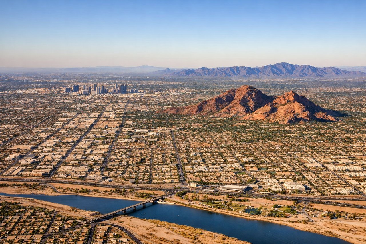
Landing at PHX
RIGHTRight side during descent into Phoenix provides views of the Salt River and the urban sprawl of the Phoenix metropolitan area. The river's distinctive course and the city's grid pattern are visible during the final approach from the east.
Landmarks on this routeAll landmarks →
Will your flight be in sunlight?
See exactly which side of the plane gets sun and shade at your departure time.
About This Route
Which side of the plane should I sit on flying from Moshoeshoe I International (MSU) to Phoenix Sky Harbor International (PHX)?
Sit on the Right side of the plane for the best views on flights from Maseru to Phoenix. While the takeoff offers dramatic Drakensberg views, the landing approach into Phoenix provides more sustained visual interest with the Salt River, extensive urban landscape, and mountain framing. The approach descent gives passengers extended viewing time over recognizable Phoenix geography.
What can I see during takeoff from Moshoeshoe I International in Maseru?
During takeoff from Moshoeshoe I International (MSU), sit on the Left side for the best views. Left side offers views of the Drakensberg Mountains immediately west of Maseru as the aircraft climbs. The range rises sharply from the plateau and provides dramatic relief against the sky during the initial climb-out phase. Notable sights include: Drakensberg Mountains (western escarpment), Maseru city grid (directly below during climb), Lesotho highland plateau, Caledon River valley.
What can I see when landing at Phoenix Sky Harbor International in Phoenix?
When landing at Phoenix Sky Harbor International (PHX), sit on the Right side for the best views. Right side during descent into Phoenix provides views of the Salt River and the urban sprawl of the Phoenix metropolitan area. The river's distinctive course and the city's grid pattern are visible during the final approach from the east. Notable sights include: Salt River (serpentine course), Phoenix urban grid, South Mountain Park (dark volcanic ridge), Superstition Mountains (distant eastern horizon).
How long is the flight from Maseru to Phoenix?
The flight from Moshoeshoe I International (MSU) to Phoenix Sky Harbor International (PHX) takes 15h 20m.
What does the Maseru to Phoenix flight path pass over?
The flight path crosses the Atlantic Ocean (no landmarks visible for approximately 8-10 hours of flight time). Approaching North America, passengers may see the Appalachian Mountains or eastern US coastline depending on exact routing. The final approach into Phoenix crosses the Sonoran Desert with scattered saguaro vegetation visible at lower altitudes, and the Salt River valley becomes prominent during descent.