Left side scores higher due to the dramatic San Juan Mountains departure providing exceptional terrain variety and visual interest for the first 90 minutes of flight. While right side offers superior landing scenery with the LA basin and coastline, the extended cruise segment over the Colorado Plateau and Arizona desert (visible from both sides equally) tips the balance to the left, which captures the most distinctive and memorable portion of the journey.
Flown MTJ to LAX? Did we get it right?
Flight Path
Montrose to Los Angeles is 665 miles (1,070 km), a flight of about 2 hours.
Colorado Plateau with scattered mesas and canyons, Arizona high desert with sparse vegetation, transition from Rocky Mountain terrain to Basin and Range topography, Lake Powell visible on some routes, Kaibab Plateau and North Rim Grand Canyon area on southern routing
Great circle distance and headings ›


Phase by phase
Takeoff from MTJ
LEFTLeft side captures the dramatic San Juan Mountains immediately after departure from Montrose, with steep peaks and deep valleys visible within minutes of liftoff. Right side shows only open high desert plateau with minimal terrain variation.
Landing at LAX
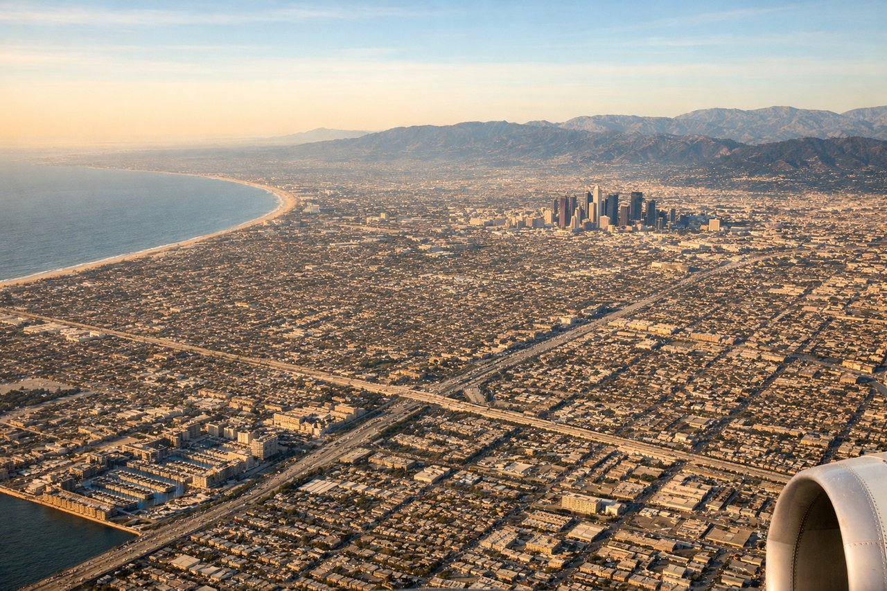
RIGHTRight side provides the classic Los Angeles approach with views of the San Gabriel Mountains, sprawling urban grid, and the Pacific coastline. Left side shows only inland desert and mountains with no urban or coastal features during final descent.
Will your flight be in sunlight?
Pick a date and time in the Sun Map to watch the sun move across your whole flight.
About This Route
Which side of the plane should I sit on flying from Montrose Regional Airport (MTJ) to Los Angeles International (LAX)?
Sit on the Left side of the plane for the best views on flights from Montrose to Los Angeles. Left side scores higher due to the dramatic San Juan Mountains departure providing exceptional terrain variety and visual interest for the first 90 minutes of flight. While right side offers superior landing scenery with the LA basin and coastline, the extended cruise segment over the Colorado Plateau and Arizona desert (visible from both sides equally) tips the balance to the left, which captures the most distinctive and memorable portion of the journey.
What can I see during takeoff from Montrose Regional Airport in Montrose?
During takeoff from Montrose Regional Airport (MTJ), sit on the Left side for the best views. Left side captures the dramatic San Juan Mountains immediately after departure from Montrose, with steep peaks and deep valleys visible within minutes of liftoff. Right side shows only open high desert plateau with minimal terrain variation. Notable sights include: San Juan Mountains (peaks to 14,000 ft), Uncompahgre Plateau, Gunnison River valley.
What can I see when landing at Los Angeles International in Los Angeles?
When landing at Los Angeles International (LAX), sit on the Right side for the best views. Right side provides the classic Los Angeles approach with views of the San Gabriel Mountains, sprawling urban grid, and the Pacific coastline. Left side shows only inland desert and mountains with no urban or coastal features during final descent. Notable sights include: San Gabriel Mountains, Los Angeles urban sprawl and street grid, Pacific Ocean and Santa Monica Bay, Long Beach harbor.
How long is the flight from Montrose to Los Angeles?
The flight from Montrose Regional Airport (MTJ) to Los Angeles International (LAX) takes about 2 hours. The shortest flight path between them is 665 miles (1,070 km); winds and air traffic control usually add a few percent.
What does the Montrose to Los Angeles flight path pass over?
Colorado Plateau with scattered mesas and canyons, Arizona high desert with sparse vegetation, transition from Rocky Mountain terrain to Basin and Range topography, Lake Powell visible on some routes, Kaibab Plateau and North Rim Grand Canyon area on southern routing