Left seats capture the dramatic Rio de la Plata estuary during departure and the Cordillera Central mountains during approach into Bogota. The mountain view on descent is particularly striking and compensates for a less dramatic takeoff view.
Flown MVD to BOG? Did we get it right?
Flight Path
Montevideo to Bogota is 2,975 miles (4,788 km), a flight of about 6 hours 10 minutes.
The flight path crosses the Atlantic coast of southern Brazil, then tracks northwest over interior Brazil and Paraguay. Notable features include the Parana River valley (visible as a darker linear feature if crossing near it), the transition from coastal lowlands to interior plateau, and scattered thunderstorm development over the Amazon basin during afternoon hours. The Andes begin appearing on the horizon roughly 90 minutes before Bogota arrival.
Great circle distance and headings ›

Phase by phase
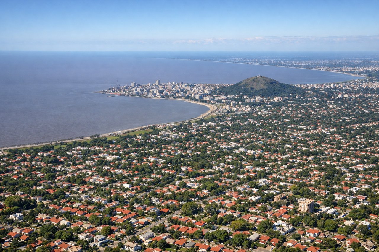
Takeoff from MVD
RIGHTMontevideo's primary runways (09/27) align with the Rio de la Plata estuary. Right-side seats face northwest across the wide brown waters of the estuary toward the Argentine coast, while left seats look inland over the city and suburbs. The estuary's scale and color contrast are striking during climb-out.
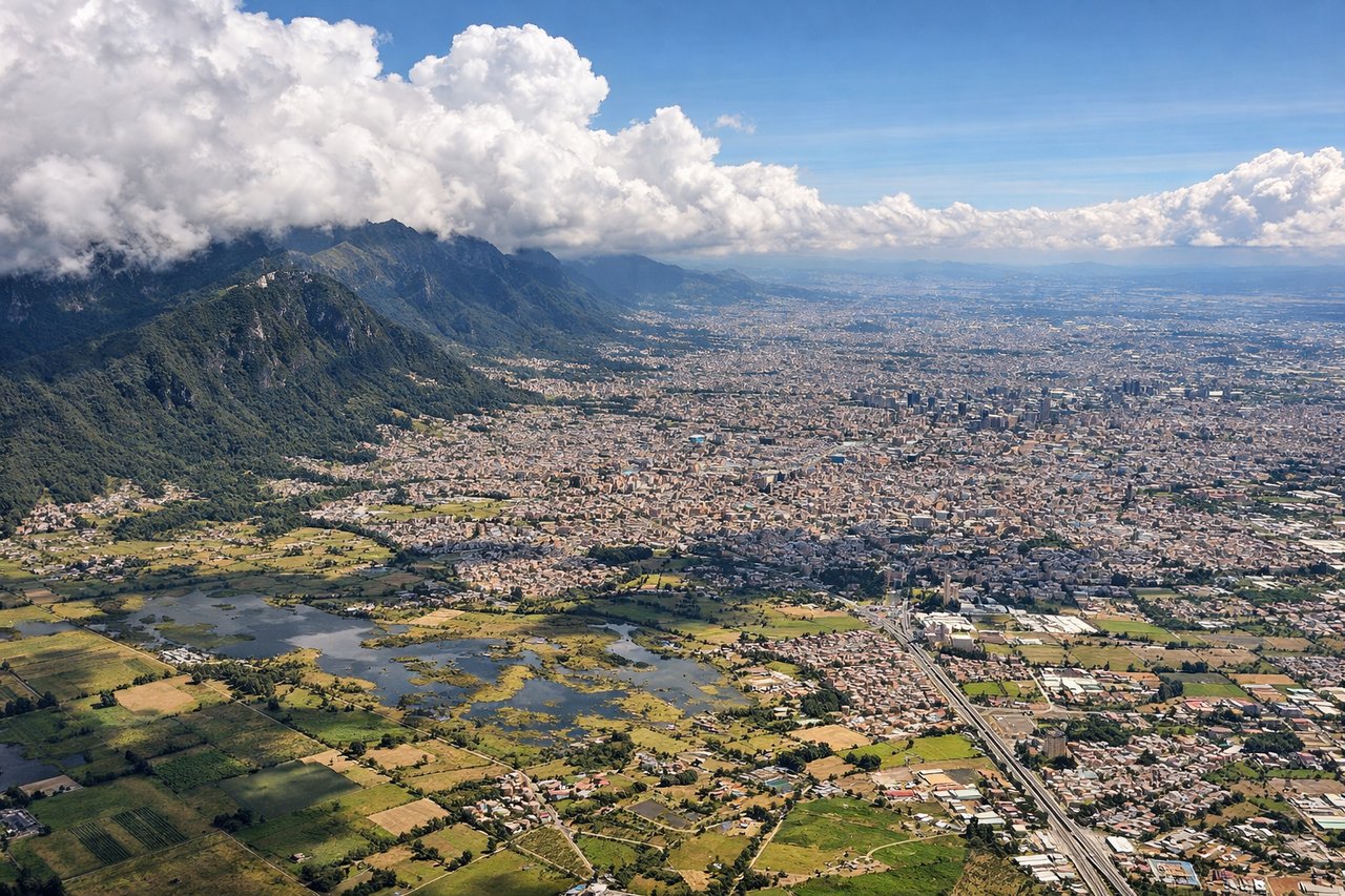
Landing at BOG
LEFTBogota's primary runway (09L/27R and 09R/27L) runs east-west. Approaching from the south (typical for MVD traffic), aircraft descend over the Sabana de Bogota plateau. Left-side seats face north toward the Cordillera Central mountains, which rise dramatically as the city approaches. Right seats see the southern plateau and approach path but miss the mountain backdrop.
Will your flight be in sunlight?
Pick a date and time in the Sun Map to watch the sun move across your whole flight.
About This Route
Which side of the plane should I sit on flying from Carrasco International (MVD) to Eldorado International (BOG)?
Sit on the Left side of the plane for the best views on flights from Montevideo to Bogota. Left seats capture the dramatic Rio de la Plata estuary during departure and the Cordillera Central mountains during approach into Bogota. The mountain view on descent is particularly striking and compensates for a less dramatic takeoff view.
What can I see during takeoff from Carrasco International in Montevideo?
During takeoff from Carrasco International (MVD), sit on the Right side for the best views. Montevideo's primary runways (09/27) align with the Rio de la Plata estuary. Right-side seats face northwest across the wide brown waters of the estuary toward the Argentine coast, while left seats look inland over the city and suburbs. The estuary's scale and color contrast are striking during climb-out. Notable sights include: Rio de la Plata estuary (wide muddy-brown waterway), Montevideo city grid and harbor, Punta Carretas peninsula, Argentine coast visible across the estuary.
What can I see when landing at Eldorado International in Bogota?
When landing at Eldorado International (BOG), sit on the Left side for the best views. Bogota's primary runway (09L/27R and 09R/27L) runs east-west. Approaching from the south (typical for MVD traffic), aircraft descend over the Sabana de Bogota plateau. Left-side seats face north toward the Cordillera Central mountains, which rise dramatically as the city approaches. Right seats see the southern plateau and approach path but miss the mountain backdrop. Notable sights include: Cordillera Central (northern mountain range with visible peaks), Sabana de Bogota plateau (flat high-altitude plain), Bogota city sprawl and urban grid, Monserrate peak (distinctive isolated summit east of city center).
How long is the flight from Montevideo to Bogota?
The flight from Carrasco International (MVD) to Eldorado International (BOG) takes about 6 hours 10 minutes. The shortest flight path between them is 2,975 miles (4,788 km); winds and air traffic control usually add a few percent.
What does the Montevideo to Bogota flight path pass over?
The flight path crosses the Atlantic coast of southern Brazil, then tracks northwest over interior Brazil and Paraguay. Notable features include the Parana River valley (visible as a darker linear feature if crossing near it), the transition from coastal lowlands to interior plateau, and scattered thunderstorm development over the Amazon basin during afternoon hours. The Andes begin appearing on the horizon roughly 90 minutes before Bogota arrival.