While takeoff offers good Nairobi and rift valley views from the right, the landing approach to Seychelles from the left provides more dramatic and visually distinctive scenery—the granite peaks and island geography are far more striking than the relatively flat ocean crossing that dominates most of the flight.
Flown NBO to SEZ? Did we get it right?
Flight Path
Nairobi to Mahe is 1,304 miles (2,098 km), a flight of about 3 hours 15 minutes.
The flight path crosses the Indian Ocean in a generally east-southeast direction. After climbing out of Nairobi and clearing the rift valley escarpment, the aircraft crosses over central Kenya's highlands and then the coastal region near Mombasa before heading over open ocean. The midpoint (roughly 1.5 hours into flight) is over the Indian Ocean with no visible landmarks—only water. The approach to Seychelles begins around 2.5 hours, when the archipelago becomes visible on the horizon. The outer islands (Silhouette, North, Aride, Praslin) may be visible as the aircraft descends toward Mahe's Seychelles International Airport on the northwestern coast.
Great circle distance and headings ›Phase by phase
Takeoff from NBO
RIGHTRight-side seats capture the Nairobi skyline and the escarpment edge of the East African Rift Valley as the aircraft climbs eastward. The terrain drops dramatically to the east, creating strong visual relief.
Landing at SEZ
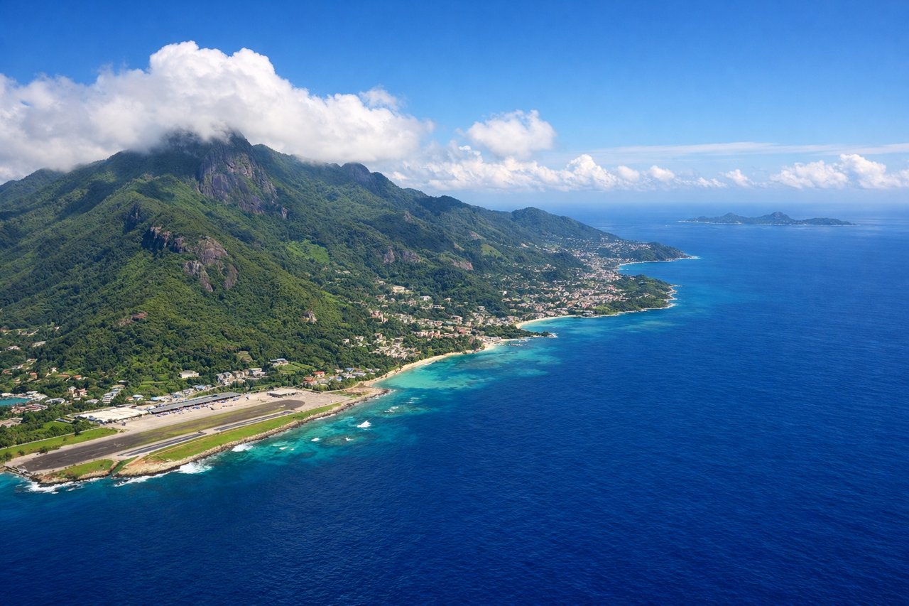
LEFTLeft-side seats offer the best approach views of the Indian Ocean, the Seychelles archipelago, and Mahe island's dramatic granite peaks as the aircraft descends from the west. The island's mountainous interior and coastal features are most visible from this angle.
Will your flight be in sunlight?
Pick a date and time in the Sun Map to watch the sun move across your whole flight.
About This Route
Which side of the plane should I sit on flying from Jomo Kenyatta International (NBO) to Seychelles International (SEZ)?
Sit on the Left side of the plane for the best views on flights from Nairobi to Mahe. While takeoff offers good Nairobi and rift valley views from the right, the landing approach to Seychelles from the left provides more dramatic and visually distinctive scenery—the granite peaks and island geography are far more striking than the relatively flat ocean crossing that dominates most of the flight.
What can I see during takeoff from Jomo Kenyatta International in Nairobi?
During takeoff from Jomo Kenyatta International (NBO), sit on the Right side for the best views. Right-side seats capture the Nairobi skyline and the escarpment edge of the East African Rift Valley as the aircraft climbs eastward. The terrain drops dramatically to the east, creating strong visual relief. Notable sights include: Nairobi city center and suburbs, East African Rift Valley escarpment edge, Ngong Hills to the southwest (visible on left but receding), Aberdare Range to the north.
What can I see when landing at Seychelles International in Mahe?
When landing at Seychelles International (SEZ), sit on the Left side for the best views. Left-side seats offer the best approach views of the Indian Ocean, the Seychelles archipelago, and Mahe island's dramatic granite peaks as the aircraft descends from the west. The island's mountainous interior and coastal features are most visible from this angle. Notable sights include: Indian Ocean (open water), Mahe island's granite peaks and interior ridges, Seychelles outer islands (Silhouette, North, Aride visible as distant specks), coral reef patterns in shallow water around Mahe.
How long is the flight from Nairobi to Mahe?
The flight from Jomo Kenyatta International (NBO) to Seychelles International (SEZ) takes about 3 hours 15 minutes. The shortest flight path between them is 1,304 miles (2,098 km); winds and air traffic control usually add a few percent.
What does the Nairobi to Mahe flight path pass over?
The flight path crosses the Indian Ocean in a generally east-southeast direction. After climbing out of Nairobi and clearing the rift valley escarpment, the aircraft crosses over central Kenya's highlands and then the coastal region near Mombasa before heading over open ocean. The midpoint (roughly 1.5 hours into flight) is over the Indian Ocean with no visible landmarks—only water. The approach to Seychelles begins around 2.5 hours, when the archipelago becomes visible on the horizon. The outer islands (Silhouette, North, Aride, Praslin) may be visible as the aircraft descends toward Mahe's Seychelles International Airport on the northwestern coast.