While the right side wins the Nagoya departure with mountain and city views, the left side delivers a stronger overall experience thanks to the dramatic Helsinki archipelago and harbor approach, plus glimpses of the Ural Mountains and Baltic coastline during cruise, giving it more consistent visual interest across the whole flight.
Flown NGO to HEL? Did we get it right?
Flight Path
Nagoya to Helsinki is 4,822 miles (7,761 km), a flight of about 10 hours 45 minutes.
The route crosses the Sea of Japan, the vast taiga and river plains of Siberia, the Ural Mountains near Yekaterinburg, and the forested lake country of western Russia and Finland before descending toward the Gulf of Finland.
Great circle distance and headings ›Phase by phase
Takeoff from NGO
RIGHTDeparting Centrair and turning northwest toward the continent, the right side offers a look back at Nagoya's urban sprawl and the Hida Mountains rising on the horizon beyond the Nobi Plain. The left side mostly shows the open waters of Ise Bay and the Kii Peninsula fading behind.
Landing at HEL
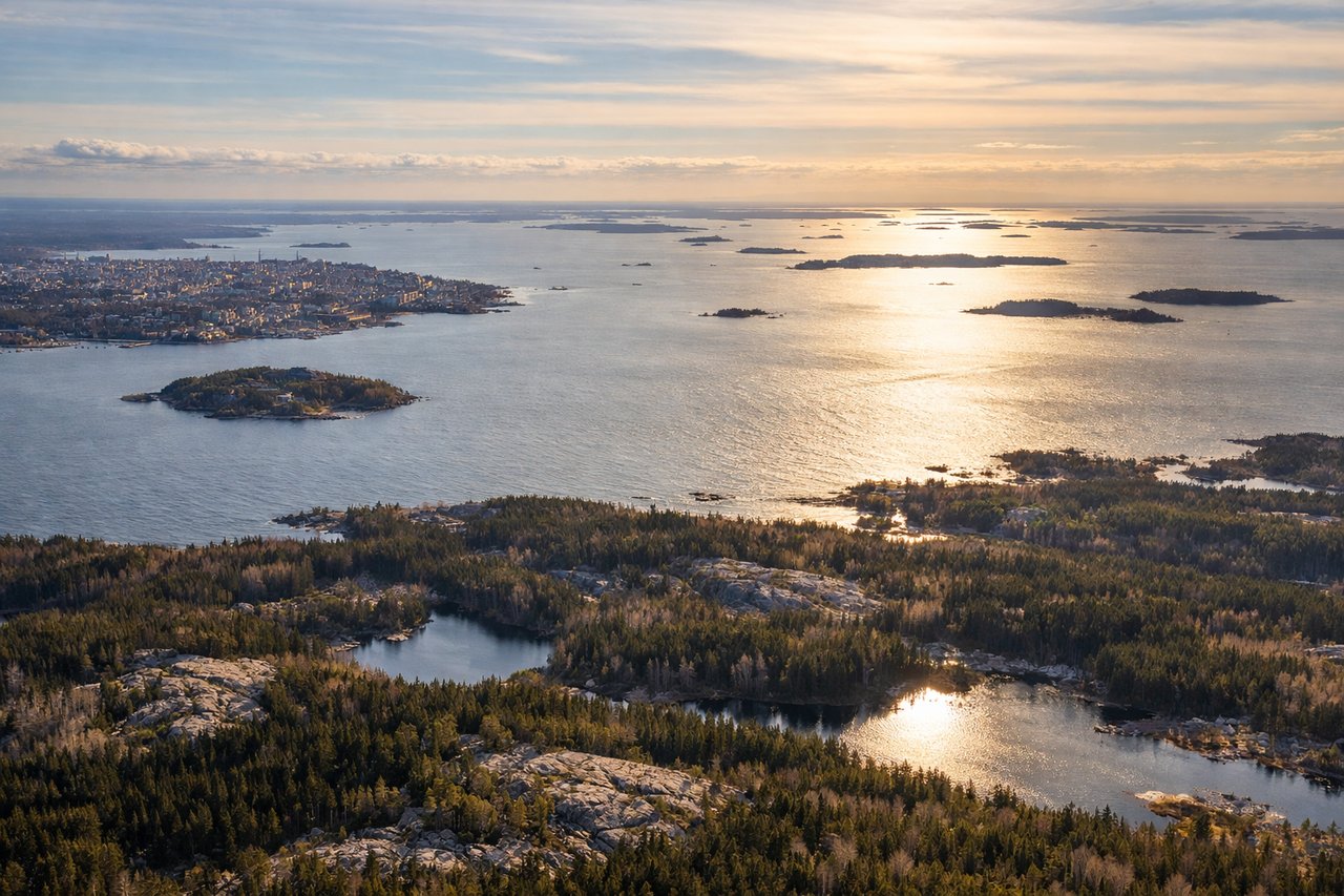
LEFTOn approach into Helsinki-Vantaa from the northeast, the final turn toward runway 22 gives left-side passengers a clear view of Helsinki's harbor, the archipelago dotting the Gulf of Finland, and the city center. The right side mostly overlooks flat forest and lake terrain inland.
Will your flight be in sunlight?
Pick a date and time in the Sun Map to watch the sun move across your whole flight.
About This Route
Which side of the plane should I sit on flying from Chubu Centrair International Airport (NGO) to Helsinki Vantaa (HEL)?
Sit on the Left side of the plane for the best views on flights from Nagoya to Helsinki. While the right side wins the Nagoya departure with mountain and city views, the left side delivers a stronger overall experience thanks to the dramatic Helsinki archipelago and harbor approach, plus glimpses of the Ural Mountains and Baltic coastline during cruise, giving it more consistent visual interest across the whole flight.
What can I see during takeoff from Chubu Centrair International Airport in Nagoya?
During takeoff from Chubu Centrair International Airport (NGO), sit on the Right side for the best views. Departing Centrair and turning northwest toward the continent, the right side offers a look back at Nagoya's urban sprawl and the Hida Mountains rising on the horizon beyond the Nobi Plain. The left side mostly shows the open waters of Ise Bay and the Kii Peninsula fading behind. Notable sights include: Nagoya city skyline, Hida Mountains (Japanese Alps), Nobi Plain, Ise Bay coastline.
What can I see when landing at Helsinki Vantaa in Helsinki?
When landing at Helsinki Vantaa (HEL), sit on the Left side for the best views. On approach into Helsinki-Vantaa from the northeast, the final turn toward runway 22 gives left-side passengers a clear view of Helsinki's harbor, the archipelago dotting the Gulf of Finland, and the city center. The right side mostly overlooks flat forest and lake terrain inland. Notable sights include: Helsinki city center and harbor, Gulf of Finland archipelago, Suomenlinna island fortress, coastal skyline.
How long is the flight from Nagoya to Helsinki?
The flight from Chubu Centrair International Airport (NGO) to Helsinki Vantaa (HEL) takes about 10 hours 45 minutes. The shortest flight path between them is 4,822 miles (7,761 km); winds and air traffic control usually add a few percent.
What does the Nagoya to Helsinki flight path pass over?
The route crosses the Sea of Japan, the vast taiga and river plains of Siberia, the Ural Mountains near Yekaterinburg, and the forested lake country of western Russia and Finland before descending toward the Gulf of Finland.