The right side consistently shows the more dramatic terrain across the flight — Ise Bay and the Kii Peninsula at departure, the Kyushu mountains and Kagoshima's Sakurajima volcano during cruise, and Okinawa's coral reefs and islands on arrival — while the left side is dominated by open, featureless Pacific waters.
Flight Path
Southern Kyushu coastline near Kagoshima with the Sakurajima volcano, followed by the Amami and Tokara island chains scattered across the East China Sea en route to Okinawa
Great circle distance and headings ›Phase by phase
Takeoff from NGO
RIGHTDeparting Centrair to the south or turning southwest, the right side offers views over Ise Bay toward the Mie Prefecture coastline and the forested hills of the Kii Peninsula, while the left side mostly shows open bay water and the flatter Chita Peninsula.
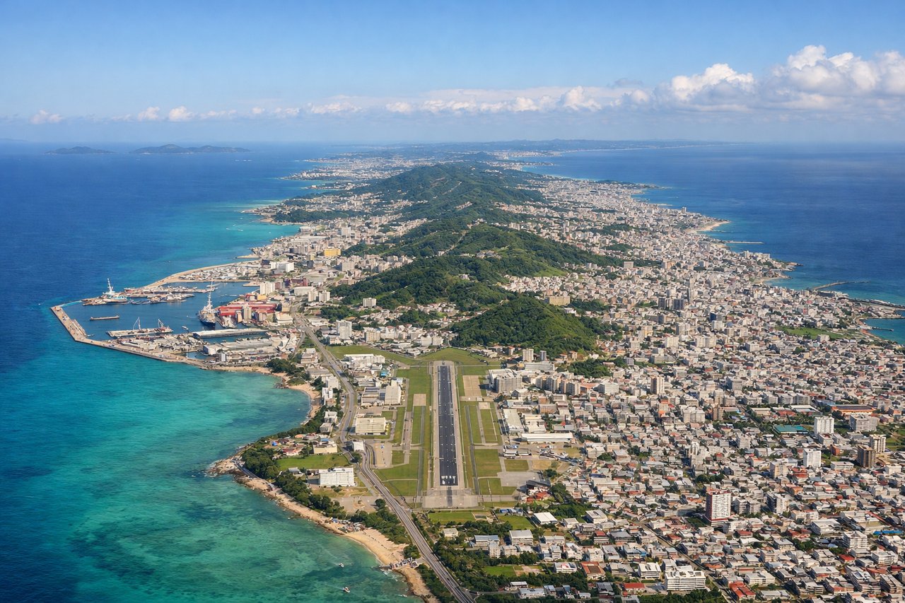
Landing at OKA
RIGHTOn approach into Naha, the right side typically reveals the turquoise reef-fringed coastline of Okinawa's main island and the small Kerama Islands offshore, offering much more visual interest than the open East China Sea seen from the left.
Will your flight be in sunlight?
See exactly which side of the plane gets sun and shade at your departure time.
About This Route
Which side of the plane should I sit on flying from Chubu Centrair International Airport (NGO) to Naha (OKA)?
Sit on the Right side of the plane for the best views on flights from Nagoya to Naha. The right side consistently shows the more dramatic terrain across the flight — Ise Bay and the Kii Peninsula at departure, the Kyushu mountains and Kagoshima's Sakurajima volcano during cruise, and Okinawa's coral reefs and islands on arrival — while the left side is dominated by open, featureless Pacific waters.
What can I see during takeoff from Chubu Centrair International Airport in Nagoya?
During takeoff from Chubu Centrair International Airport (NGO), sit on the Right side for the best views. Departing Centrair to the south or turning southwest, the right side offers views over Ise Bay toward the Mie Prefecture coastline and the forested hills of the Kii Peninsula, while the left side mostly shows open bay water and the flatter Chita Peninsula. Notable sights include: Ise Bay, Chita Peninsula, Kii Peninsula foothills, Mie coastline.
What can I see when landing at Naha in Naha?
When landing at Naha (OKA), sit on the Right side for the best views. On approach into Naha, the right side typically reveals the turquoise reef-fringed coastline of Okinawa's main island and the small Kerama Islands offshore, offering much more visual interest than the open East China Sea seen from the left. Notable sights include: Kerama Islands, Okinawa coral reefs, Naha coastline, Cape Manzamo.
How long is the flight from Nagoya to Naha?
The flight from Chubu Centrair International Airport (NGO) to Naha (OKA) takes 2h05m.
What does the Nagoya to Naha flight path pass over?
Southern Kyushu coastline near Kagoshima with the Sakurajima volcano, followed by the Amami and Tokara island chains scattered across the East China Sea en route to Okinawa