Left side (Nanjing departure) edges ahead due to the Yangtze River and Nanjing's urban scenery during takeoff, providing more visual variety than the relatively uniform North China Plain approach to Beijing. Both sides score equally on the cruise segment over monotonous plains, but the departure experience is slightly more engaging.
Flown NKG to PEK? Did we get it right?
Flight Path
Nanjing to Beijing is 590 miles (950 km), a flight of about 2 hours 15 minutes.
Henan Province plains with scattered cities (Kaifeng, Zhengzhou visible from altitude), Yellow River valley, transition from Yangtze watershed to North China Plain, agricultural fields with irrigation networks, no significant mountains or dramatic terrain changes
Great circle distance and headings ›Phase by phase
Takeoff from NKG
LEFTLeft side captures Nanjing's urban sprawl and the Yangtze River valley during climb-out, offering brief city scenery before transitioning to plains. Right side shows only flat agricultural terrain immediately.
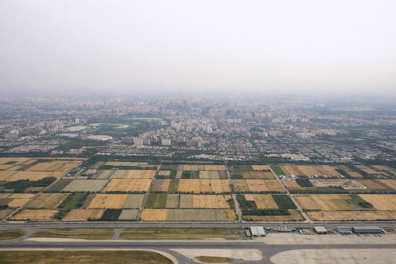
Landing at PEK
RIGHTRight side offers views of Beijing's urban approach and the North China Plain's geometric field patterns during descent. Left side shows similar flat terrain with less distinctive urban character during final approach.
Will your flight be in sunlight?
Pick a date and time in the Sun Map to watch the sun move across your whole flight.
About This Route
Which side of the plane should I sit on flying from Lu Kou Airport (NKG) to Capital (PEK)?
Sit on the Left side of the plane for the best views on flights from Nanjing to Beijing. Left side (Nanjing departure) edges ahead due to the Yangtze River and Nanjing's urban scenery during takeoff, providing more visual variety than the relatively uniform North China Plain approach to Beijing. Both sides score equally on the cruise segment over monotonous plains, but the departure experience is slightly more engaging.
What can I see during takeoff from Lu Kou Airport in Nanjing?
During takeoff from Lu Kou Airport (NKG), sit on the Left side for the best views. Left side captures Nanjing's urban sprawl and the Yangtze River valley during climb-out, offering brief city scenery before transitioning to plains. Right side shows only flat agricultural terrain immediately. Notable sights include: Nanjing city center and Yangtze River, Lu Kou Airport runway orientation, suburban development zones.
What can I see when landing at Capital in Beijing?
When landing at Capital (PEK), sit on the Right side for the best views. Right side offers views of Beijing's urban approach and the North China Plain's geometric field patterns during descent. Left side shows similar flat terrain with less distinctive urban character during final approach. Notable sights include: Beijing's sprawling urban grid, North China Plain agricultural fields, Capital Airport approach corridor.
How long is the flight from Nanjing to Beijing?
The flight from Lu Kou Airport (NKG) to Capital (PEK) takes about 2 hours 15 minutes. The shortest flight path between them is 590 miles (950 km); winds and air traffic control usually add a few percent.
What does the Nanjing to Beijing flight path pass over?
Henan Province plains with scattered cities (Kaifeng, Zhengzhou visible from altitude), Yellow River valley, transition from Yangtze watershed to North China Plain, agricultural fields with irrigation networks, no significant mountains or dramatic terrain changes