The landing approach to Cochin (3.5) significantly outscores the Mumbai departure (2.5). While Mumbai offers harbor and coastal views, the Cochin backwaters present far greater visual variety, distinctive geography, and scenic drama. The intricate lagoon system, river delta, and tropical landscape create a more memorable and geographically interesting flight segment than the relatively flat coastal departure from Mumbai.
Flown NMI to COK? Did we get it right?
Flight Path
Navi Mumbai to Kochi is 650 miles (1,046 km), a flight of about 1 hour 50 minutes.
The flight path crosses the Western Ghats mountain range (elevation 3,000-4,000 feet, visible as a north-south ridge), then descends over the Deccan Plateau transitioning to the coastal plains of Karnataka and Kerala. The Tungabhadra and Krishna river valleys are visible in the midpoint section. As the aircraft approaches Kerala, the terrain becomes increasingly lush and green with visible paddy fields and coconut plantations. The transition from the arid Deccan to the wet tropical landscape of Kerala is the most dramatic geographical shift along this route.
Great circle distance and headings ›

Phase by phase
Takeoff from NMI
LEFTNavi Mumbai departure offers views of Mumbai's harbor infrastructure, the Arabian Sea coastline, and the Western Ghats escarpment rising inland. The left side captures the industrial port area and coastal development during climb-out.
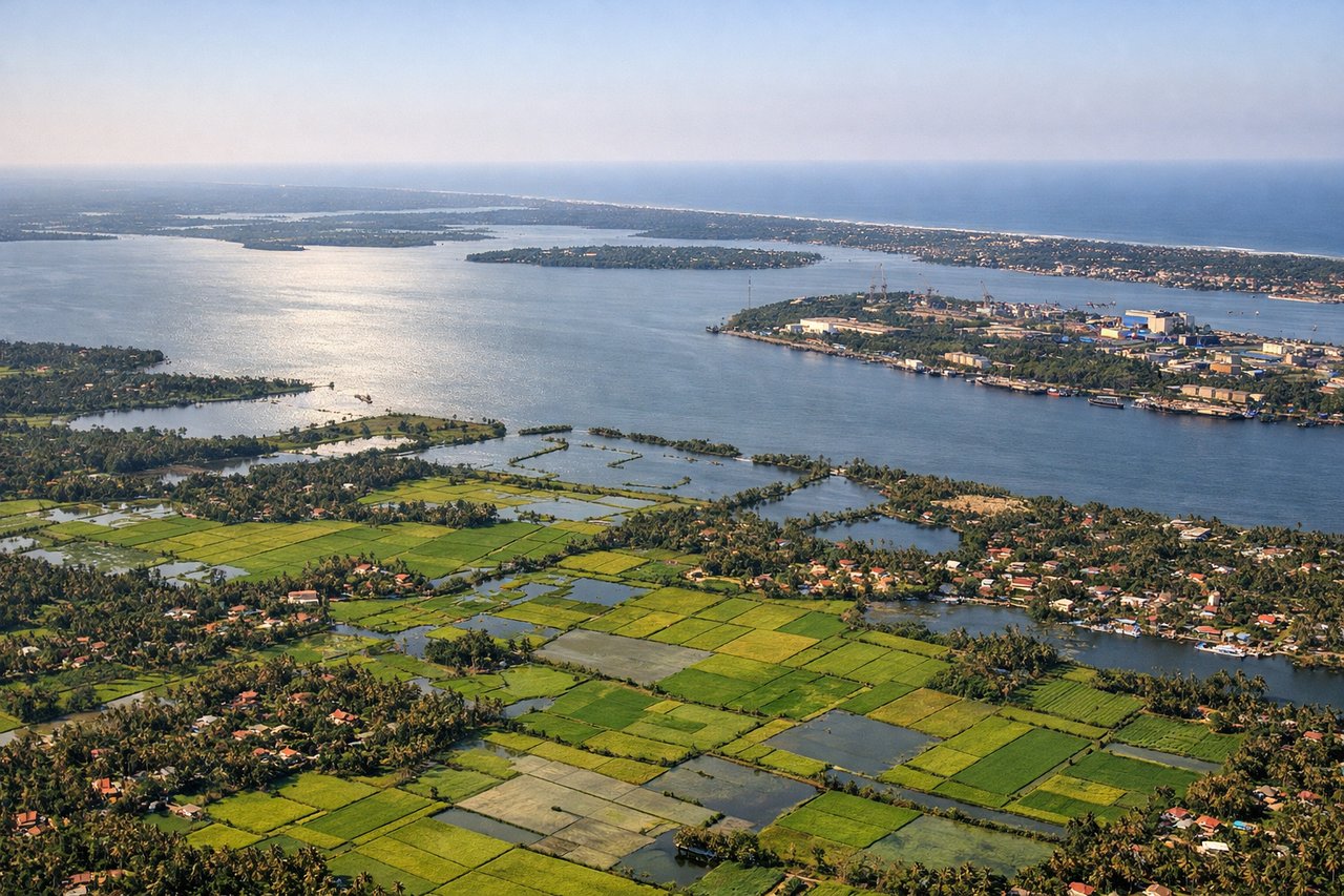
Landing at COK
RIGHTThe approach to Cochin from the northeast provides superior scenery: the backwaters of Kerala, the Periyar River delta, and the lush tropical landscape are far more visually distinctive than the departure side. The right side captures the intricate waterway system and verdant terrain during descent.
Will your flight be in sunlight?
Pick a date and time in the Sun Map to watch the sun move across your whole flight.
About This Route
Which side of the plane should I sit on flying from Navi Mumbai International Airport (NMI) to Cochin International Airport (COK)?
Sit on the Right side of the plane for the best views on flights from Navi Mumbai to Kochi. The landing approach to Cochin (3.5) significantly outscores the Mumbai departure (2.5). While Mumbai offers harbor and coastal views, the Cochin backwaters present far greater visual variety, distinctive geography, and scenic drama. The intricate lagoon system, river delta, and tropical landscape create a more memorable and geographically interesting flight segment than the relatively flat coastal departure from Mumbai.
What can I see during takeoff from Navi Mumbai International Airport in Navi Mumbai?
During takeoff from Navi Mumbai International Airport (NMI), sit on the Left side for the best views. Navi Mumbai departure offers views of Mumbai's harbor infrastructure, the Arabian Sea coastline, and the Western Ghats escarpment rising inland. The left side captures the industrial port area and coastal development during climb-out. Notable sights include: Mumbai Harbor and port facilities, Arabian Sea coastline, Western Ghats mountain range (distant), Thane Creek estuary.
What can I see when landing at Cochin International Airport in Kochi?
When landing at Cochin International Airport (COK), sit on the Right side for the best views. The approach to Cochin from the northeast provides superior scenery: the backwaters of Kerala, the Periyar River delta, and the lush tropical landscape are far more visually distinctive than the departure side. The right side captures the intricate waterway system and verdant terrain during descent. Notable sights include: Cochin backwaters and lagoon system, Periyar River delta, Arabian Sea coastline, lush tropical vegetation and paddy fields.
How long is the flight from Navi Mumbai to Kochi?
The flight from Navi Mumbai International Airport (NMI) to Cochin International Airport (COK) takes about 1 hour 50 minutes. The shortest flight path between them is 650 miles (1,046 km); winds and air traffic control usually add a few percent.
What does the Navi Mumbai to Kochi flight path pass over?
The flight path crosses the Western Ghats mountain range (elevation 3,000-4,000 feet, visible as a north-south ridge), then descends over the Deccan Plateau transitioning to the coastal plains of Karnataka and Kerala. The Tungabhadra and Krishna river valleys are visible in the midpoint section. As the aircraft approaches Kerala, the terrain becomes increasingly lush and green with visible paddy fields and coconut plantations. The transition from the arid Deccan to the wet tropical landscape of Kerala is the most dramatic geographical shift along this route.