Right side scores 3.5 vs left's 2.5 due to superior scenic variety across the full flight. Takeoff offers immediate coastal and urban contrast; cruise provides views of Japan's mountainous terrain and the Kanto Plain; landing delivers Tokyo Bay's distinctive geography and the city's dramatic skyline. Left side is dominated by extended ocean views during cruise with minimal landmark density, capping its score at 2.5 (ocean-heavy penalty applies).
Flown NMI to HND? Did we get it right?
Flight Path
Navi Mumbai to Tokyo is 4,177 miles (6,722 km), a flight of about 7 hours 15 minutes.
East China Sea (open water for 4+ hours), Izu Islands (volcanic chain south of Tokyo, visible during descent), Kanto Plain (flat agricultural and urban terrain), Mount Fuji (occasionally visible on clear days during approach to Tokyo, though not guaranteed)
Great circle distance and headings ›Phase by phase
Takeoff from NMI
RIGHTRight side captures the Arabian Sea coastline and Mumbai's urban sprawl during initial climb. Depending on runway direction (08 vs 26), right-side passengers see either the western coastline receding or the city's eastern industrial zones. The Arabian Sea provides immediate water contrast against urban development.
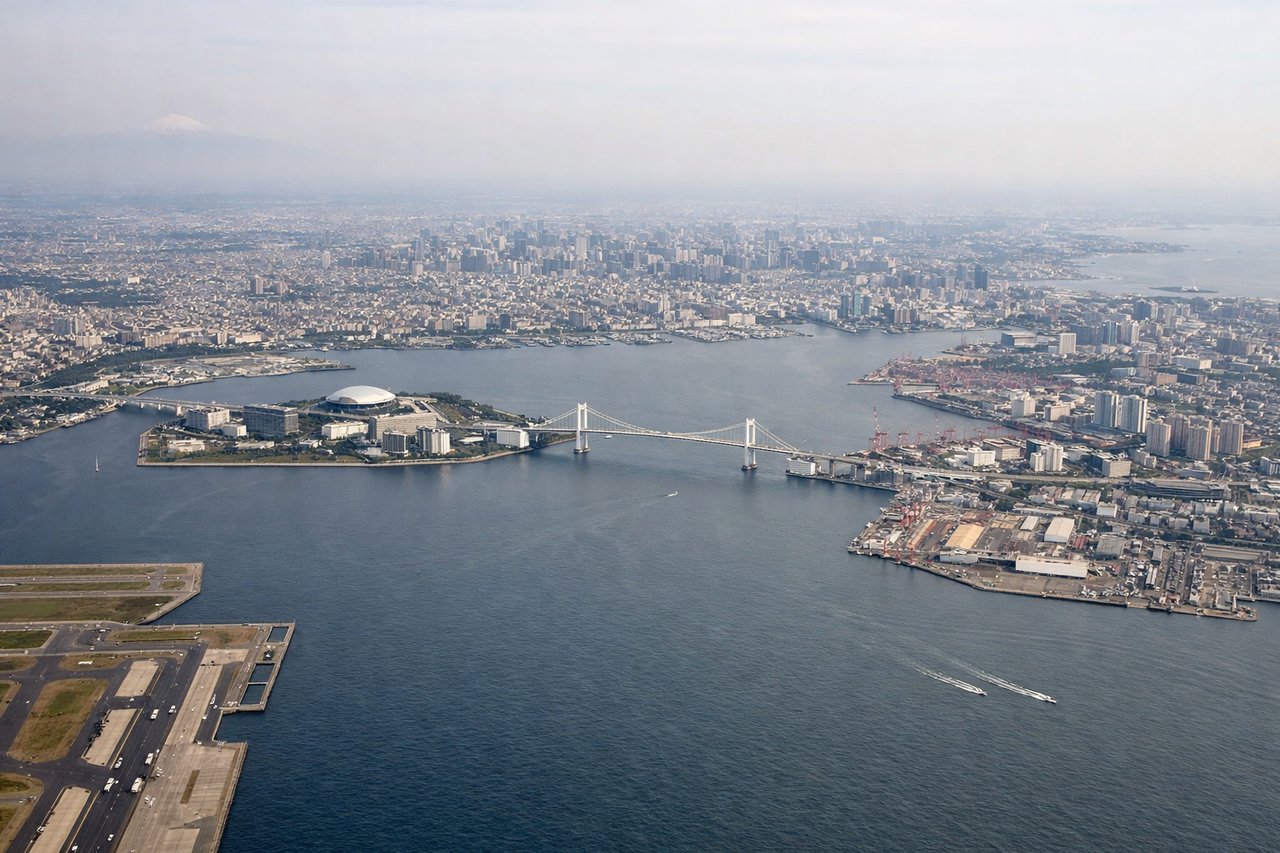
Landing at HND
RIGHTRight side offers superior Tokyo Bay approach views. During typical daytime south-wind operations, arrivals descend over the bay from the south, giving right-side passengers direct views of Tokyo Bay's islands, the Boso Peninsula, and the city skyline. Even in north-wind reversals, right-side passengers see either the bay or the Kanto Plain's urban sprawl.
Will your flight be in sunlight?
Pick a date and time in the Sun Map to watch the sun move across your whole flight.
About This Route
Which side of the plane should I sit on flying from Navi Mumbai International Airport (NMI) to Tokyo International (HND)?
Sit on the Right side of the plane for the best views on flights from Navi Mumbai to Tokyo. Right side scores 3.5 vs left's 2.5 due to superior scenic variety across the full flight. Takeoff offers immediate coastal and urban contrast; cruise provides views of Japan's mountainous terrain and the Kanto Plain; landing delivers Tokyo Bay's distinctive geography and the city's dramatic skyline. Left side is dominated by extended ocean views during cruise with minimal landmark density, capping its score at 2.5 (ocean-heavy penalty applies).
What can I see during takeoff from Navi Mumbai International Airport in Navi Mumbai?
During takeoff from Navi Mumbai International Airport (NMI), sit on the Right side for the best views. Right side captures the Arabian Sea coastline and Mumbai's urban sprawl during initial climb. Depending on runway direction (08 vs 26), right-side passengers see either the western coastline receding or the city's eastern industrial zones. The Arabian Sea provides immediate water contrast against urban development. Notable sights include: Arabian Sea, Mumbai metropolitan area, Thane Creek, Western Ghats foothills (distant).
What can I see when landing at Tokyo International in Tokyo?
When landing at Tokyo International (HND), sit on the Right side for the best views. Right side offers superior Tokyo Bay approach views. During typical daytime south-wind operations, arrivals descend over the bay from the south, giving right-side passengers direct views of Tokyo Bay's islands, the Boso Peninsula, and the city skyline. Even in north-wind reversals, right-side passengers see either the bay or the Kanto Plain's urban sprawl. Notable sights include: Tokyo Bay, Boso Peninsula, Haneda Airport runways, Tokyo metropolitan skyline.
How long is the flight from Navi Mumbai to Tokyo?
The flight from Navi Mumbai International Airport (NMI) to Tokyo International (HND) takes about 7 hours 15 minutes. The shortest flight path between them is 4,177 miles (6,722 km); winds and air traffic control usually add a few percent.
What does the Navi Mumbai to Tokyo flight path pass over?
East China Sea (open water for 4+ hours), Izu Islands (volcanic chain south of Tokyo, visible during descent), Kanto Plain (flat agricultural and urban terrain), Mount Fuji (occasionally visible on clear days during approach to Tokyo, though not guaranteed)