Napier to Auckland is 204 miles (328 km), a flight of about 55 minutes.
While takeoff offers coastal views, the landing approach provides more dramatic and varied scenery: the Waitakere Ranges, Manukau Harbour, and Auckland's distinctive volcanic landscape. Left-side seats capture the most visually interesting portion of the flight.
Flight Path
During cruise, the flight passes over the Kaingaroa Forest and Rotorua geothermal region (inland, not visible from standard cruising altitude on this route), then transitions over the central North Island plateau before descending toward Auckland. The most notable midpoint feature is the transition from Hawke Bay's coastal terrain to the rolling farmland and forests of the central North Island, though these are typically viewed from higher altitude and offer less dramatic scenery than the takeoff and landing phases.
Great circle distance and headings ›Phase by phase
Takeoff from NPE
RIGHTRight-side seats offer views of Hawke Bay and the Pacific coastline as the aircraft climbs northwest. You'll see the bay's distinctive crescent shape and the Mahia Peninsula extending into the ocean.
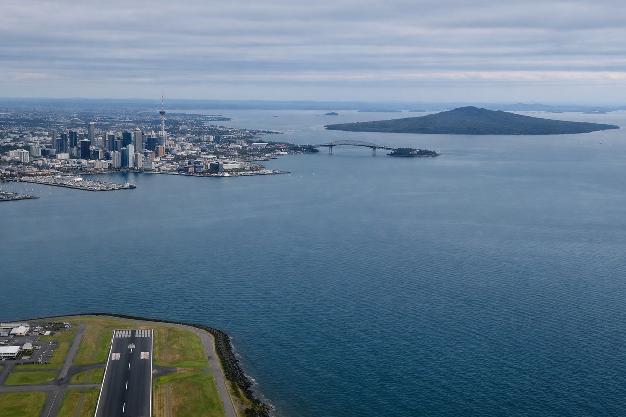
Landing at AKL
LEFTLeft-side seats provide excellent views during descent into Auckland. You'll see the Waitakere Ranges to the west, then the urban sprawl of Auckland's western suburbs, and finally the approach over the Manukau Harbour.
Will your flight be in sunlight?
Pick a date and time in the Sun Map to watch the sun move across your whole flight.
About This Route
Which side of the plane should I sit on flying from Hawke's Bay Airport (NPE) to Auckland International (AKL)?
Sit on the Left side of the plane for the best views on flights from Napier to Auckland. While takeoff offers coastal views, the landing approach provides more dramatic and varied scenery: the Waitakere Ranges, Manukau Harbour, and Auckland's distinctive volcanic landscape. Left-side seats capture the most visually interesting portion of the flight.
What can I see during takeoff from Hawke's Bay Airport in Napier?
During takeoff from Hawke's Bay Airport (NPE), sit on the Right side for the best views. Right-side seats offer views of Hawke Bay and the Pacific coastline as the aircraft climbs northwest. You'll see the bay's distinctive crescent shape and the Mahia Peninsula extending into the ocean. Notable sights include: Hawke Bay, Mahia Peninsula, Pacific Ocean coastline, Napier city waterfront.
What can I see when landing at Auckland International in Auckland?
When landing at Auckland International (AKL), sit on the Left side for the best views. Left-side seats provide excellent views during descent into Auckland. You'll see the Waitakere Ranges to the west, then the urban sprawl of Auckland's western suburbs, and finally the approach over the Manukau Harbour. Notable sights include: Waitakere Ranges, Manukau Harbour, Auckland's western suburbs, volcanic cones of the Auckland volcanic field.
How long is the flight from Napier to Auckland?
The flight from Hawke's Bay Airport (NPE) to Auckland International (AKL) takes about 55 minutes. The shortest flight path between them is 204 miles (328 km); winds and air traffic control usually add a few percent.
What does the Napier to Auckland flight path pass over?
During cruise, the flight passes over the Kaingaroa Forest and Rotorua geothermal region (inland, not visible from standard cruising altitude on this route), then transitions over the central North Island plateau before descending toward Auckland. The most notable midpoint feature is the transition from Hawke Bay's coastal terrain to the rolling farmland and forests of the central North Island, though these are typically viewed from higher altitude and offer less dramatic scenery than the takeoff and landing phases.