Astana to Istanbul is 2,120 miles (3,411 km), a flight of about 5 hours 30 minutes.
Right side wins at both ends of the flight. During cruise the route crosses the northern Caspian region, the Caucasus foothills, and the Black Sea coast of Turkey, all of which are marginally better on the right (north-facing) side, though at 35,000 feet the difference is minimal over flat terrain.
Flight Path
The flight tracks southwest over the flat Kazakh steppe, crosses the northern tip of the Caspian Sea or skirts just north of it, passes over western Kazakhstan and southern Russia near the Volga-Ural region, then crosses the Caucasus Mountains or their northern foothills, transits the Black Sea, and enters Turkish airspace over the Anatolian plateau before descending toward Istanbul. The Caucasus range is the most visually dramatic feature en route, visible as a snow-capped wall of peaks from cruising altitude.
Great circle distance and headings ›Phase by phase
Takeoff from NQZ
RIGHTAstana's runways are oriented roughly east-west. Departing westbound toward Istanbul, the right side faces north, giving views over the flat steppe and the Ishim River winding through the city. The left side faces south over featureless plain, so right wins by default for the city overview.
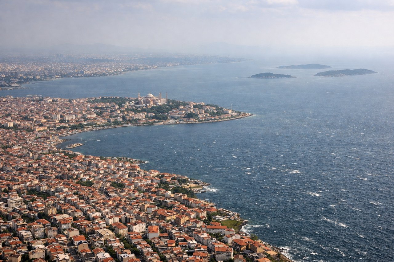
Landing at IST
RIGHTAtaturk Airport's main runway 06/24 means arrivals from the east typically land on runway 06, approaching from over the Sea of Marmara or the Asian side. On a westbound approach, the right side faces north, giving clear views of the Golden Horn, Bosphorus strait, and the historic peninsula with Hagia Sophia and Topkapi Palace. The left side looks south over the Marmara, which is scenic but less iconic.
Landmarks on this routeAll landmarks →
Will your flight be in sunlight?
Pick a date and time in the Sun Map to watch the sun move across your whole flight.
About This Route
Which side of the plane should I sit on flying from Nursultan Nazarbayev International Airport (NQZ) to İstanbul Airport (IST)?
Sit on the Right side of the plane for the best views on flights from Astana to Istanbul. Right side wins at both ends of the flight. During cruise the route crosses the northern Caspian region, the Caucasus foothills, and the Black Sea coast of Turkey, all of which are marginally better on the right (north-facing) side, though at 35,000 feet the difference is minimal over flat terrain.
What can I see during takeoff from Nursultan Nazarbayev International Airport in Astana?
During takeoff from Nursultan Nazarbayev International Airport (NQZ), sit on the Right side for the best views. Astana's runways are oriented roughly east-west. Departing westbound toward Istanbul, the right side faces north, giving views over the flat steppe and the Ishim River winding through the city. The left side faces south over featureless plain, so right wins by default for the city overview. Notable sights include: Ishim River bend through central Astana, Bayterek Tower visible in the city core, the geometric grid of Nur-Sultan's planned districts, flat Kazakh steppe extending to the horizon.
What can I see when landing at İstanbul Airport in Istanbul?
When landing at İstanbul Airport (IST), sit on the Right side for the best views. Ataturk Airport's main runway 06/24 means arrivals from the east typically land on runway 06, approaching from over the Sea of Marmara or the Asian side. On a westbound approach, the right side faces north, giving clear views of the Golden Horn, Bosphorus strait, and the historic peninsula with Hagia Sophia and Topkapi Palace. The left side looks south over the Marmara, which is scenic but less iconic. Notable sights include: Bosphorus strait, Golden Horn inlet, historic Sultanahmet peninsula with Hagia Sophia and Blue Mosque domes, Prince's Islands in the Sea of Marmara.
How long is the flight from Astana to Istanbul?
The flight from Nursultan Nazarbayev International Airport (NQZ) to İstanbul Airport (IST) takes about 5 hours 30 minutes. The shortest flight path between them is 2,120 miles (3,411 km); winds and air traffic control usually add a few percent.
What does the Astana to Istanbul flight path pass over?
The flight tracks southwest over the flat Kazakh steppe, crosses the northern tip of the Caspian Sea or skirts just north of it, passes over western Kazakhstan and southern Russia near the Volga-Ural region, then crosses the Caucasus Mountains or their northern foothills, transits the Black Sea, and enters Turkish airspace over the Anatolian plateau before descending toward Istanbul. The Caucasus range is the most visually dramatic feature en route, visible as a snow-capped wall of peaks from cruising altitude.