Oklahoma City to Salt Lake City is 865 miles (1,392 km), a flight of about 2 hours 20 minutes.
The left side captures both the brief but distinctive OKC skyline at departure and the dramatic Wasatch Range on arrival, giving it more terrain variety and visual interest across the flight. The right side stays largely flat and featureless for most of the route.
Flight Path
The flight path crosses the Texas Panhandle and eastern Colorado plains before the terrain rises toward the Rocky Mountain foothills near the Colorado-Utah border, with distant views of the Sangre de Cristo and San Juan Mountains possible to the south on clear days.
Great circle distance and headings ›.jpg?width=600)

Phase by phase
Takeoff from OKC
LEFTDeparting OKC to the south before turning northwest, the left side offers a brief view of downtown Oklahoma City's skyline and the Oklahoma River before the plains take over. The right side just shows flat suburban sprawl with no distinguishing features.
Landing at SLC
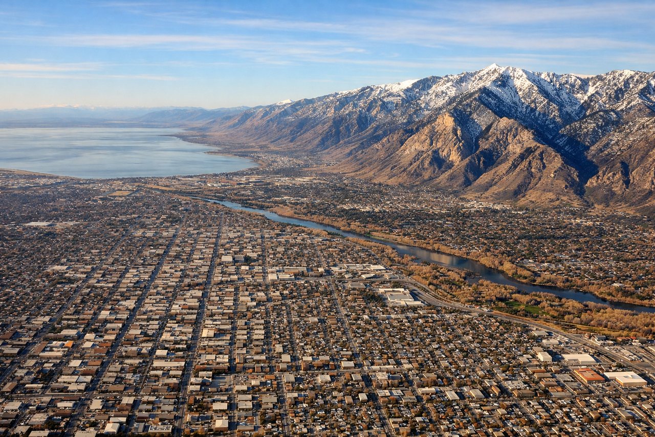
LEFTOn approach into SLC from the east, the descent brings the jagged, snow-streaked Wasatch Range dramatically close on the left side, with canyons and ridgelines visible right up to touchdown. The right side mostly shows the flat Salt Lake Valley floor and distant lake shoreline, less dramatic in comparison.
Landmarks on this routeAll landmarks →
Will your flight be in sunlight?
Pick a date and time in the Sun Map to watch the sun move across your whole flight.
About This Route
Which side of the plane should I sit on flying from Will Rogers World (OKC) to Salt Lake City International (SLC)?
Sit on the Left side of the plane for the best views on flights from Oklahoma City to Salt Lake City. The left side captures both the brief but distinctive OKC skyline at departure and the dramatic Wasatch Range on arrival, giving it more terrain variety and visual interest across the flight. The right side stays largely flat and featureless for most of the route.
What can I see during takeoff from Will Rogers World in Oklahoma City?
During takeoff from Will Rogers World (OKC), sit on the Left side for the best views. Departing OKC to the south before turning northwest, the left side offers a brief view of downtown Oklahoma City's skyline and the Oklahoma River before the plains take over. The right side just shows flat suburban sprawl with no distinguishing features. Notable sights include: Downtown Oklahoma City skyline, Oklahoma River, Lake Overholser.
What can I see when landing at Salt Lake City International in Salt Lake City?
When landing at Salt Lake City International (SLC), sit on the Left side for the best views. On approach into SLC from the east, the descent brings the jagged, snow-streaked Wasatch Range dramatically close on the left side, with canyons and ridgelines visible right up to touchdown. The right side mostly shows the flat Salt Lake Valley floor and distant lake shoreline, less dramatic in comparison. Notable sights include: Wasatch Range peaks, Traverse Mountains, Salt Lake Valley floor, Great Salt Lake shoreline in the distance.
How long is the flight from Oklahoma City to Salt Lake City?
The flight from Will Rogers World (OKC) to Salt Lake City International (SLC) takes about 2 hours 20 minutes. The shortest flight path between them is 865 miles (1,392 km); winds and air traffic control usually add a few percent.
What does the Oklahoma City to Salt Lake City flight path pass over?
The flight path crosses the Texas Panhandle and eastern Colorado plains before the terrain rises toward the Rocky Mountain foothills near the Colorado-Utah border, with distant views of the Sangre de Cristo and San Juan Mountains possible to the south on clear days.