Okayama to Sapporo is 696 miles (1,120 km), a flight of about 2 hours 15 minutes.
Takeoff from Okayama on the right side provides superior views of the Seto Inland Sea and Asahi Mountains. While landing favors the left, the northbound departure offers more visually distinctive geography. The flight path itself crosses central Honshu with limited dramatic features at cruise altitude, making the departure experience the stronger choice overall.
Flight Path
During cruise at 25,000-30,000 feet, the flight passes over central Honshu's mountainous terrain. The Chugoku Mountains form a north-south spine visible as a textured ridge system roughly 60-80 kilometers west of the direct route. Lake Biwa (Japan's largest freshwater lake) may be visible on the eastern horizon during the northern portion of cruise if weather permits. The flight then transitions into the Kanto Plain region before turning northeast toward Hokkaido. The Tsugaru Strait separating Honshu from Hokkaido marks the final approach segment, with the strait itself visible as a narrow water channel approximately 15-20 kilometers wide.
Great circle distance and headings ›Phase by phase
Takeoff from OKJ
RIGHTOkayama typically departs runway 26 (westbound). Right-side seats face north during initial climb, offering views of the Asahi Mountains and the Seto Inland Sea's northern coastline. Left seats look toward industrial areas and urban sprawl with less geographic interest.
Landing at CTS
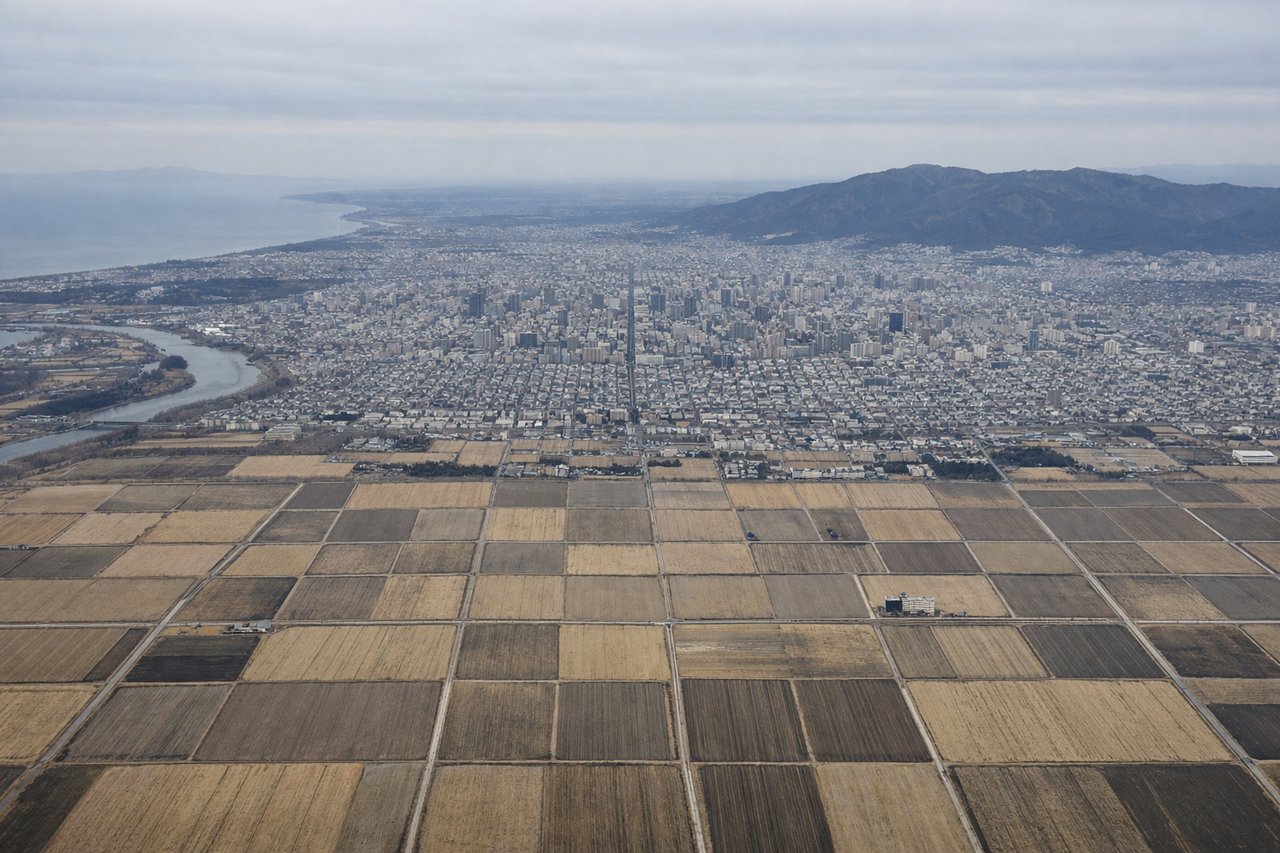
LEFTChitose typically lands runway 19 (southbound approach). Left-side seats during descent face west, providing views of the Ishikari Plain, Toyohira River valley, and the Daisetsu Mountains on the western horizon. Right seats see less distinctive terrain—mostly suburban sprawl and industrial areas around Sapporo.
Will your flight be in sunlight?
Pick a date and time in the Sun Map to watch the sun move across your whole flight.
About This Route
Which side of the plane should I sit on flying from Okayama (OKJ) to Chitose International Airport (CTS)?
Sit on the Right side of the plane for the best views on flights from Okayama to Sapporo. Takeoff from Okayama on the right side provides superior views of the Seto Inland Sea and Asahi Mountains. While landing favors the left, the northbound departure offers more visually distinctive geography. The flight path itself crosses central Honshu with limited dramatic features at cruise altitude, making the departure experience the stronger choice overall.
What can I see during takeoff from Okayama in Okayama?
During takeoff from Okayama (OKJ), sit on the Right side for the best views. Okayama typically departs runway 26 (westbound). Right-side seats face north during initial climb, offering views of the Asahi Mountains and the Seto Inland Sea's northern coastline. Left seats look toward industrial areas and urban sprawl with less geographic interest. Notable sights include: Asahi Mountains (northeast), Seto Inland Sea (northern horizon), Okayama city grid (directly below during initial climb), Kojima Bay (visible to the right as you climb).
What can I see when landing at Chitose International Airport in Sapporo?
When landing at Chitose International Airport (CTS), sit on the Left side for the best views. Chitose typically lands runway 19 (southbound approach). Left-side seats during descent face west, providing views of the Ishikari Plain, Toyohira River valley, and the Daisetsu Mountains on the western horizon. Right seats see less distinctive terrain—mostly suburban sprawl and industrial areas around Sapporo. Notable sights include: Daisetsu Mountains (western horizon), Toyohira River valley (visible as a linear feature), Ishikari Plain (expansive agricultural grid), Sapporo urban area (approaching from north).
How long is the flight from Okayama to Sapporo?
The flight from Okayama (OKJ) to Chitose International Airport (CTS) takes about 2 hours 15 minutes. The shortest flight path between them is 696 miles (1,120 km); winds and air traffic control usually add a few percent.
What does the Okayama to Sapporo flight path pass over?
During cruise at 25,000-30,000 feet, the flight passes over central Honshu's mountainous terrain. The Chugoku Mountains form a north-south spine visible as a textured ridge system roughly 60-80 kilometers west of the direct route. Lake Biwa (Japan's largest freshwater lake) may be visible on the eastern horizon during the northern portion of cruise if weather permits. The flight then transitions into the Kanto Plain region before turning northeast toward Hokkaido. The Tsugaru Strait separating Honshu from Hokkaido marks the final approach segment, with the strait itself visible as a narrow water channel approximately 15-20 kilometers wide.