While the left offers good mountain views on departure, the right side captures the dramatic Rocky Mountain Front Range during descent—the visual climax of the flight. The Continental Divide and high peaks are far more striking than the San Gabriel range seen on takeoff.
Flown ONT to BJC? Did we get it right?
Flight Path
Ontario to Denver is 798 miles (1,284 km), a flight of about 2 hours 15 minutes.
Mojave Desert (sparse, open scrubland with minimal landmarks), transition into Arizona high desert near the Colorado River drainage, then the Colorado Plateau with mesas and canyons becoming visible, finally the transition to the Front Range foothills as you approach Denver from the west
Great circle distance and headings ›


Phase by phase
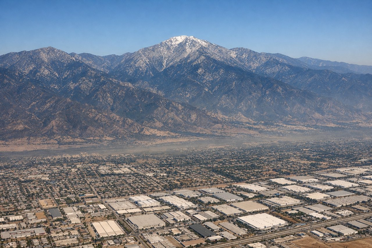
Takeoff from ONT
LEFTLeft side offers immediate views of the San Gabriel Mountains as you climb eastward out of Ontario. The range rises dramatically to the north and northeast, creating a striking backdrop during the initial 10,000–15,000 ft climb phase.
Landing at BJC
RIGHTRight side provides excellent views of the Front Range of the Rocky Mountains during descent into Denver. The Continental Divide and peaks like Mount Evans are visible on the right, and you'll see the transition from high plains to foothills clearly.
Will your flight be in sunlight?
Pick a date and time in the Sun Map to watch the sun move across your whole flight.
About This Route
Which side of the plane should I sit on flying from Ontario International (ONT) to Rocky Mountain Metropolitan Airport (BJC)?
Sit on the Right side of the plane for the best views on flights from Ontario to Denver. While the left offers good mountain views on departure, the right side captures the dramatic Rocky Mountain Front Range during descent—the visual climax of the flight. The Continental Divide and high peaks are far more striking than the San Gabriel range seen on takeoff.
What can I see during takeoff from Ontario International in Ontario?
During takeoff from Ontario International (ONT), sit on the Left side for the best views. Left side offers immediate views of the San Gabriel Mountains as you climb eastward out of Ontario. The range rises dramatically to the north and northeast, creating a striking backdrop during the initial 10,000–15,000 ft climb phase. Notable sights include: San Gabriel Mountains, San Bernardino Mountains (distant northeast), Los Angeles Basin urban sprawl (south and west), Mojave Desert beginning to open up (east).
What can I see when landing at Rocky Mountain Metropolitan Airport in Denver?
When landing at Rocky Mountain Metropolitan Airport (BJC), sit on the Right side for the best views. Right side provides excellent views of the Front Range of the Rocky Mountains during descent into Denver. The Continental Divide and peaks like Mount Evans are visible on the right, and you'll see the transition from high plains to foothills clearly. Notable sights include: Front Range of the Rocky Mountains, Continental Divide, Denver metropolitan area sprawl (northeast), High Plains extending east toward Kansas.
How long is the flight from Ontario to Denver?
The flight from Ontario International (ONT) to Rocky Mountain Metropolitan Airport (BJC) takes about 2 hours 15 minutes. The shortest flight path between them is 798 miles (1,284 km); winds and air traffic control usually add a few percent.
What does the Ontario to Denver flight path pass over?
Mojave Desert (sparse, open scrubland with minimal landmarks), transition into Arizona high desert near the Colorado River drainage, then the Colorado Plateau with mesas and canyons becoming visible, finally the transition to the Front Range foothills as you approach Denver from the west