Both sides score equally at 2.0 due to the short flight duration (3h 15m) over predominantly flat terrain with limited dramatic geography. However, the right side edges ahead for the landing sequence: the downtown Dallas skyline and Trinity River provide genuine urban and hydrological landmarks during descent that are more visually distinctive than Ontario's industrial sprawl during takeoff. The right side captures the more memorable portion of the flight.
Flown ONT to DAL? Did we get it right?
Flight Path
Ontario to Dallas is 1,197 miles (1,927 km), a flight of about 3 hours 15 minutes.
The flight path crosses the Permian Basin and western Texas plains. Notable features include the Davis Mountains (far south of direct route, not visible), the Pecos River valley (south of track), and the flat High Plains of west-central Texas. No major mountain ranges or water bodies intersect the direct ONT-DAL corridor; the route is predominantly over open prairie, scrubland, and scattered ranch country. The landscape remains visually monotonous from cruise altitude—tan and brown grassland with occasional ranch roads and sparse vegetation. No significant urban centers lie directly on the route between Ontario and Dallas.
Great circle distance and headings ›Phase by phase
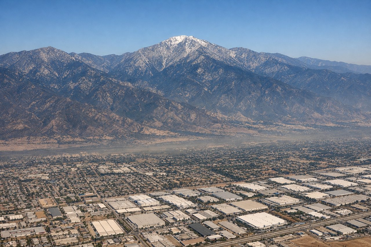
Takeoff from ONT
LEFTLeft side (north) offers views of the San Gabriel Mountains during initial climb, providing brief terrain relief before the aircraft turns eastward. Right side faces the flat Inland Empire sprawl with minimal visual interest.
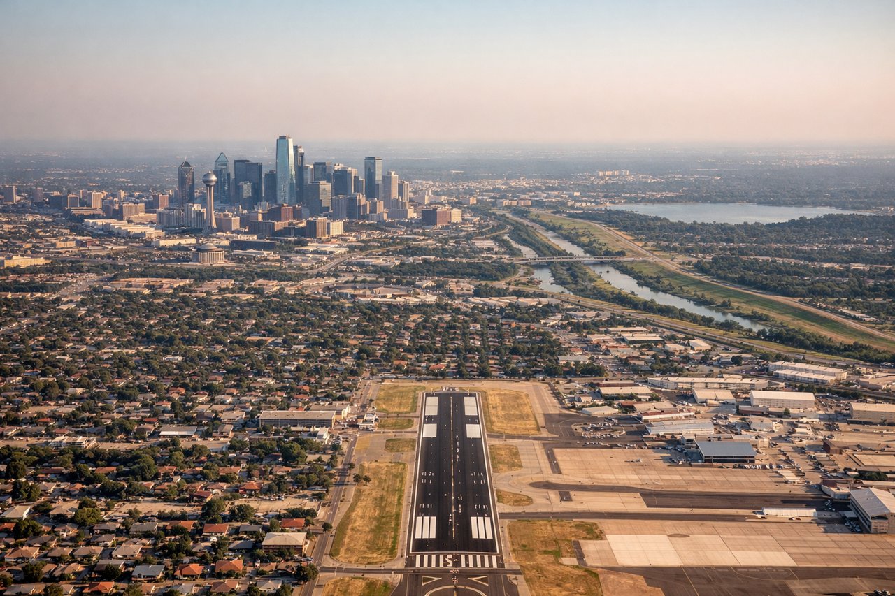
Landing at DAL
RIGHTRight side (south) during approach to Dallas Love Field captures views of downtown Dallas skyline and the Trinity River corridor as the aircraft descends from the southeast. Left side faces the northern suburbs and open terrain with less urban definition.
Will your flight be in sunlight?
Pick a date and time in the Sun Map to watch the sun move across your whole flight.
About This Route
Which side of the plane should I sit on flying from Ontario International (ONT) to Dallas Love Fld (DAL)?
Sit on the Right side of the plane for the best views on flights from Ontario to Dallas. Both sides score equally at 2.0 due to the short flight duration (3h 15m) over predominantly flat terrain with limited dramatic geography. However, the right side edges ahead for the landing sequence: the downtown Dallas skyline and Trinity River provide genuine urban and hydrological landmarks during descent that are more visually distinctive than Ontario's industrial sprawl during takeoff. The right side captures the more memorable portion of the flight.
What can I see during takeoff from Ontario International in Ontario?
During takeoff from Ontario International (ONT), sit on the Left side for the best views. Left side (north) offers views of the San Gabriel Mountains during initial climb, providing brief terrain relief before the aircraft turns eastward. Right side faces the flat Inland Empire sprawl with minimal visual interest. Notable sights include: San Gabriel Mountains (north), Ontario city grid and industrial areas (immediate), San Bernardino Valley (east).
What can I see when landing at Dallas Love Fld in Dallas?
When landing at Dallas Love Fld (DAL), sit on the Right side for the best views. Right side (south) during approach to Dallas Love Field captures views of downtown Dallas skyline and the Trinity River corridor as the aircraft descends from the southeast. Left side faces the northern suburbs and open terrain with less urban definition. Notable sights include: Downtown Dallas skyline (south-southwest), Trinity River and its floodplain (south), White Rock Lake (southeast), Reunion Tower and central business district.
How long is the flight from Ontario to Dallas?
The flight from Ontario International (ONT) to Dallas Love Fld (DAL) takes about 3 hours 15 minutes. The shortest flight path between them is 1,197 miles (1,927 km); winds and air traffic control usually add a few percent.
What does the Ontario to Dallas flight path pass over?
The flight path crosses the Permian Basin and western Texas plains. Notable features include the Davis Mountains (far south of direct route, not visible), the Pecos River valley (south of track), and the flat High Plains of west-central Texas. No major mountain ranges or water bodies intersect the direct ONT-DAL corridor; the route is predominantly over open prairie, scrubland, and scattered ranch country. The landscape remains visually monotonous from cruise altitude—tan and brown grassland with occasional ranch roads and sparse vegetation. No significant urban centers lie directly on the route between Ontario and Dallas.